Western Mahoosuc Trail Loop - Into the Wild and the Mud
Join us for a traverse of the western third of the Mahoosuc Trail. The 26.6 mile long Mahoosuc Trail runs from Gorham, New Hampshire eastward across the Mahoosuc Range to the summit of Old Speck Mountain above Grafton Notch. The Appalachian Trail follows the Mahoosuc Trail for all but the first 2.7 miles of trail.
For this hike we've patched together a few trails and a road walk to make a 13.5 mile loop on the western third of the Mahoosuc Trail. We take the Centennial Trail to the Mahoosuc Trail/Appalachian Trail. Then follow the Mahoosuc Trail to the Peabody Brook Trail, descend the Peabody Brook Trail to North Road, and then walk North Road back to our car at the trailhead located at the intersection of North Road and Hogan Road.
We began by parking at the trailhead located at the junction of North Road and Hogan Road. Hogan Road isn't maintained for winter travel and is a rough gravel road in the summer months for high-clearance vehicles. When you park here, make sure you aren't blocking access to Hogan Road.
From the trailhead parking, we walked Hogan Road to where the Centennial Trail turns north off the road and begins to climb Mount Hayes. The true start of the Mahoosuc Trail is several miles down Hogan Road, across the Androscoggin River from Gorham, but it's not a very well traveled route and since the Appalachian Trail follows the Centennial Trail up Mount Hayes, that's the route most hikers take.
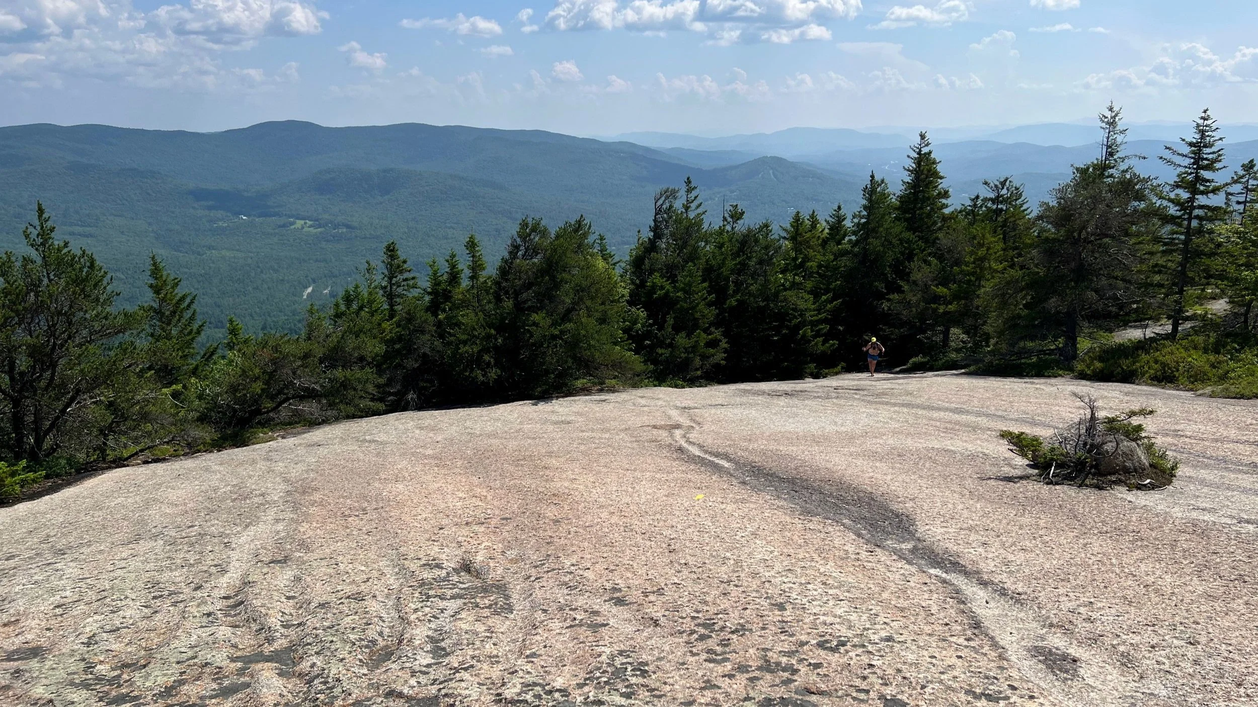
It's 3.1 miles of steady climbing up the Centennial Trail to Mount Hayes and the intersection with the Mahoosuc Trail. There are some nice views right around the trail junction.
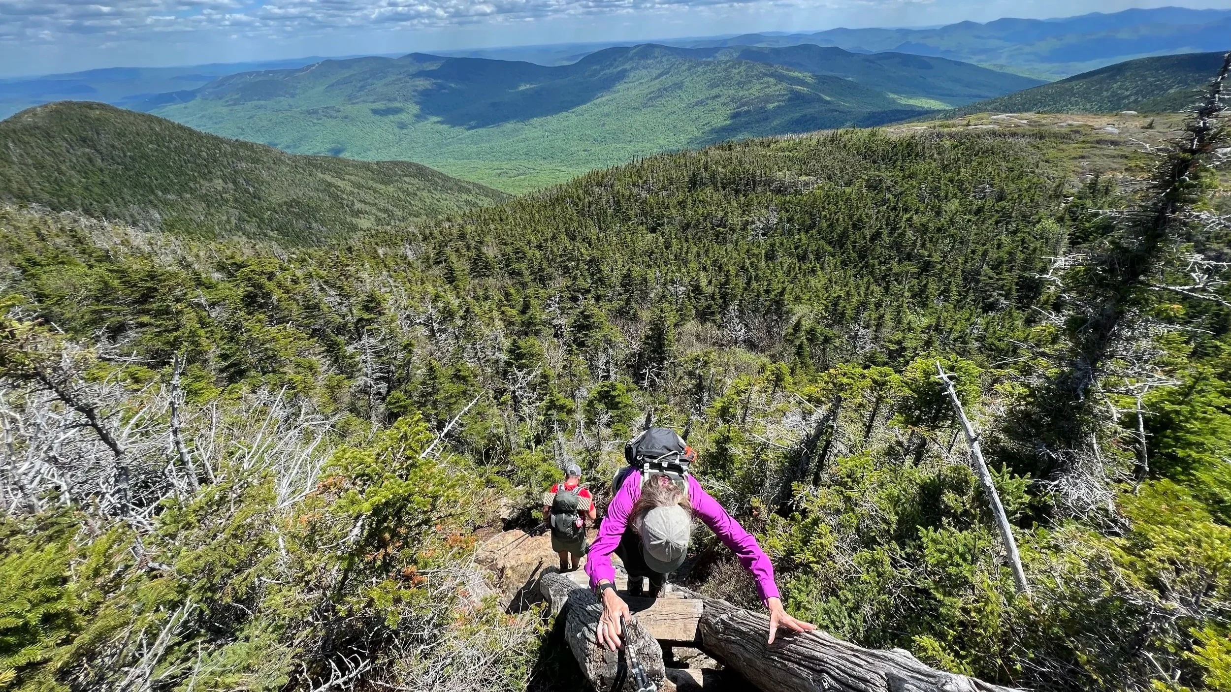
From the trail junction, it's 1.8 miles to the summit of Cascade Mountain, then 1.2 to Trident Col, another mile to Page Pond (we didn't know the name in the video), 0.6 miles up to the Wocket Ledge viewpoint, and then 1.1 miles down to Dream Lake and the intersection with the Peabody Brook Trail.
At this point, we took the Peabody Brook Trail 3.1 miles down to North Road and we walked the mile or so on North Road to return to the trailhead at the intersection of North and Hogan Roads where our car was waiting.
All told this difficult loop hike was 13.5 miles in length with about 3,900 feet of elevation gain along the way (there are plenty of ups and down in this section, so be prepared). There's plenty of mud, rocky sections, and overall this is a difficult hike that will take longer than you expect.
For More Information
You can find this hike:
Hike On Guides: Don’t know where to start with hiking, backpacking, and camping? We can help you! Visit our professional Outdoor Hiking, Backpacking and Camping Guide Services Company at Hike On Guides.
Gear we used on this hike:
(Product links are affiliate links, so if you purchase something through them, it helps us out)
Important Hiking Considerations:
Weather: Check the weather forecast before your hike and be prepared for changes in conditions.
Safety: Some sections of the trail can be steep and rocky, so use caution and watch your footing.
Leave No Trace: As with any outdoor activity, remember to follow the principles of Leave No Trace. Pack out any trash, stay on the trail, and be respectful of the natural environment.