Welch-Dickey Loop Hike in New Hampshire's White Mountains
Hiking the Welch-Dickey Loop
The Welch Dickey Loop is an unforgettable hike with amazing views of the surrounding landscapes of New Hampshire's White Mountains. This 4.5 mile hike features the open rock summits of Welch and Dickey Mountains and offers panoramic views that will leave you in awe.
Join us on the adventure that is a hike on the Welch Dickey Loop, exploring the stunning landscapes of New Hampshire's White Mountains. This 4.5 mile breathtaking beauty of a hike, features Welch and Dickey Mountains, and offers panoramic views from their open rock summits that will leave you amazed along the way! The Welch Dickey Loop is a not to be missed hike in the White Mountains.
Welch-Dickey Loop Hike and Trailhead Information
A classic New Hampshire loop hike with nonstop views and just the right mix of challenge and fun - the Welch Dickey Loop Trail in Thornton, NH is one of our favorite day hikes in the White Mountains.
The Welch and Dickey Mountains loop is a moderate hike that’s perfect for adventurous day hikers, families looking for a challenge, or anyone who loves those classic New England vistas. The trailhead is easy to access just a few miles off I-93 on Orris Road, making it a popular White Mountains hike - but trust us, the views are worth every step and the wait for a parking spot.
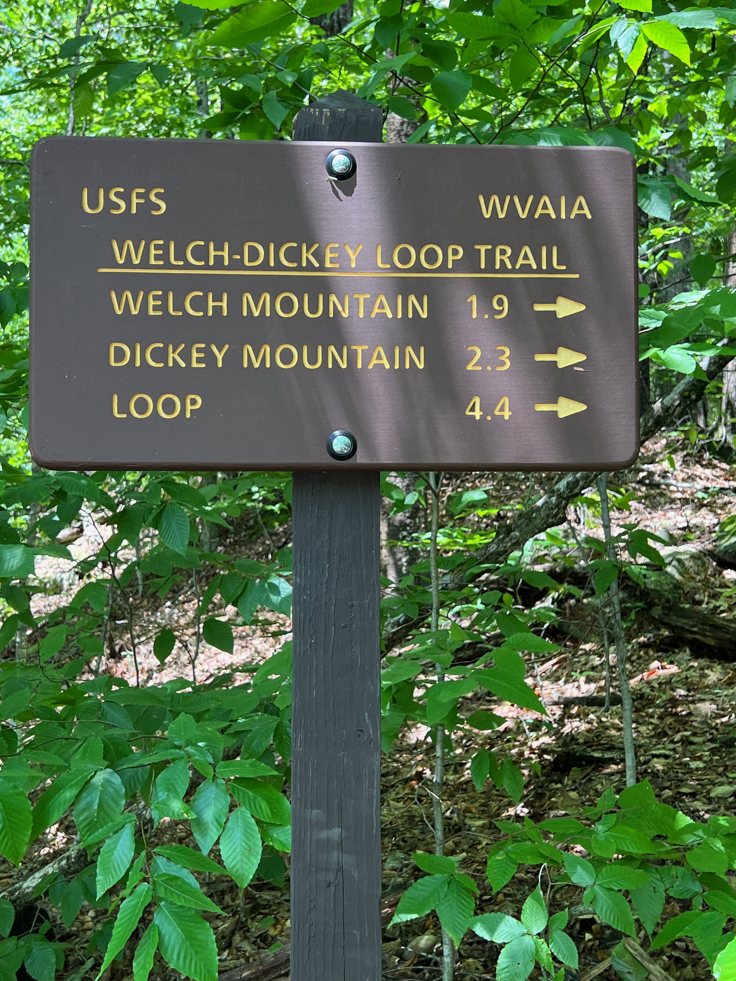
Welch Dickey Loop Trail Quick Facts
Trailhead: Orris Road, Thornton, NH (Google Maps)
Distance: 4.5 miles (loop)
Elevation Gain: 1,785 feet
Difficulty: Moderate
Best For: Moderate hikers, View seekers, open rock climbing fans
Highlights: Open rock, panoramic views, alpine-like summits
GPS Information: Welch-Dickey Trail Route in GPX Format
Welch-Dickey Loop Trail Description
We believe that the Welch Dickey loop is best done in a counterclockwise direction, which starts with a gradual ascent up Welch Mountain.
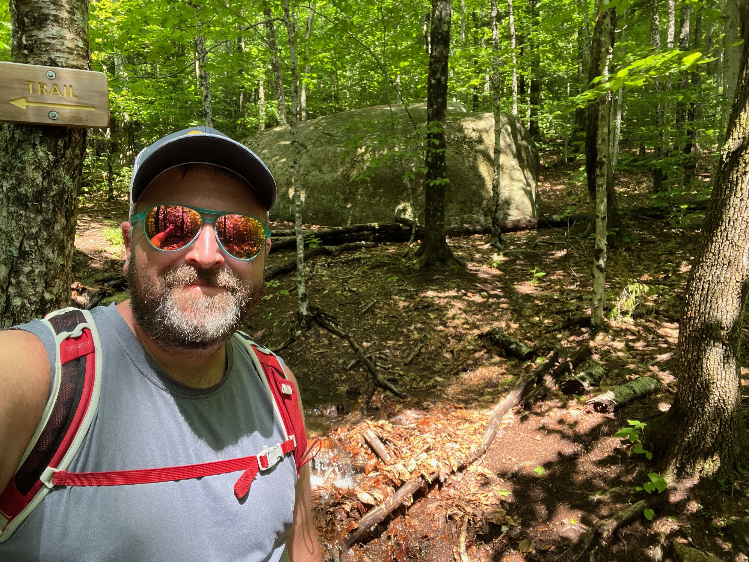
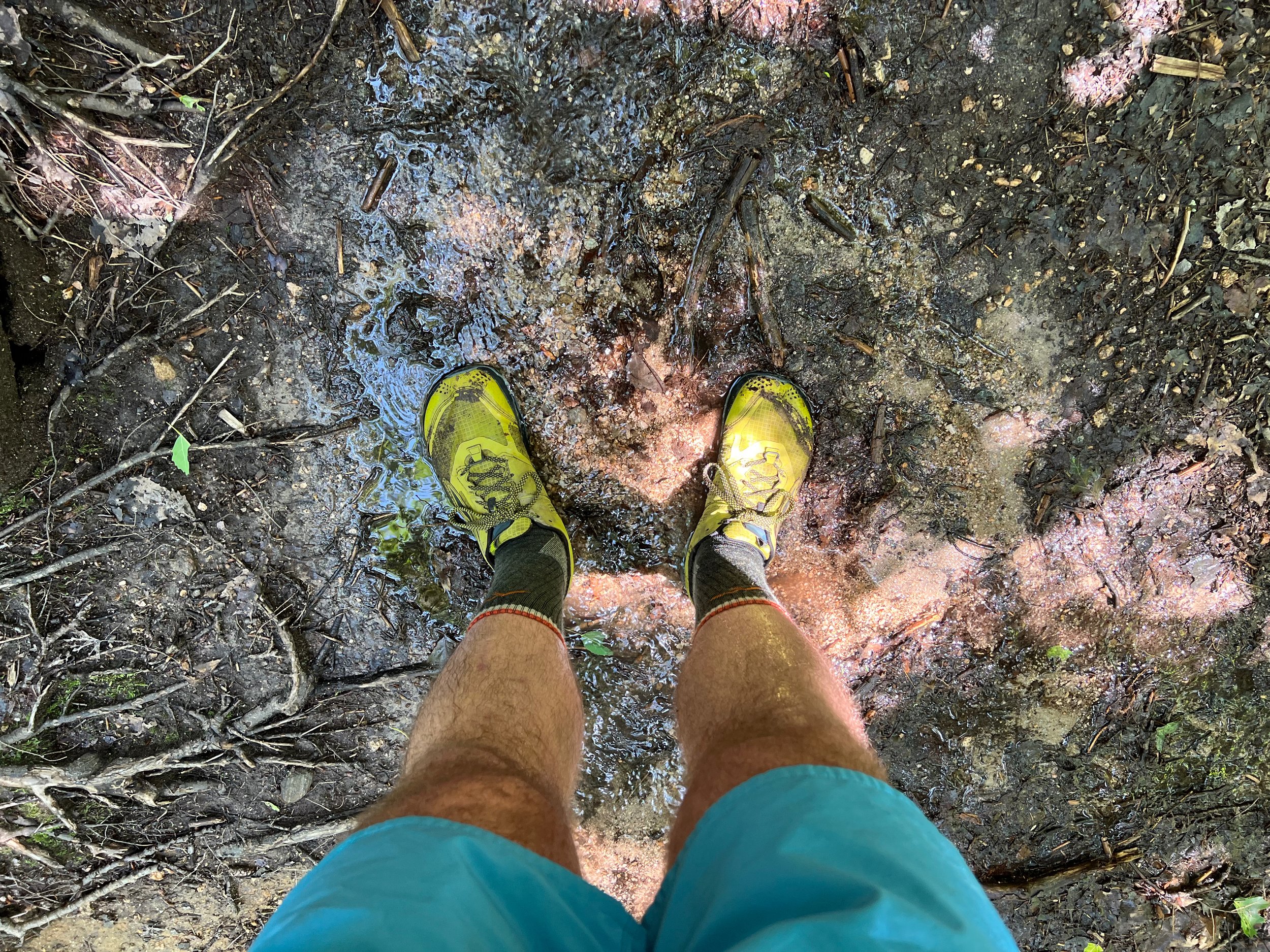
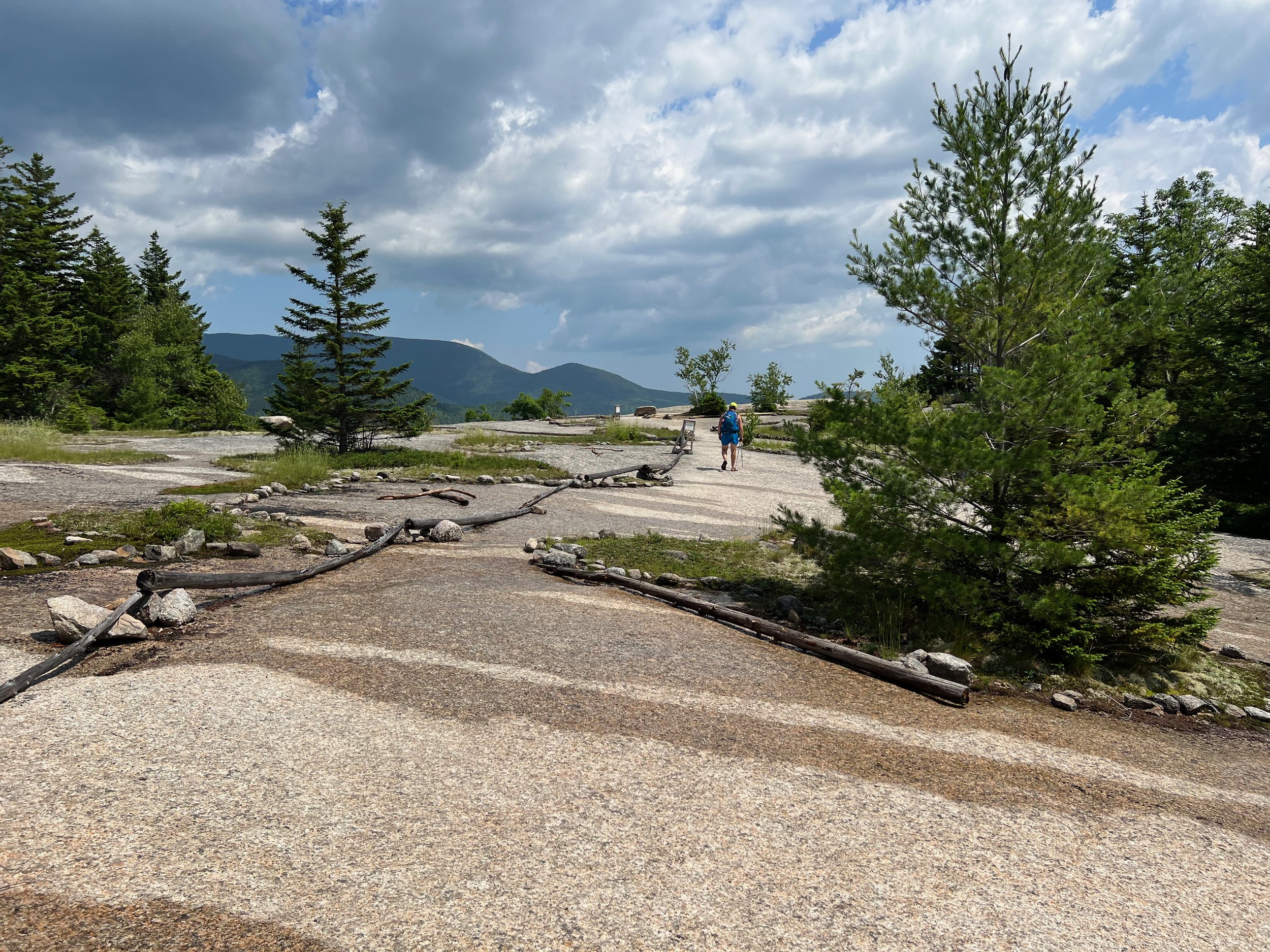
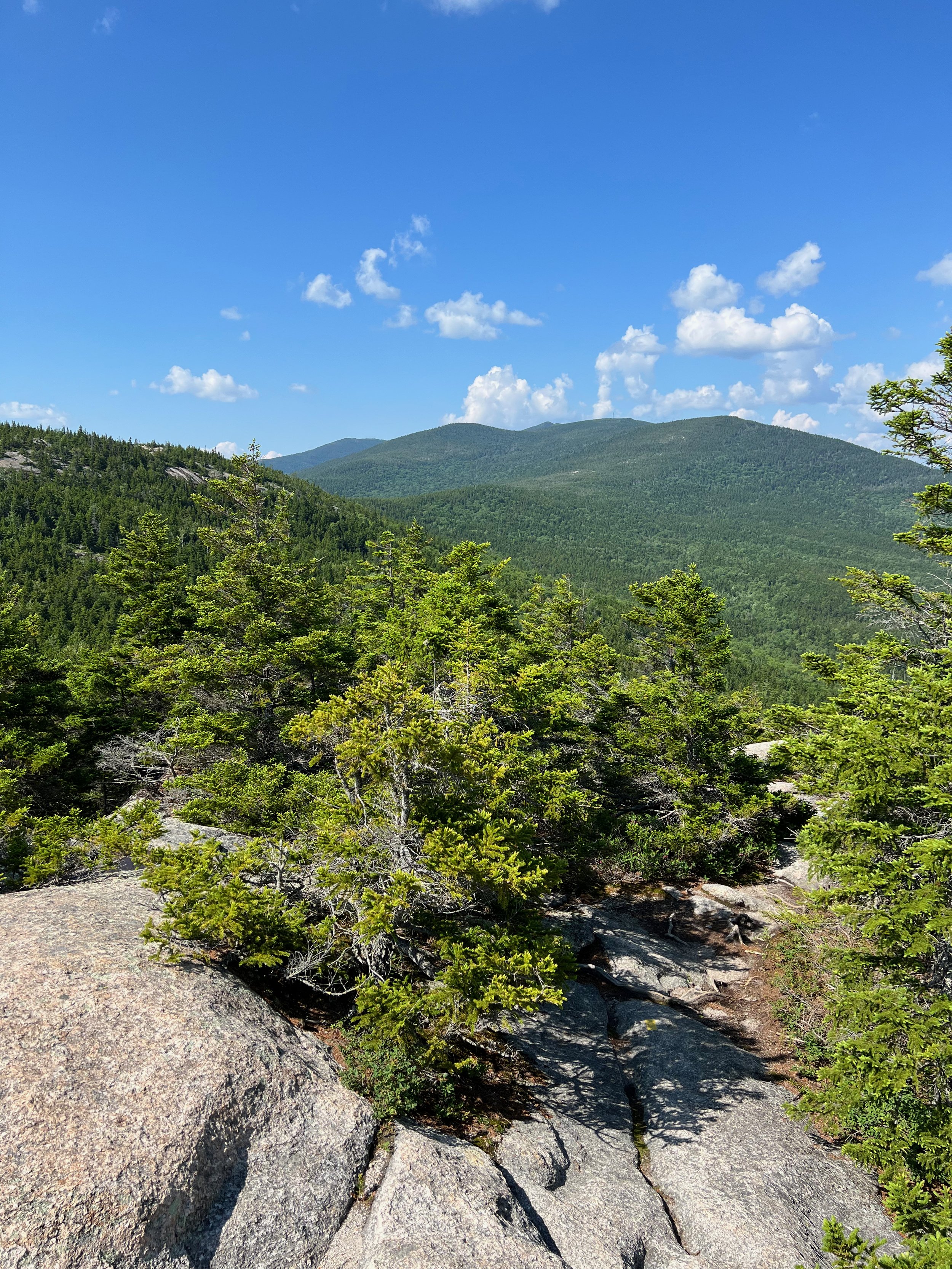
Heading up Welch Mountain first, the trail winds through a mixed forest, going through a number of muddy areas in the first 1.3 miles or so. After that, the trail begins climbing more on bedrock and more views and vistas begin to appear.
Doing the Welch-Dickey Loop in a counterclockwise fashion also puts the steepest ledges of Welch Mountain on the ascent and saves the more gentle ledges of Dickey Mountain for the descent.

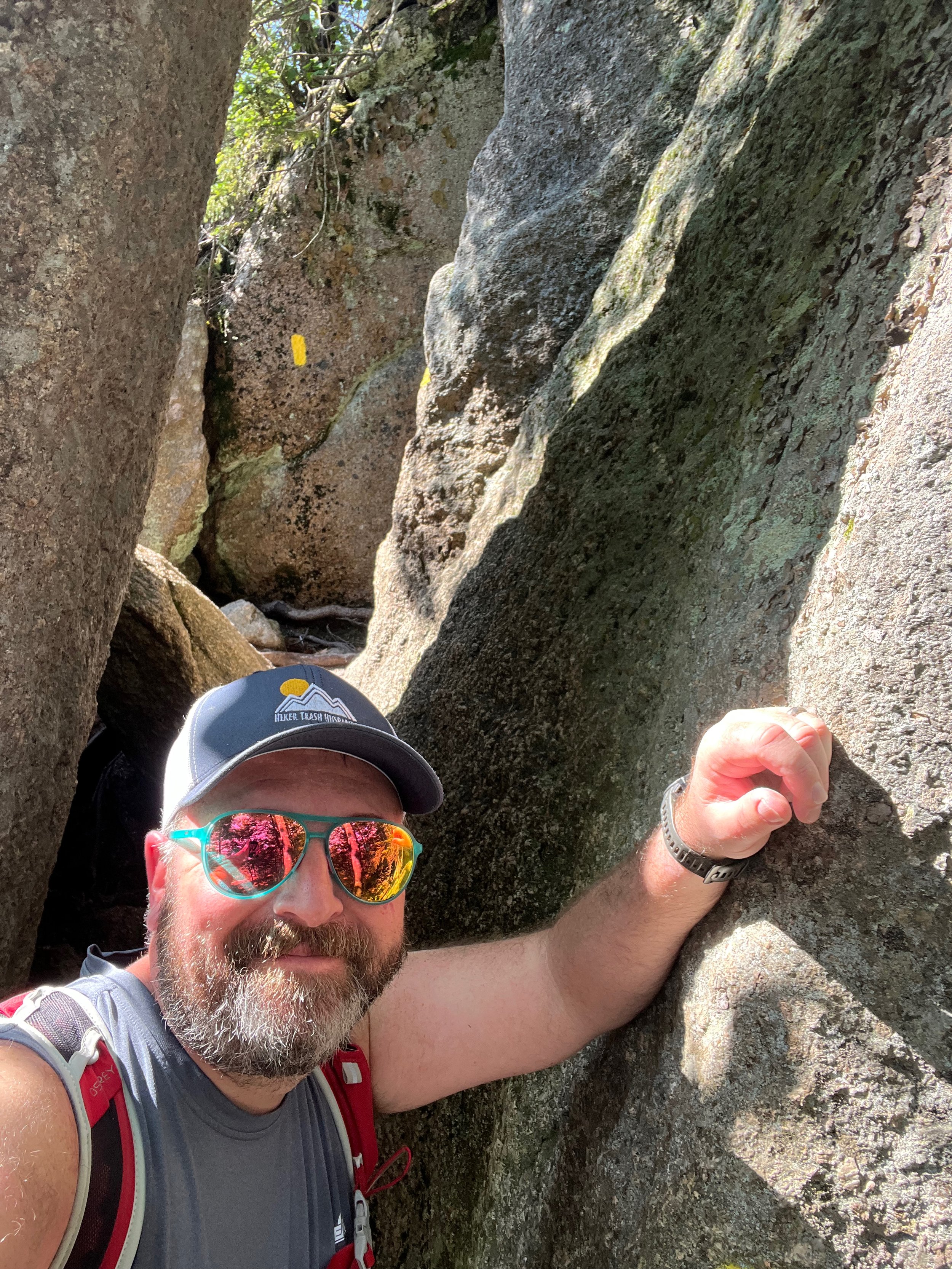
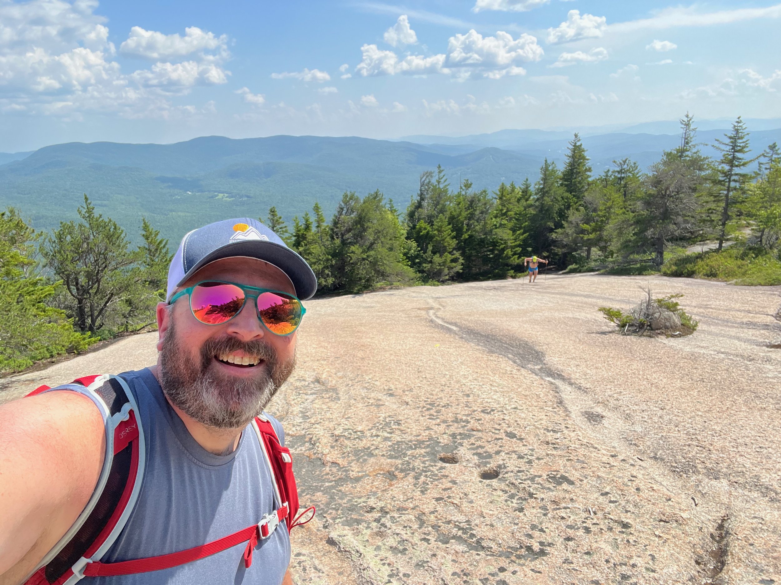
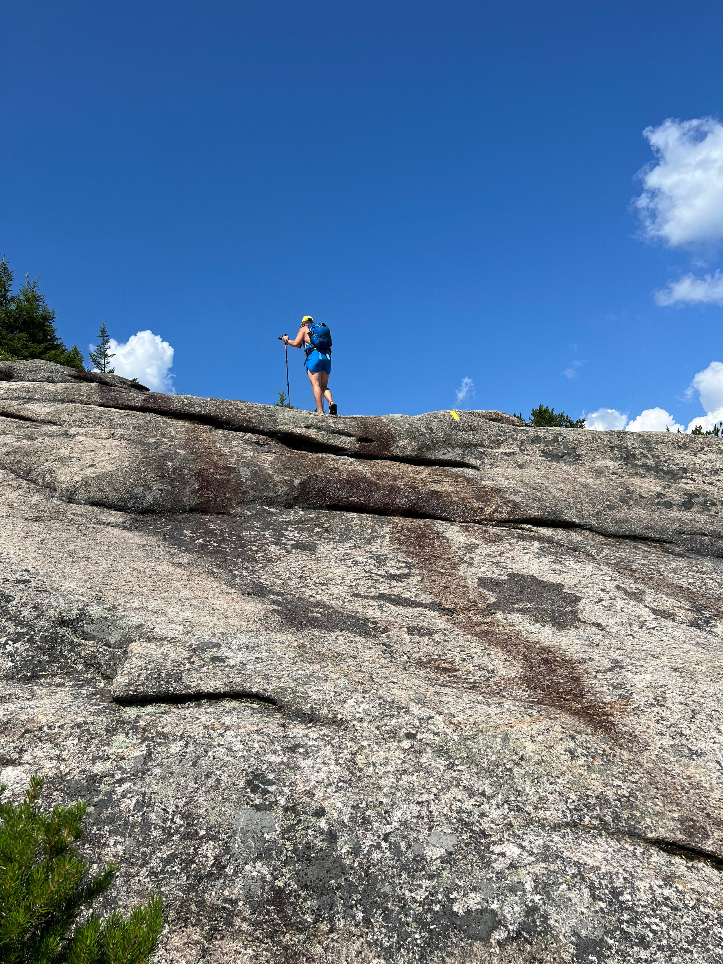
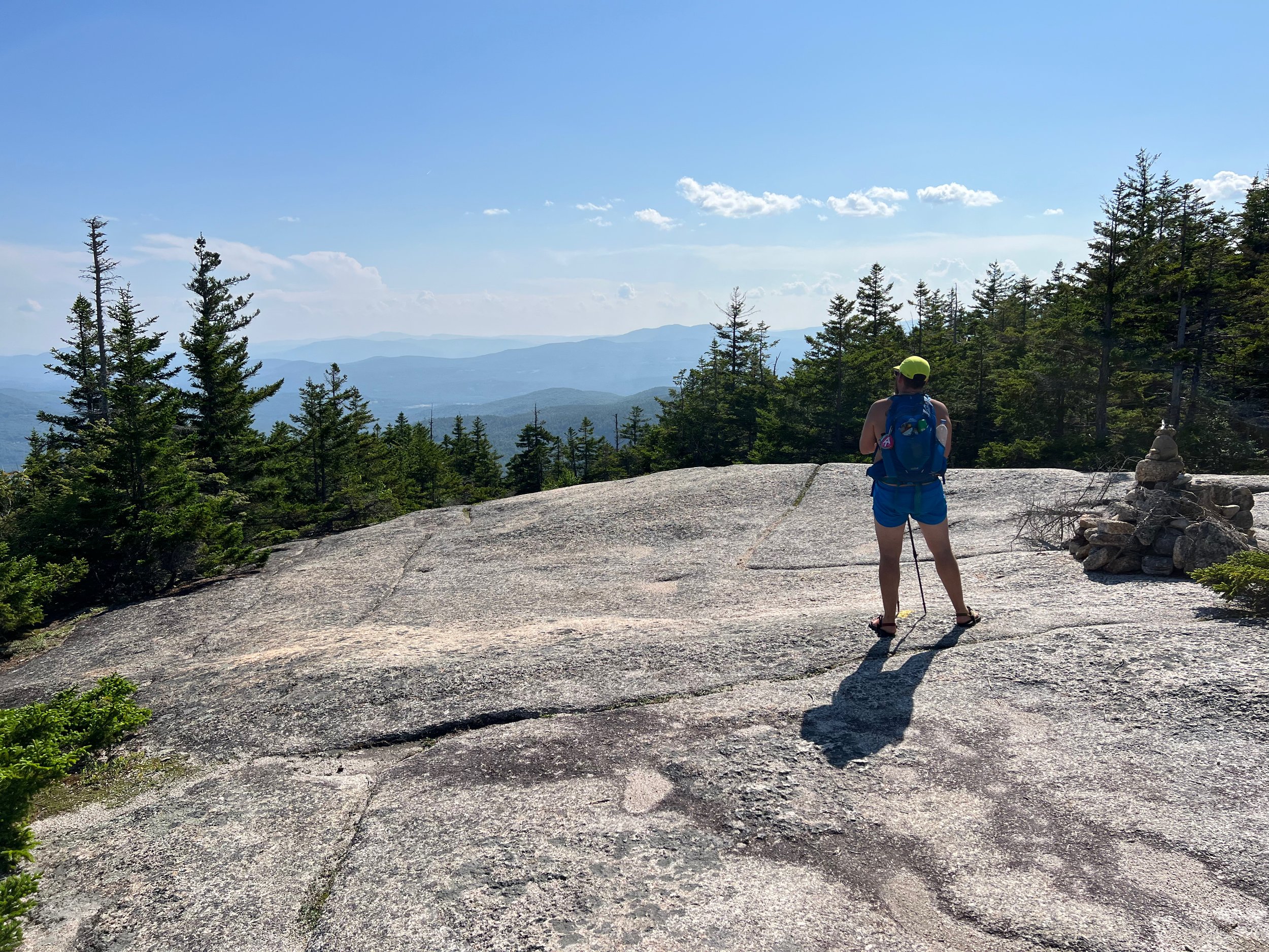
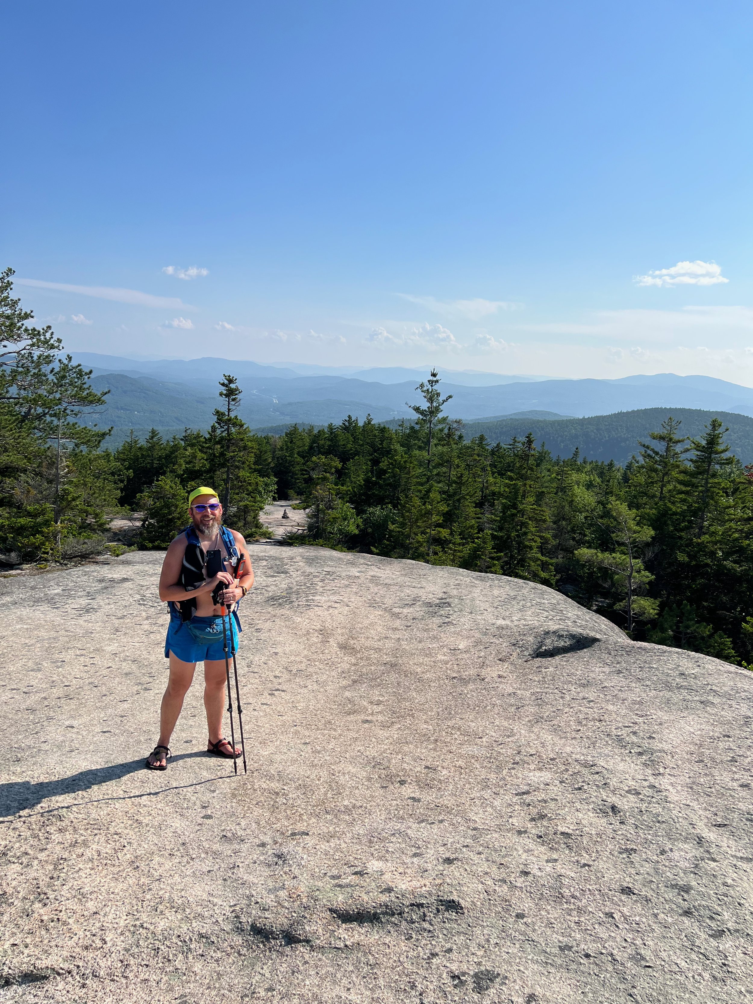
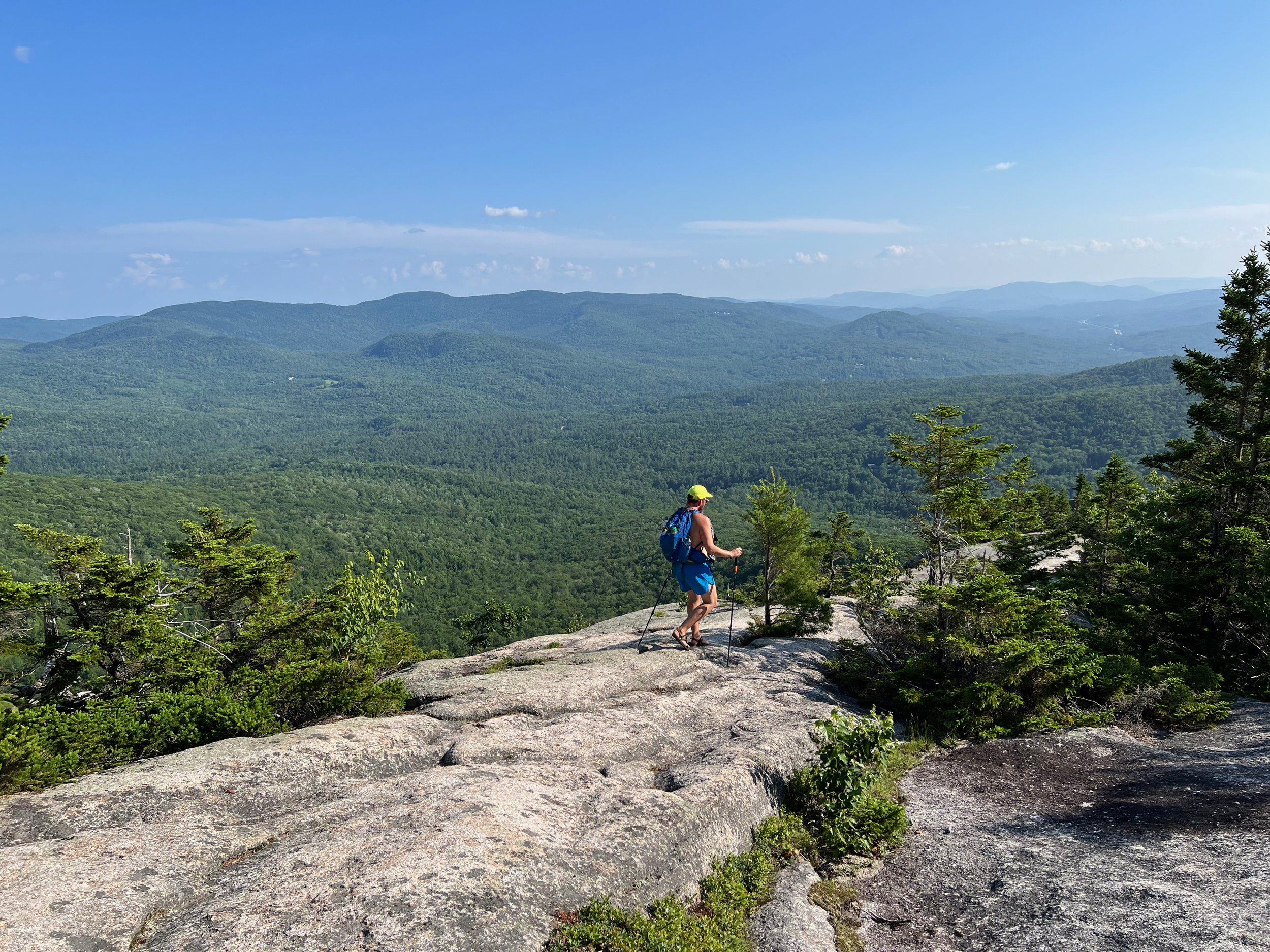
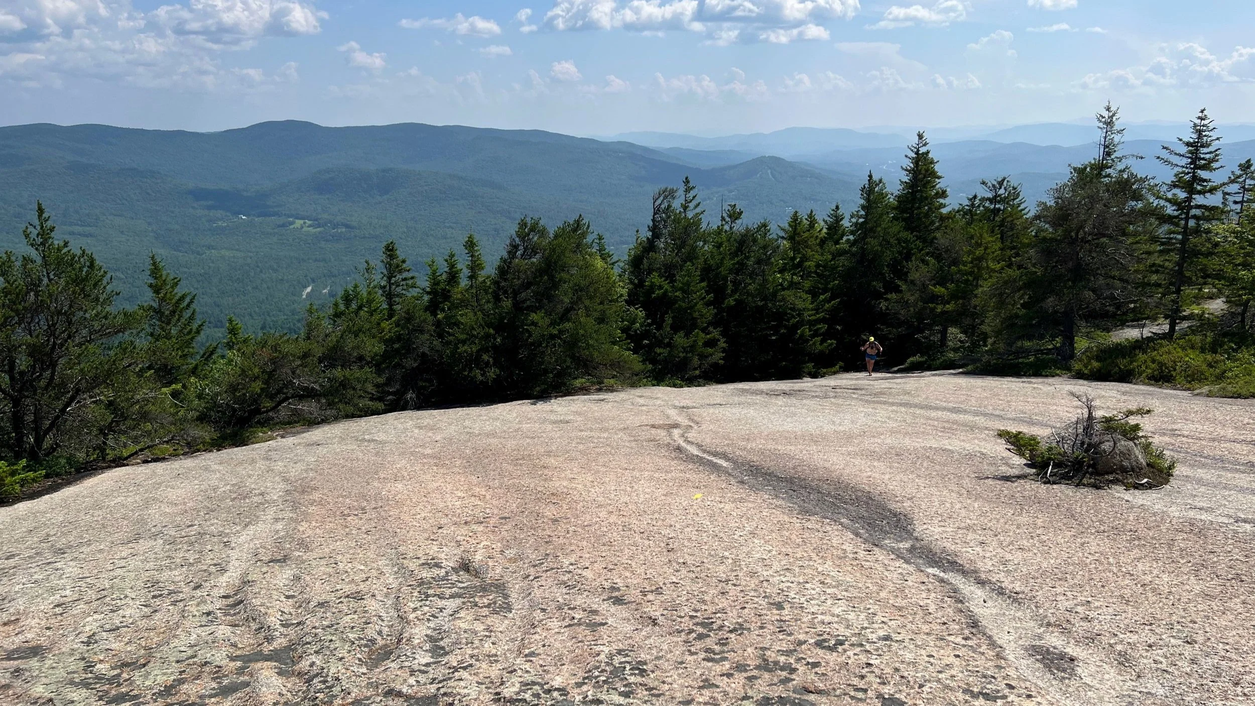
The ascent of Welch Mountain includes a number of large, smooth, open rock ledges that you walk up. The trail is generally easy to follow and well marked with paint blazes and cairns, but for those who are a bit scared of heights (Jeff included), some of the climbs can be intimidating.
The climbs up the open rocks of the Welch Dickey Loop aren’t difficult and it is easy to walk up with good hiking shoes, but it can be a dit disconcerting to be in the middle of such a large, open rock expanse on a fairly significant angle of ascent!
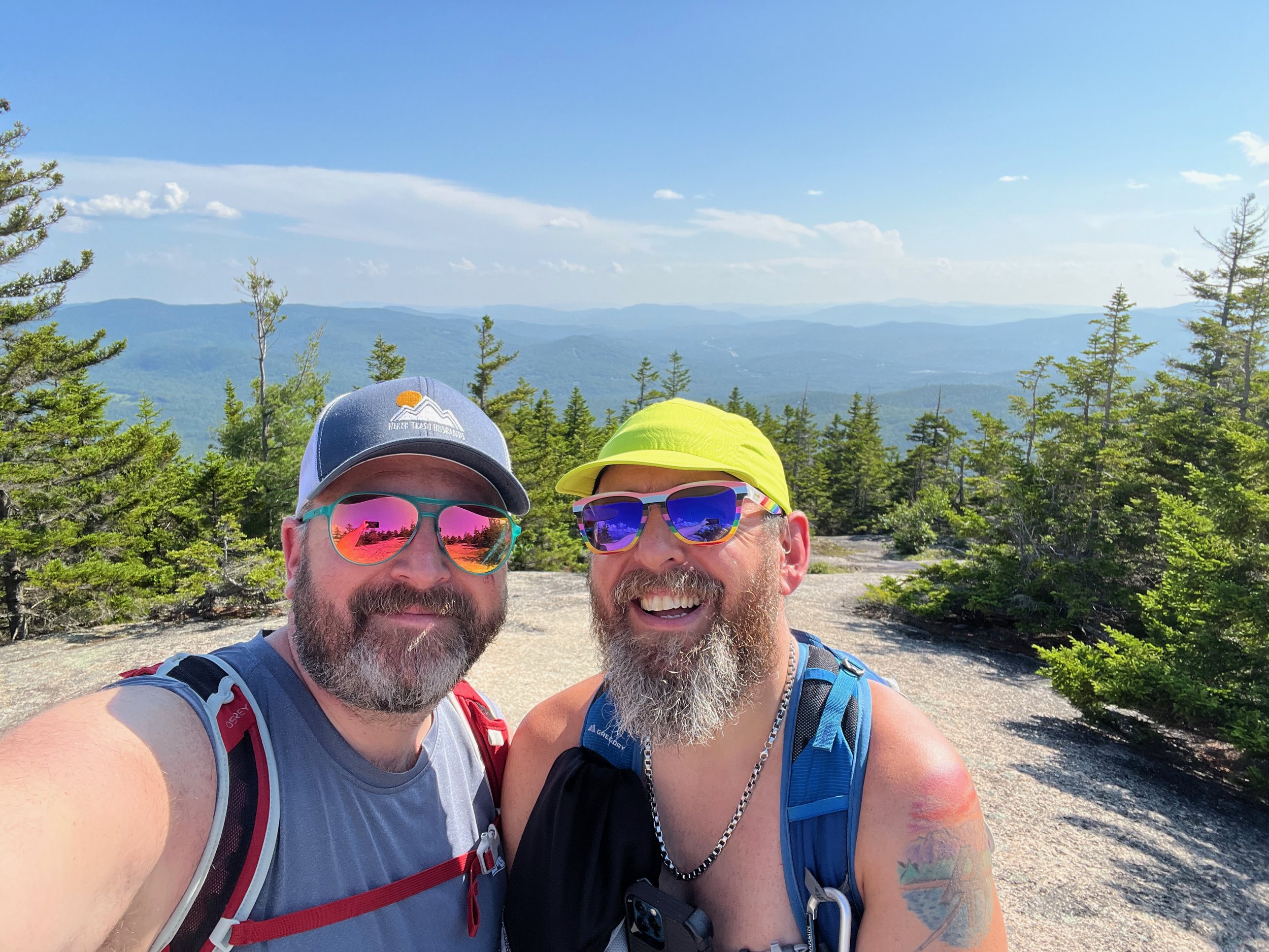
Jeff made it without a problem, though as you can tell from the video, he didn’t capture too much video on the ledges themselves as he focused on going up.
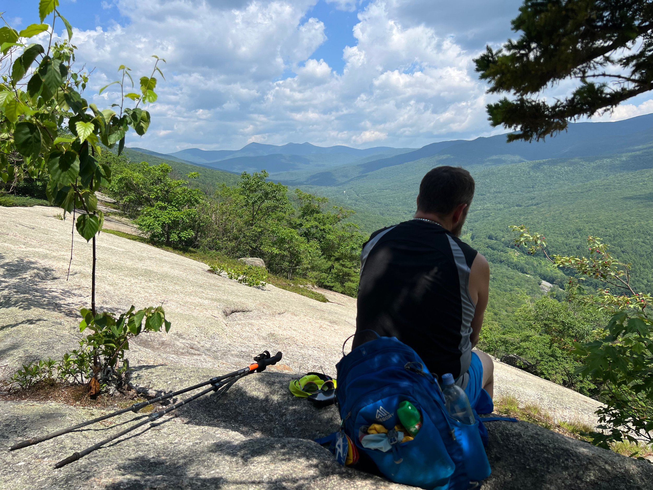
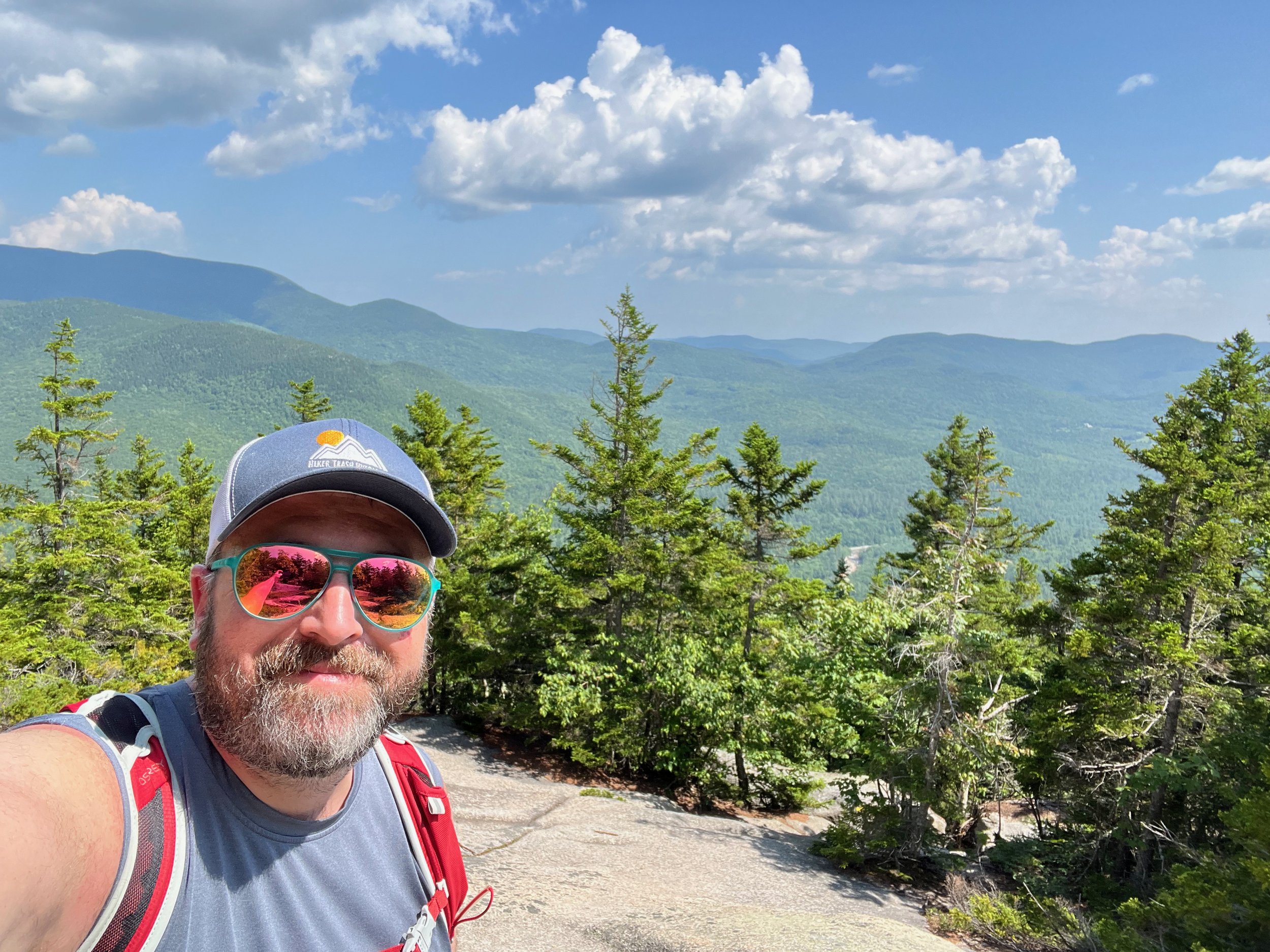
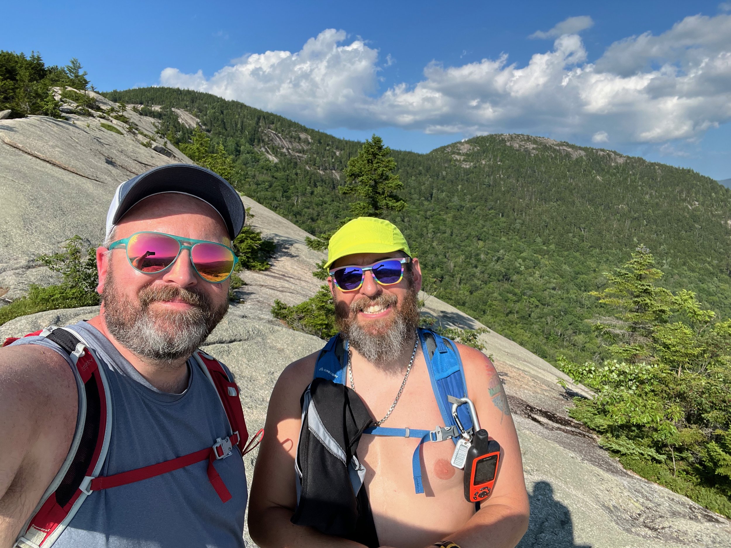
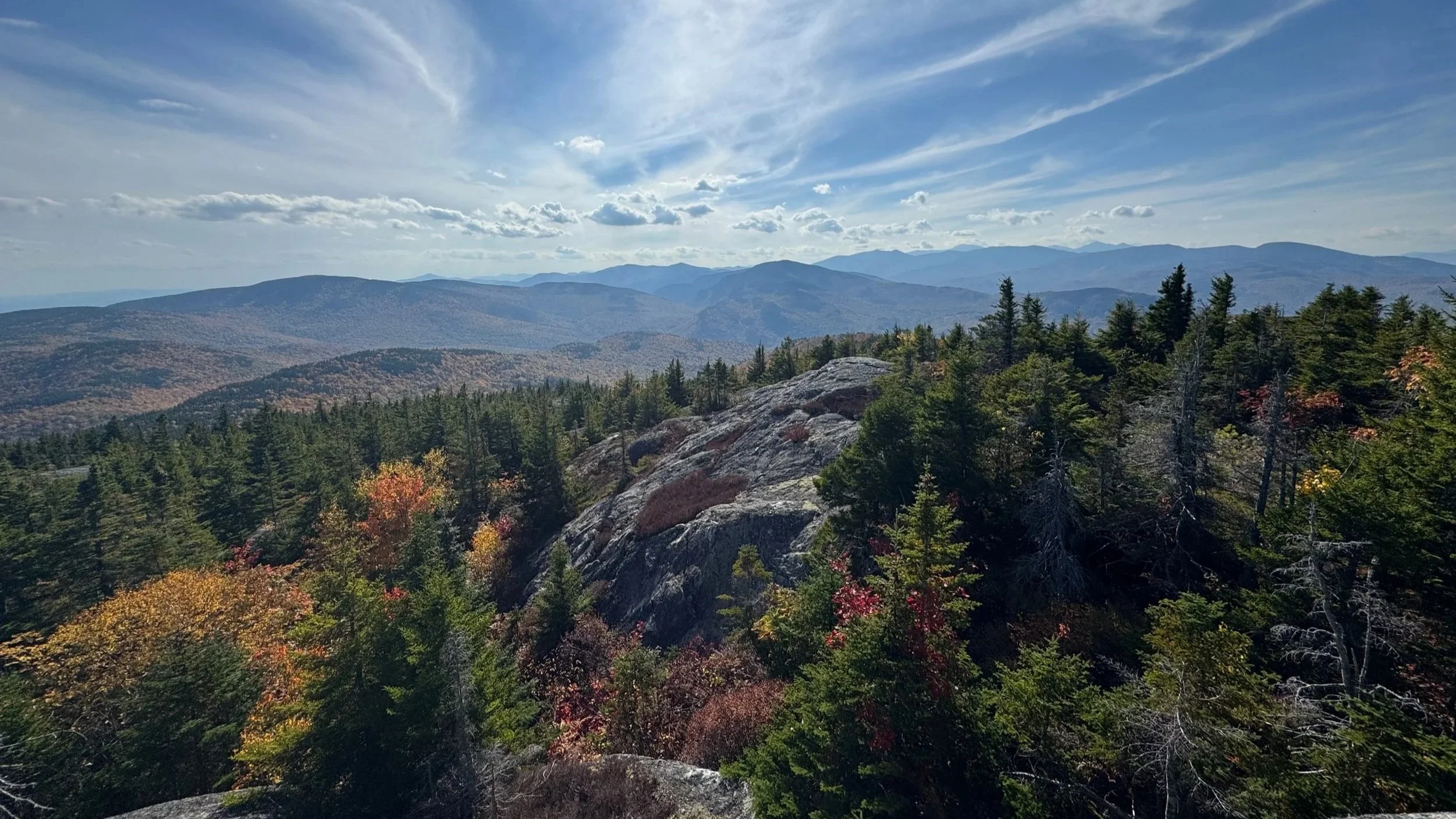
The summit of Welch Mountain offers a panoramic view that stretches as far as the eye can see. The open ledges provide an ideal spot to take a break and enjoy some snacks. Along the Welch Dickey Loop, after the summit of Welch Mountain, you descend to the col between Welch and Dickey Mountains.

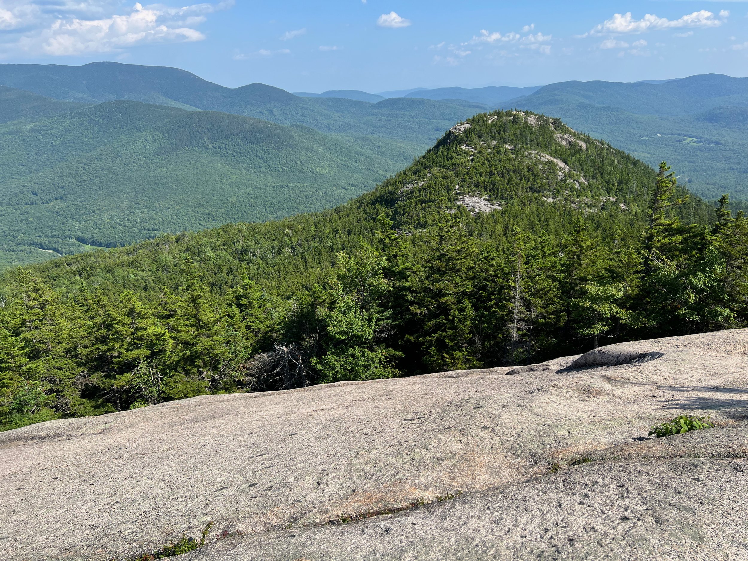
Once at the col, it's time to go up and you begin the climb up Dickey Mountain, There are some steep sections, but the views at the summit are well worth it.
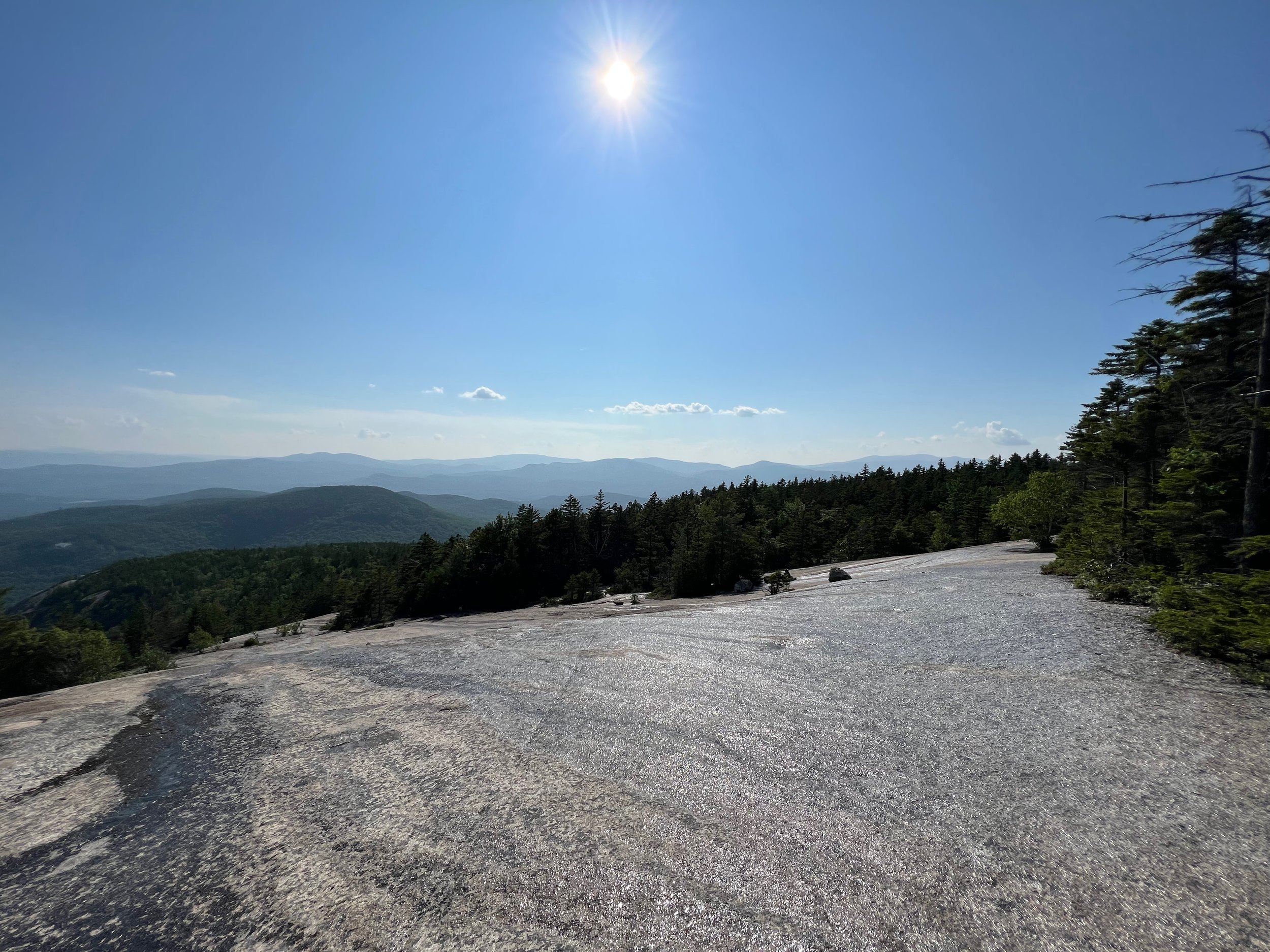
The ascent up Dickey is more in the woods and less on open rock slabs than the ascent of Welch was and the summit itself is a bit more grown in, but still offers great views in almost 360 degrees, including some beautiful views of Mount Tecumseh (Waterville Valley), one of New Hampshire’s 4000-footers.
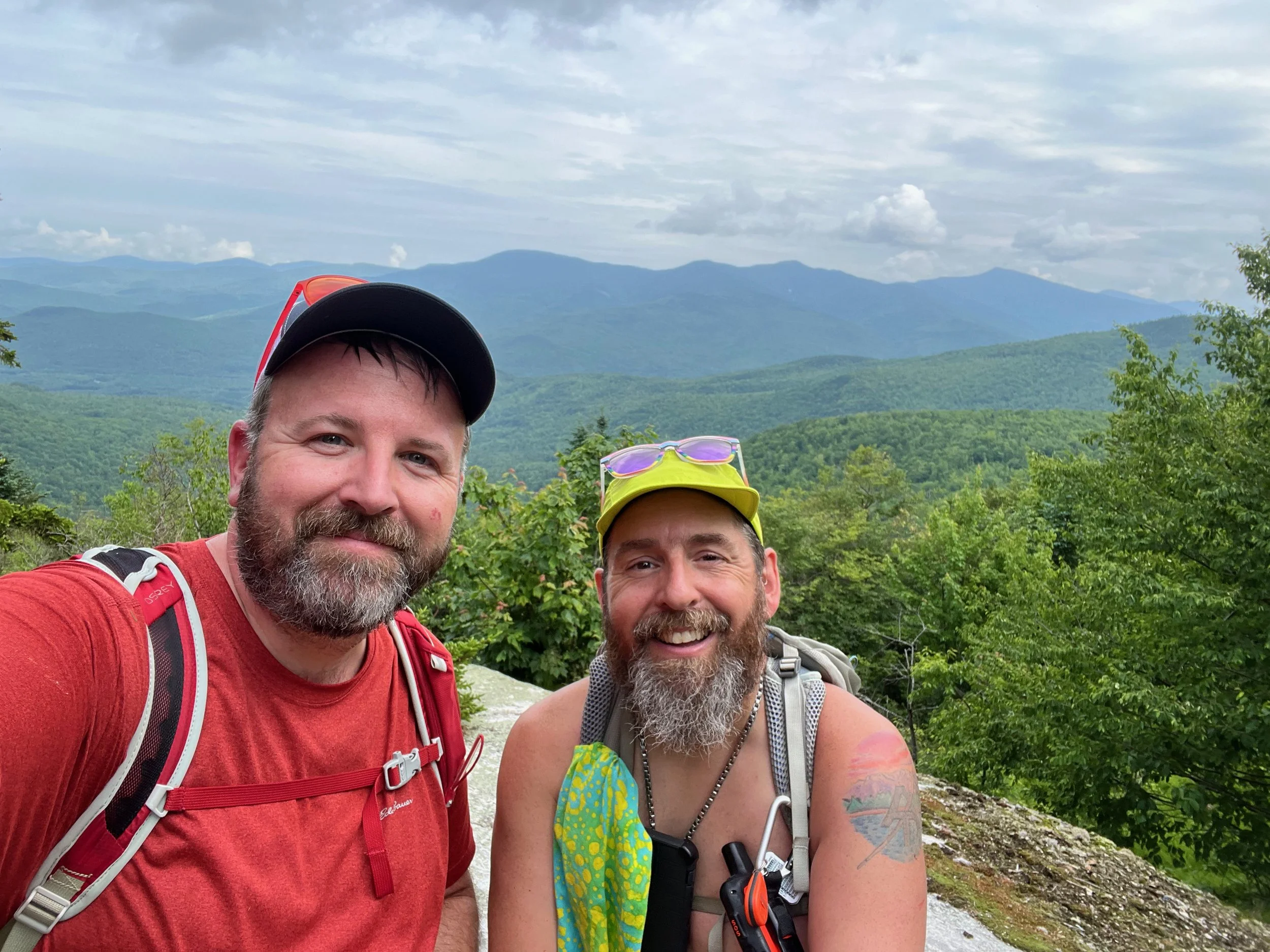
From Dickey Mountain, the trail descends via one of the mountain's ridges. There are several large open rock slabs you descend down and at one point, walk alongside a long cliff, giving you the opportunity to look back on both Dickey and Welch Mountains and see your entire hike laid out before you.
All told, the Welch Dickey Loop hike is 4.5 miles with about 1,785 feet of elevation gain. This is a moderate hike that would be considered challenging for those who are afraid of heights or open rock slabs (Jeff's mildly afraid of heights and wasn't always comfortable). In addition, the Welch Dickey Loop should only be attempted in dry weather, as the rock slabs could become slippery when wet. There's also no water on the trail after the first 1.2 miles until you return to the trailhead.
Welch Dickey Loop Hike FAQ
How do you get to the Welch Dickey Loop?
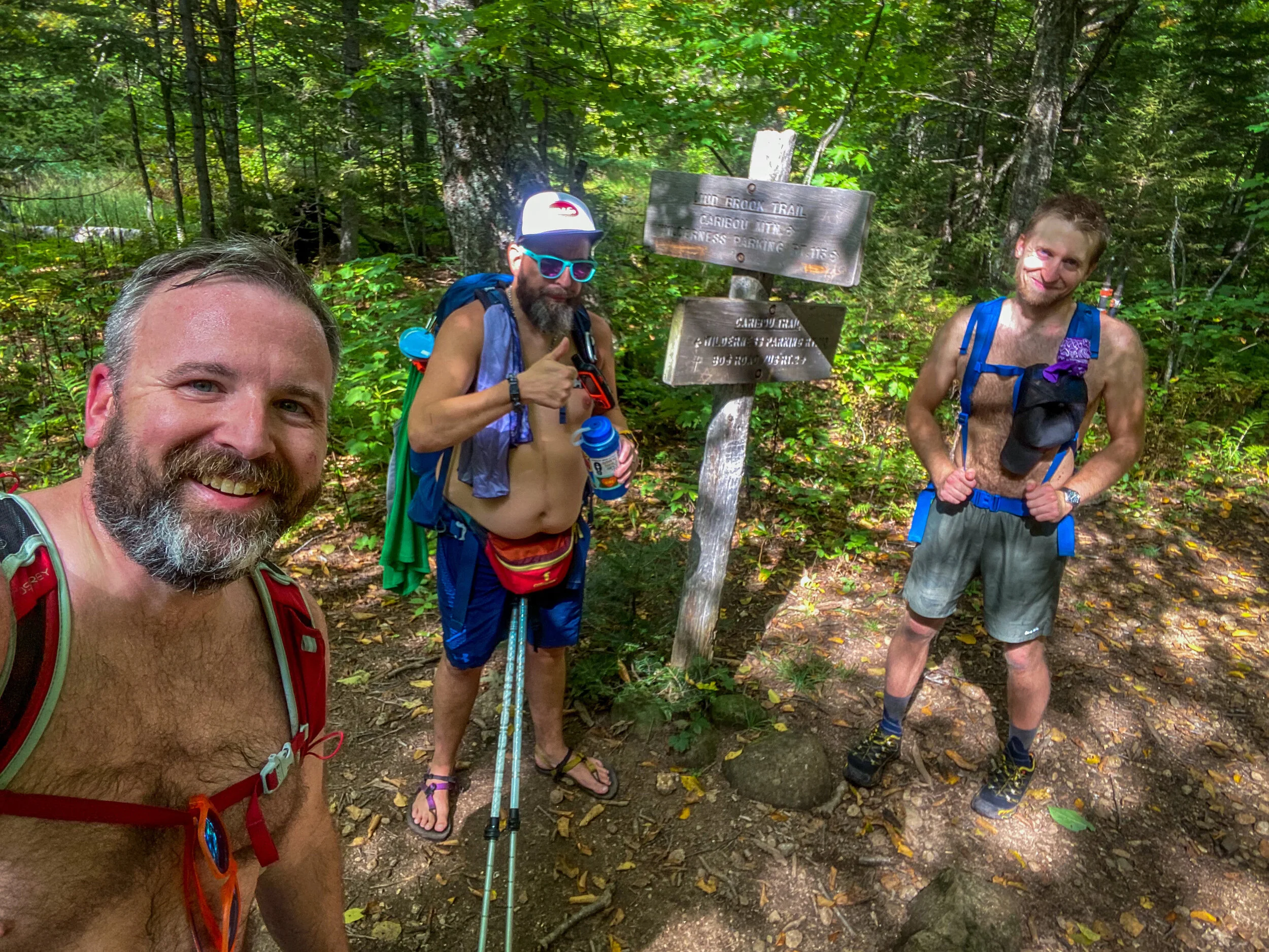
The Welch Dickey Loop begins at the Welch Dickey Loop trailhead at the end of Orris Road, a few miles east of the Campton exit on Interstate 93, off of NH Route 49 and about 15 minutes south of Franconia Notch.
How long does it take to hike the Welch Dickey Loop?
Most hikers complete the 4.5-mile Welch Dickey Loop in about 3 to 4 hours, depending on pace, weather, and how long you spend soaking in the views from the ledges.
Is the Welch Dickey Loop difficult?
This hike is rated moderate. While the mileage is relatively short, hikers should be prepared for steep, rocky sections and open ledges. Good footwear and steady footing are essential.
Is the Welch Dickey Loop accessible year-round?
The Welch Dickey Loop is accessible year-round, but in the winter months, it can be a signficantly more difficult hike. The best time to hike the Welch Dickey Loop is the summer and fall months.
Can kids hike the Welch Dickey Loop?
Yes, experienced and active kids can enjoy this hike, but parents should be cautious around the steep ledges and exposed sections. It may not be the best first hike for young children.
Is there parking for the Welch Dickey Loop?
The trailhead at the end of Orris Road has parking, but this is a popular hike and the parking lot does fill up quickly. If the lot is full, there’s no overflow parking available on the street.
Is it free to access the Welch Dickey Loop?
The Welch Dickey Loop is free and open to the public.
When is the best time to hike Welch and Dickey Mountains?
The loop is beautiful year-round, but fall foliage makes it especially stunning. In spring and early summer, sections of the trail can be wet, and in winter it becomes a more advanced snowshoe or microspike adventure.
Is there a trail map for the Welch Dickey Loop?
The Welch Dickey Loop is shown on AMC’s White Mountains Map, the White Mountains Trail Map, on AllTrails, and as part of the White Mountains Download on the FarOut Guides App.
Are dogs allowed on the Welch Dickey Loop?
Yes! Dogs are welcome on the trail, but keep them leashed for safety, especially near open ledges.
More White Mountains Hikes
For More Information
You can find out more about the Welch Dickey Loop hike here:
We’re AllTrails Ambassadors and use it to track our hikes – get 30% off a subscription!
Our Hiking Advice and Hiking Gear Recommendations
Hike On Guides: Don’t know where to start with hiking, backpacking, and camping? We can help you! Visit our professional Outdoor Hiking, Backpacking and Camping Guide Services Company at Hike On Guides.
Gear we used on this hike:
(Product links are affiliate links, so if you purchase something through them, it helps us out)
Important Hiking Considerations:
Weather: Check the weather forecast before your hike and be prepared for changes in conditions.
Safety: Some sections of the trail can be steep and rocky, so use caution and watch your footing.
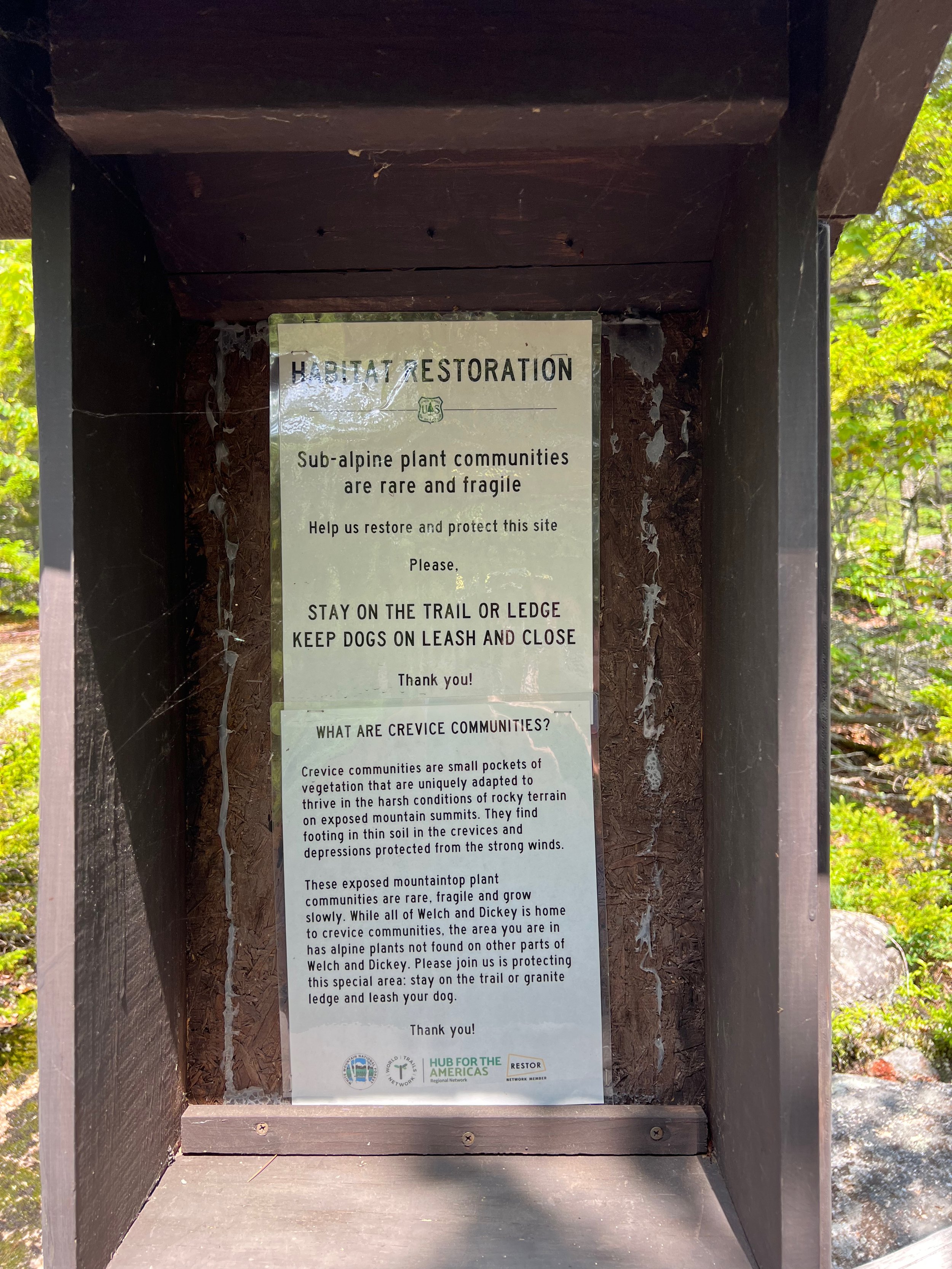
Leave No Trace: As with any outdoor activity, remember to follow the principles of Leave No Trace. Pack out any trash, stay on the trail, and be respectful of the natural environment.