Hiking Mount Martha and Owl’s Head via the Cherry Mountain Trail | White Mountains, NH
Hiking Mount Martha & Owl’s Head via the Cherry Mountain Trail - Epic White Mountains Views
Discover the Cherry Mountain Trail to Mount Martha and Owl’s Head in New Hampshire’s White Mountains - a quiet hike with epic views of the Presidential Range and beyond.
If you’re looking for a quiet hike in the White Mountains that still delivers epic Presidential Range views, the Cherry Mountain Trail to Mount Martha and Owl’s Head in New Hampshire is hard to beat. This Mount Martha hike offers steep climbs, ridge walking, and scenic ledges, all without the crowds or parking challenges of the more famous hikes.
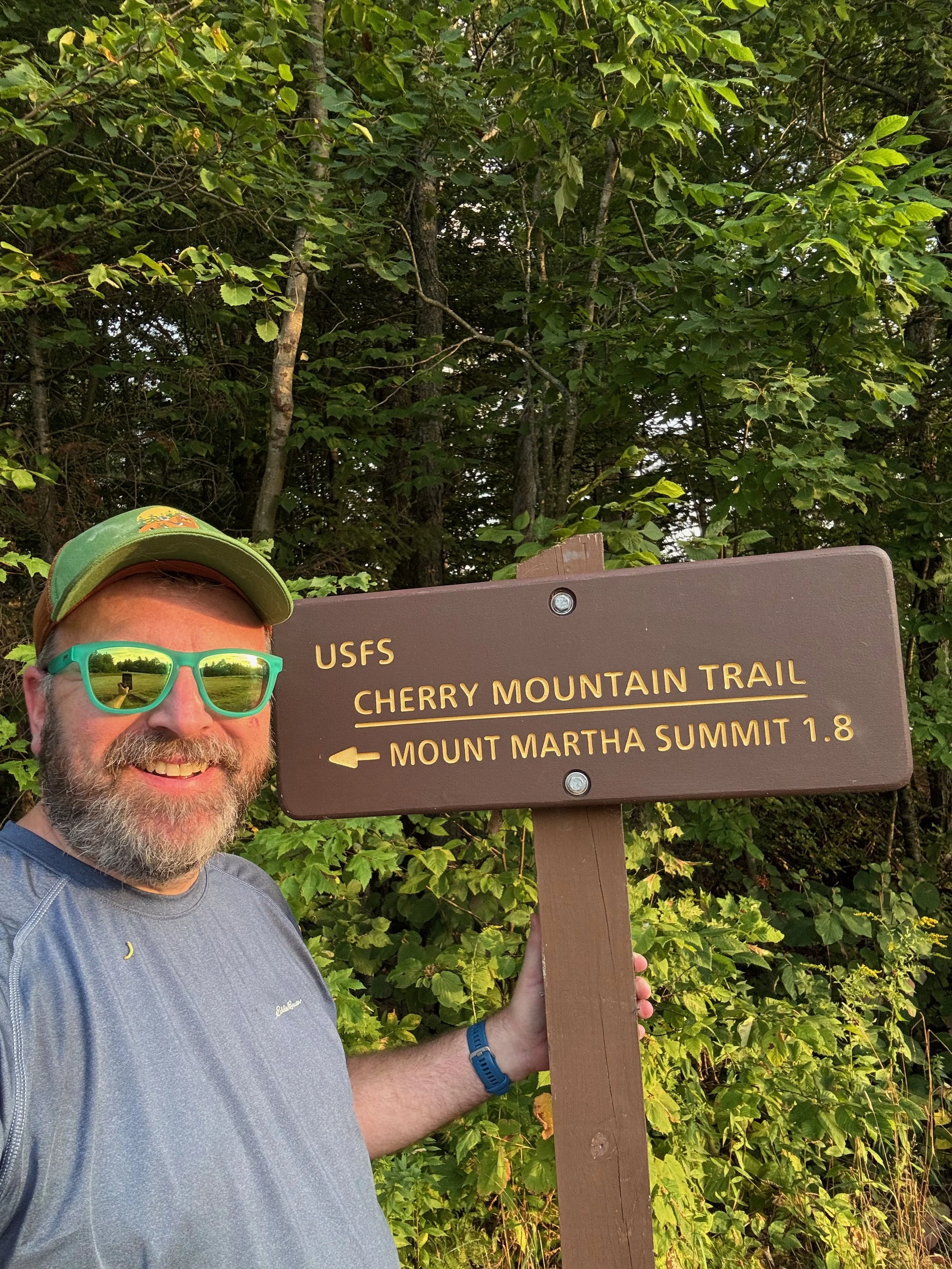
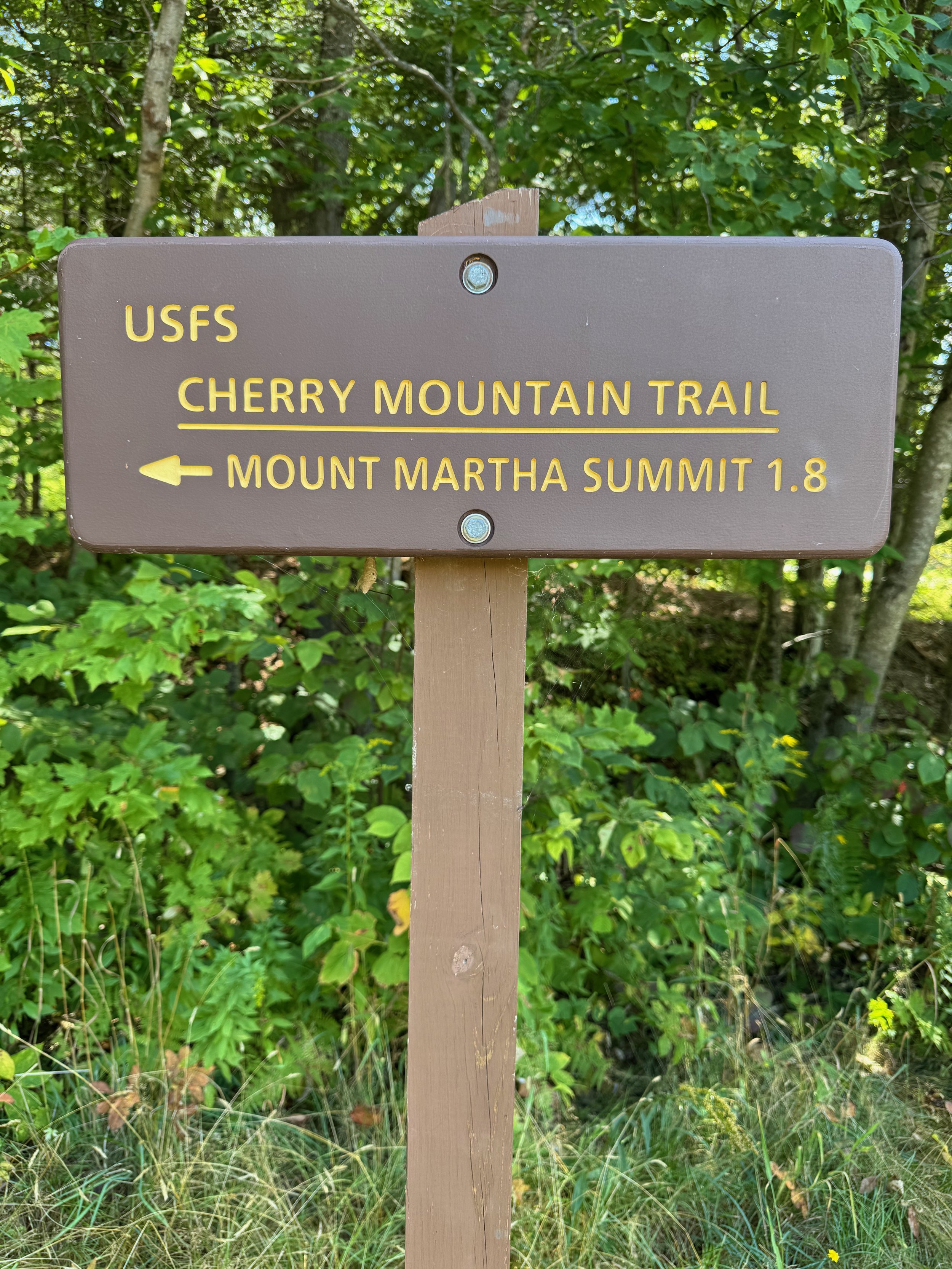
Cherry Mountain Trailhead
We tackled this route starting from the Cherry Mountain Trailhead on Route 115 in Carroll, New Hampshire, making the out-and-back journey to Mount Martha (3,563 ft) and continuing across Martha’s Mile to Owl’s Head. Along the way, we found a little bit of everything: peaceful woods, steady climbs, and open ledges looking straight into the heart of the Presidentials.
Mount Martha and Owl’s Head Trail Description
The hike kicks off with a steady, sometimes steep climb right from the trailhead on the Cherry Mountain Trail. Over the course of about 1.7 miles, you gain close to 1,700 feet of elevation.
From the parking area, the trail follows an old woods road that is a generally moderate climb for about a mile. After that first mile, you’ll leave the old woods road and begin climbing in earnest over the next 0.7 miles to reach the ridge line of Mount Martha. It’s a heart-pumping climb, but once you crest onto the ridge, the trail eases up.
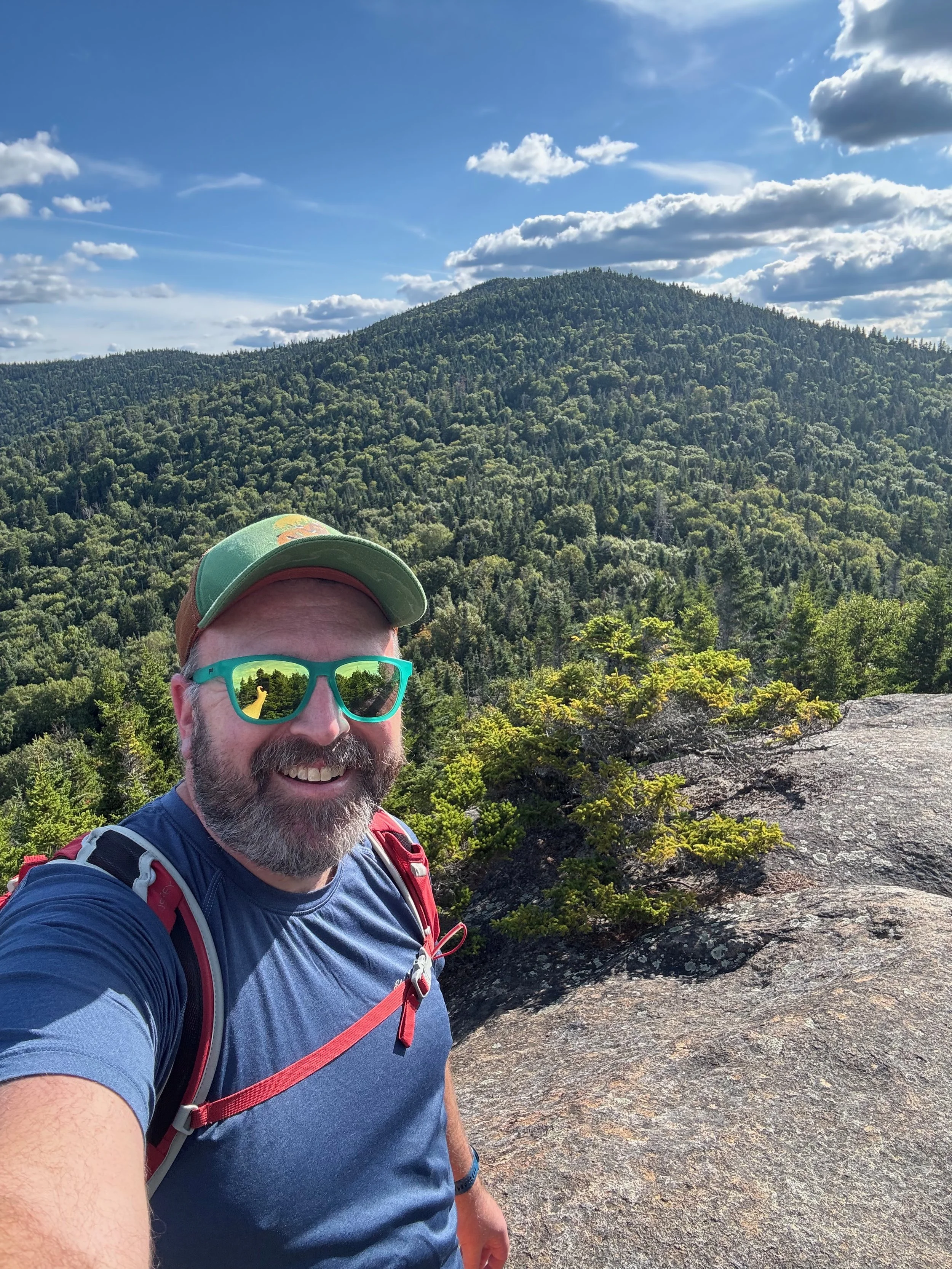
Once on the ridge, you’ll come to a trail junction between the Cherry Mountain Trail and the short spur trail (Mount Martha Trail) that leads to the summit of Mount Martha, where the remains of an old fire tower hint at its history and there are two separate views on the summit. The trail junction is also where the Cherry Mountain Trail continues to the right (north) and eventually reaches Cherry Mountain Road (about 3.6 miles). For this hike, you’ll turn left onto the Mount Martha Trail and head 0.2 miles from the trail junction to the summit of Mount Martha.
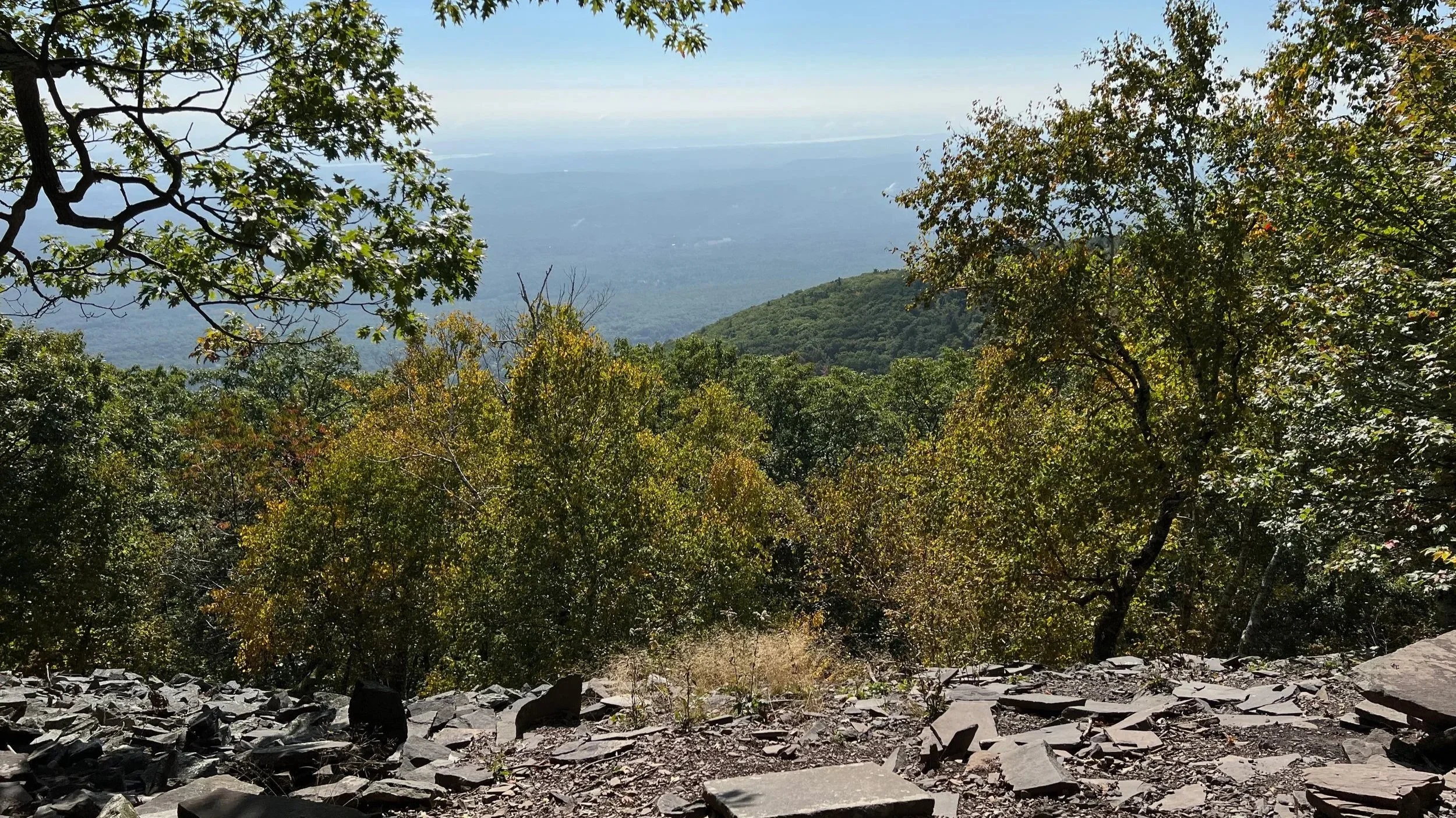
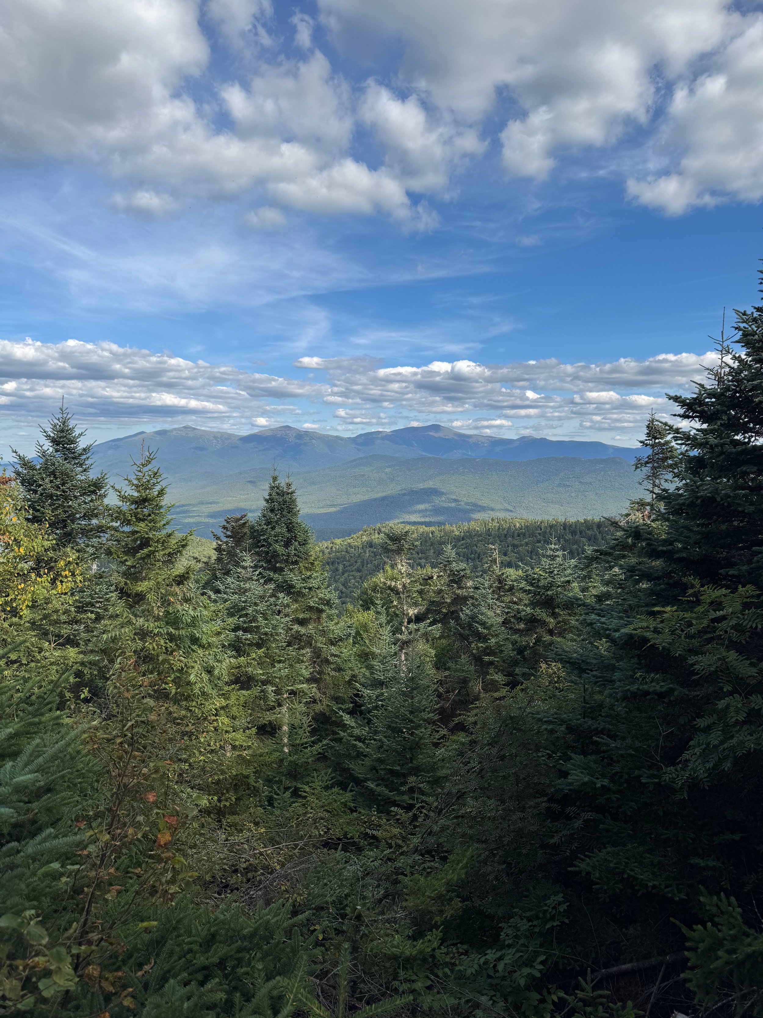
The summit of Mount Martha offers two decent views. The first is right on the trail, at the edge of the clearing for the former fire tower. This view looks north to the Presidential Range. The second view is on a short side trail that passes through the remnants of the old fire tower and descends slightly on the southern side of the summit. From there you will have views southward towards Franconia Notch.
For the most epic view, you’ll need to continue on to Owl’s Head!
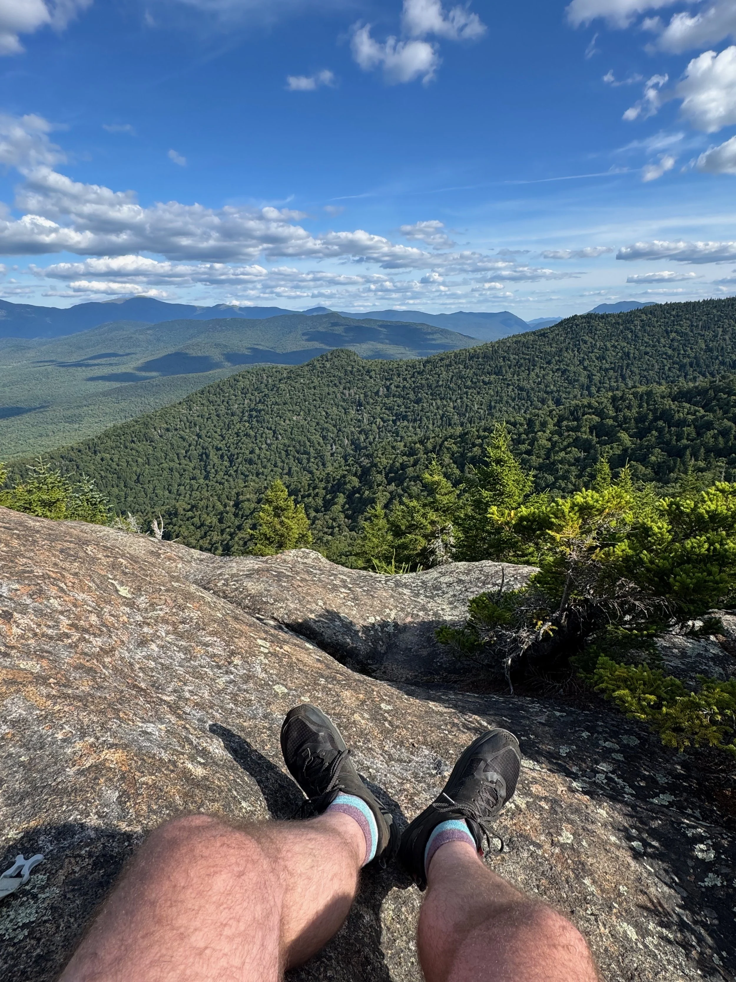
From the summit of Mount Martha, the trek continues as you’ll hike across the ridge to Owl’s Head on the trail that’s named Martha’s Mile, but is only 0.8-miles long (someone add a switchback). This is a beautiful stretch of trail that at first undulates along the ridge, before dropping more steeply and and climbing again before reaching the summit of Owl’s Head.
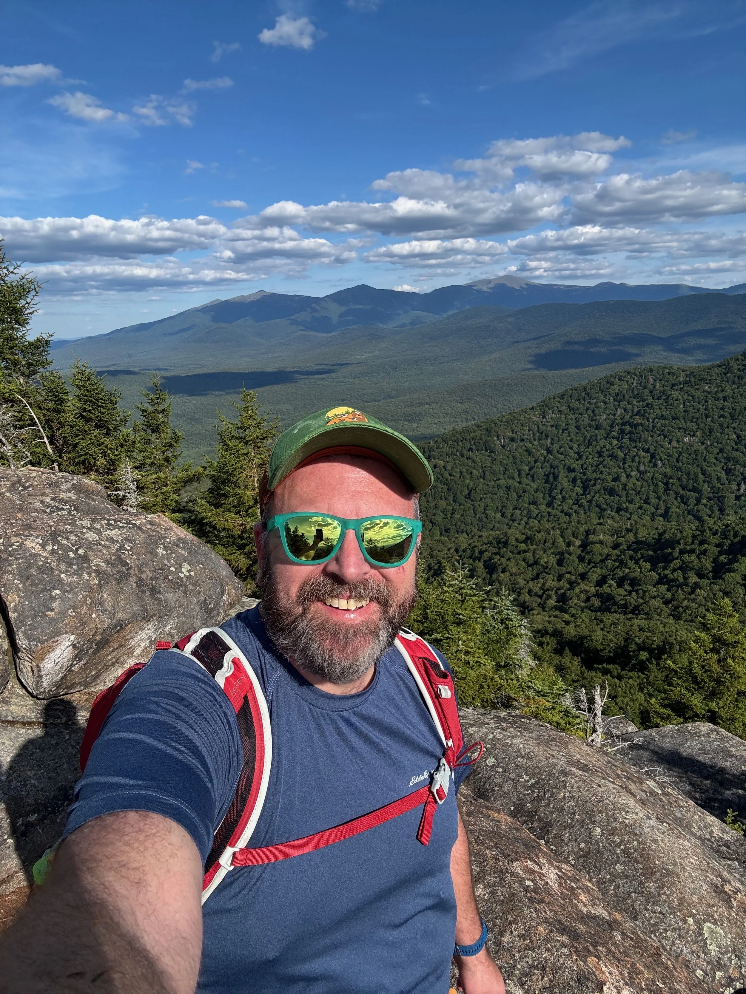
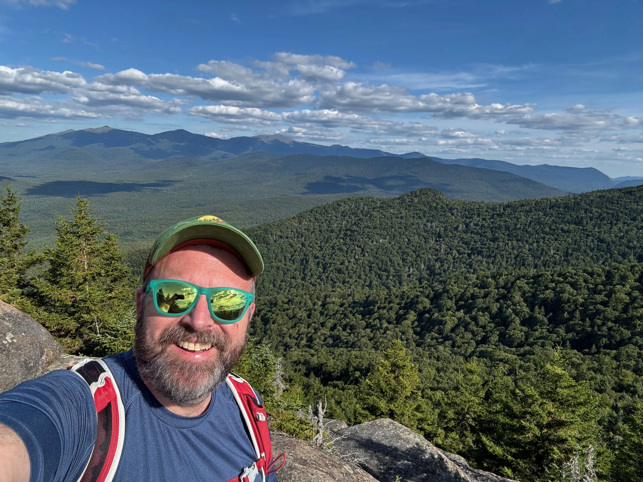
The final push to the summit of Owl’s Head involves some steeper, rocky sections, but the reward is worth it: wide-open ledges with panoramic views of the Presidential Range and the surrounding mountains.
After soaking in the scenery, retrace your steps across Martha’s Mile, summit Mount Martha again, and descend back down the Cherry Mountain Trail to the trailhead on Route 115.
Tips for Hiking Mount Martha and Owl’s Head
Footwear: The trail is rocky and steep in sections—wear sturdy boots or trail shoes.
Navigation: Trail junctions are marked, but it’s always smart to bring a map or GPS.
Parking: The lot on Route 115 is small but usually not full, a perk compared to other White Mountains trailheads.
Timing: Allow 4–6 hours for the full hike, depending on your pace and how long you linger at the viewpoints.
Mount Martha and Owl’s Head Hike Summary
🧭 Trailhead: Cherry Mountain Trailhead, Route 115, Carroll, NH (Google Maps)
🗺️ Route: Cherry Mountain Trail —> Mount Martha Spur —> Martha’s Mile —> and reverse
🥾 Distance: ~5.5 miles round-trip
📈 Elevation Gain: ~2,400 feet
⚠️ Difficulty: Easy - Moderate
🗺️ GPS Information: Trail Route in GPX Format
For More Information on Hiking Mount Martha and Owl’s Head:
Hikes near Mount Crescent Loop in the White Mountains
More of our White Mountains hikes on YouTube
Gear we used on the Mount Crescent Loop hike:
Some product links are affiliate links and we earn from qualifying purchases. Others are links through the Amazon Influencer program and as an Amazon Influencer, we earn from qualifying purchases. Still others, we just want you to know about some good gear we enjoy!
Important Hiking Considerations:
Weather: Check the weather forecast before your hike and be prepared for changes in conditions.
Safety: Some sections of trail can be steep and rocky, others can be muddy, so use caution and always watch your footing.
Leave No Trace: As with any outdoor activity, remember to follow the principles of Leave No Trace. Pack out any trash, stay on the trail, and be respectful of the natural environment.


The White Mountains have thousands of miles of trails to explore, check out our Hiking the White Mountains playlist on YouTube to continue the adventure!