Split ascents of Mount Madison, White Mountains, NH
Hiking Mount Madison: Best Routes, Difficulty, and What to Expect on this Presidential Peak
At 5,366 feet in elevation in the White Mountains of New Hampshire, Mount Madison is the northernmost mountain in the Presidential Range. Hiking Mount Madison is an incredibly rewarding adventure in New Hampshire’s Presidential Range, offering big mountain views, rugged trails, and a true taste of classic White Mountains terrain. Whether you’re climbing via Valley Way, Osgood, or another popular route, this summit delivers sweeping ridgelines and an unforgettable day above treeline. In this guide, we break down everything you need to know to plan your Mount Madison hike via the Osgood Trail, Madison Gulf Trail, and the Buttress Trail.
Be Prepared
Mount Madison and the entire Presidential Range, including nearby Mount Adams, Mount Jefferson and Mount Washington all rise well above treeline into the alpine zone. Weather can be very changeable and harsh without much notice, but on this trip, we lucked out with clear skies, but a steady wind. Even so we had fully stocked backpacks and were prepared for whatever kind of weather the White Mountains were going to throw at us.
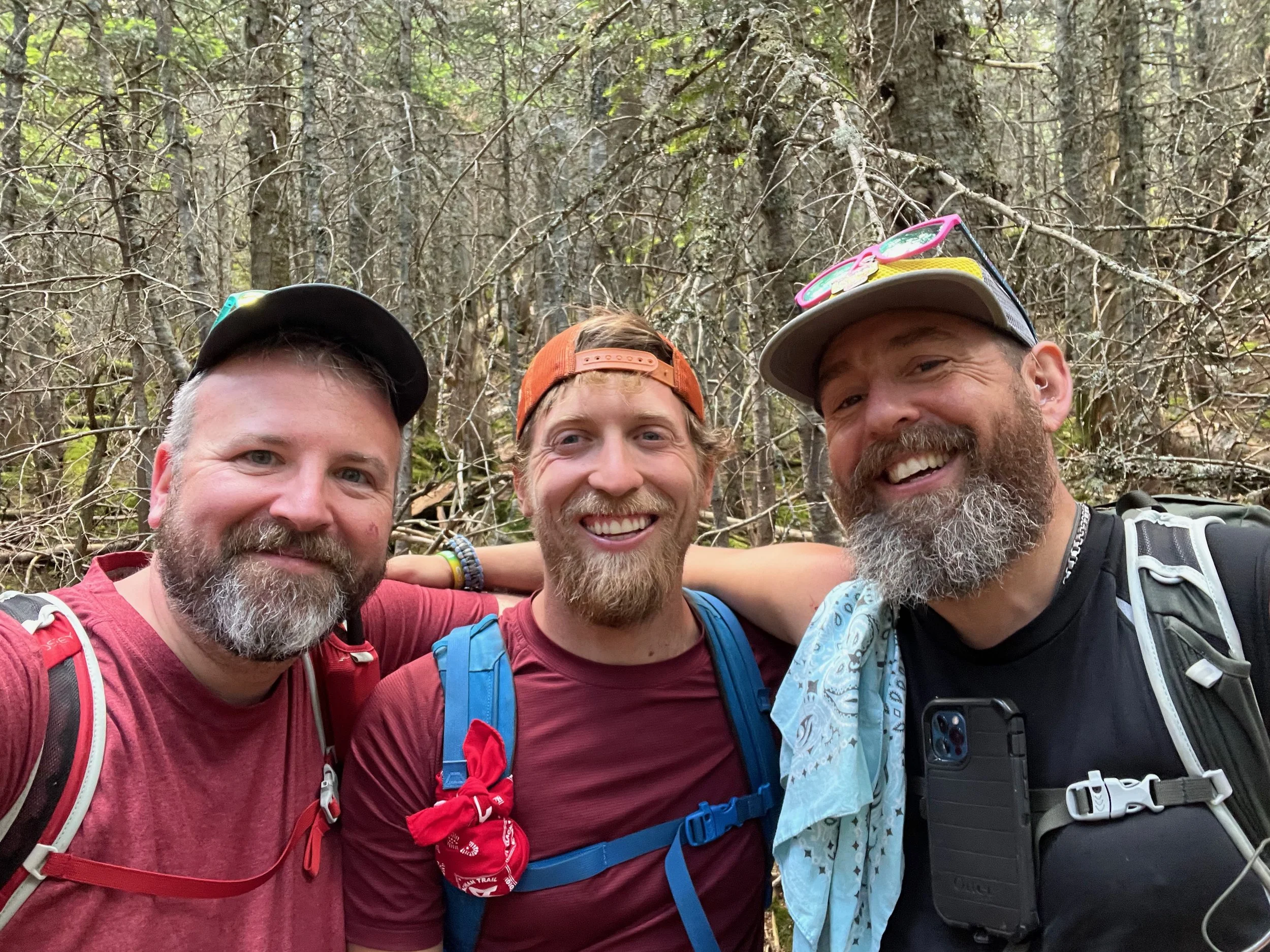
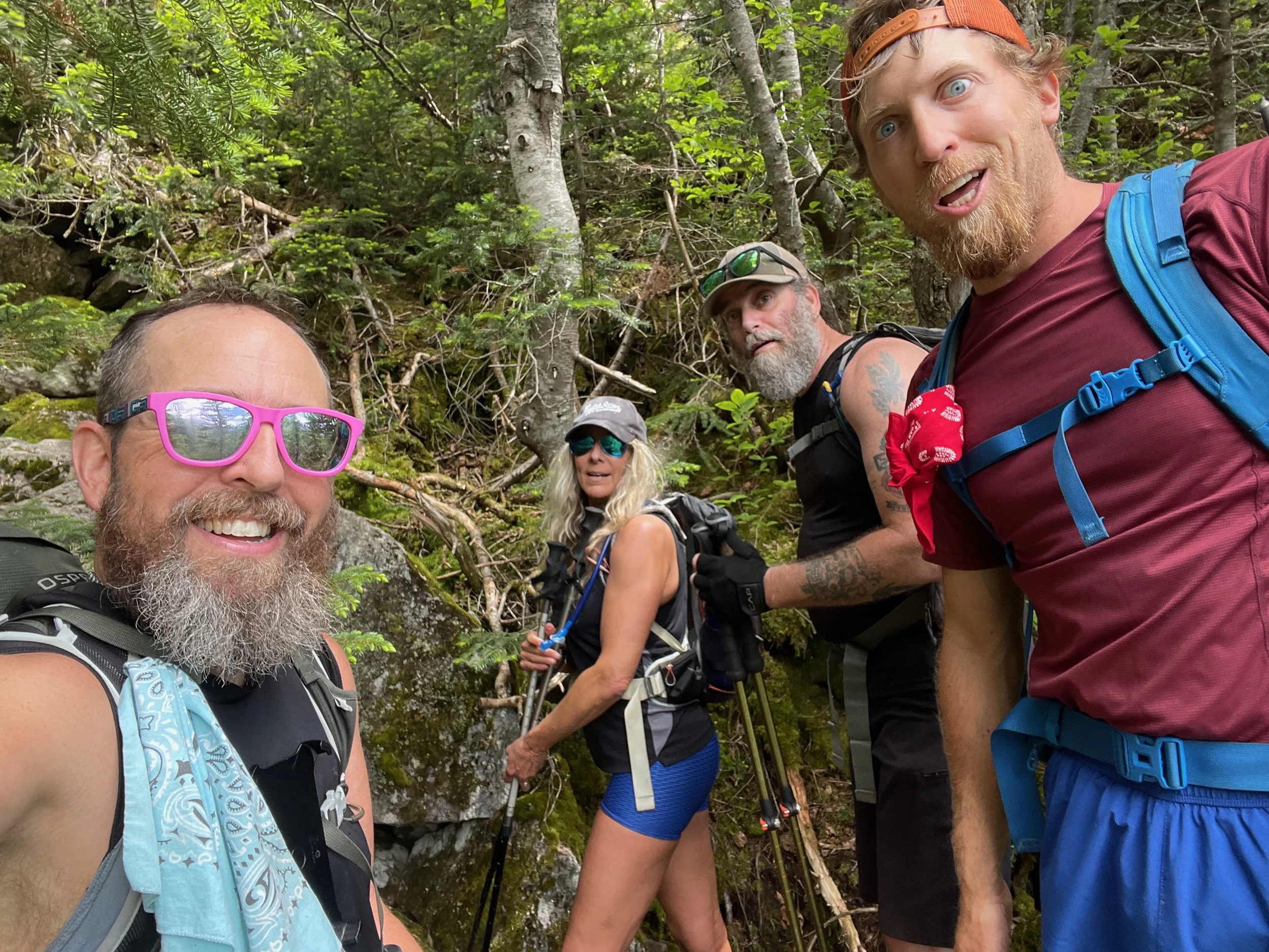
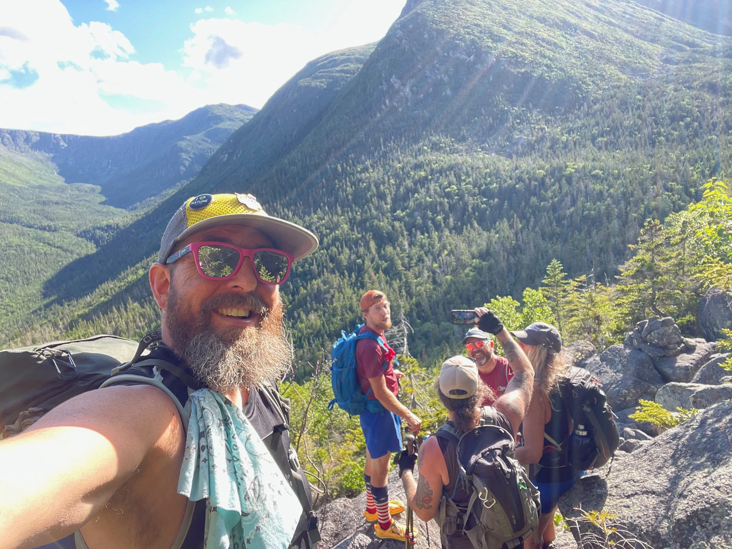
We were joined with by our friends Greg, Barb, and Patrick on this hike and began at the Great Gulf Trailhead on Route 16, just outside of Gorham. From the trailhead, we followed the Great Gulf Trail 1.5 miles to the the junction with the Osgood Trail. At that trail junction, Jeff headed up the Osgood Trail to the summit, while the rest of the group continued on Great Gulf Trail to the Madison Gulf Trail, then along the Parapet Trail, before reconnecting with the Osgood Trail for the final ascent to the summit of Mount Madison.
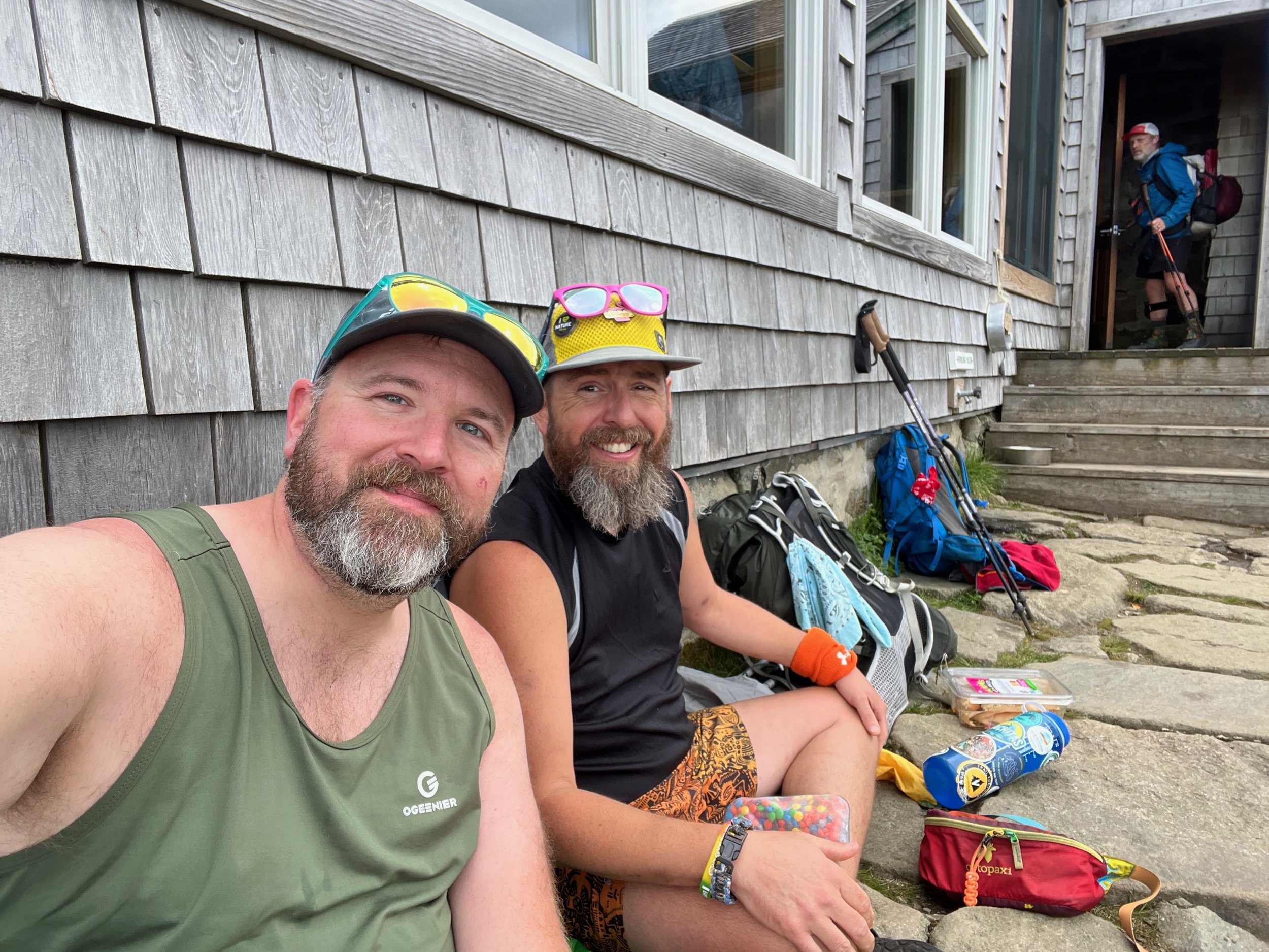
From the summit the entire group descended down to the Madison Spring Hut, where we had a good long rest and then took the Star Lake Trail to the Buttress Trail, descended the Buttress Trail to the Six Husbands Trail, and finally out to the Great Gulf Trail, which we followed back to the trailhead.
Mount Madison Ascent via the Osgood Trail
The Osgood Trail begins from the Great Gulf Trail near the Great Gulf Trailhead off NH Route 16. For the first 1.5 miles from the Great Gulf Trailhead, you follow the Great Gulf Trail on a mostly gentle grade with typical New Engand footing - roots, rocks, and occasional wet sections. At the trail junction with the Osgood Trail, you will turn right onto the Osgood Trail, begin climbing at a moderately, and hike about 0.8 miles to the trail junction with the Osgood Connector and the Osgood Tentsite.
Once past the Osgood Connector and Tentsite, the character of the hike changes quickly. The trail climbs steadily through mixed forest, becoming rockier and more uneven as it gains elevation. The trail becomes very steep and at around 3,500 feet, you begin approaching the lower edge of krummholz, and soon after, the trail breaks fully above treeline - where the climbing also moderates from the very steep ascent just before.
From here, the Osgood Trail follows Osgood Ridge directly toward Mount Madison. This section is exposed to wind and weather and consists of continuous rock-hopping over angular boulders. The grade is consistent, defintely not the steepest in the range, but steady enough that progress slows due to footing and exposure. Views toward the Great Gulf, Mount Adams, and the Northern Presidentials are constant.
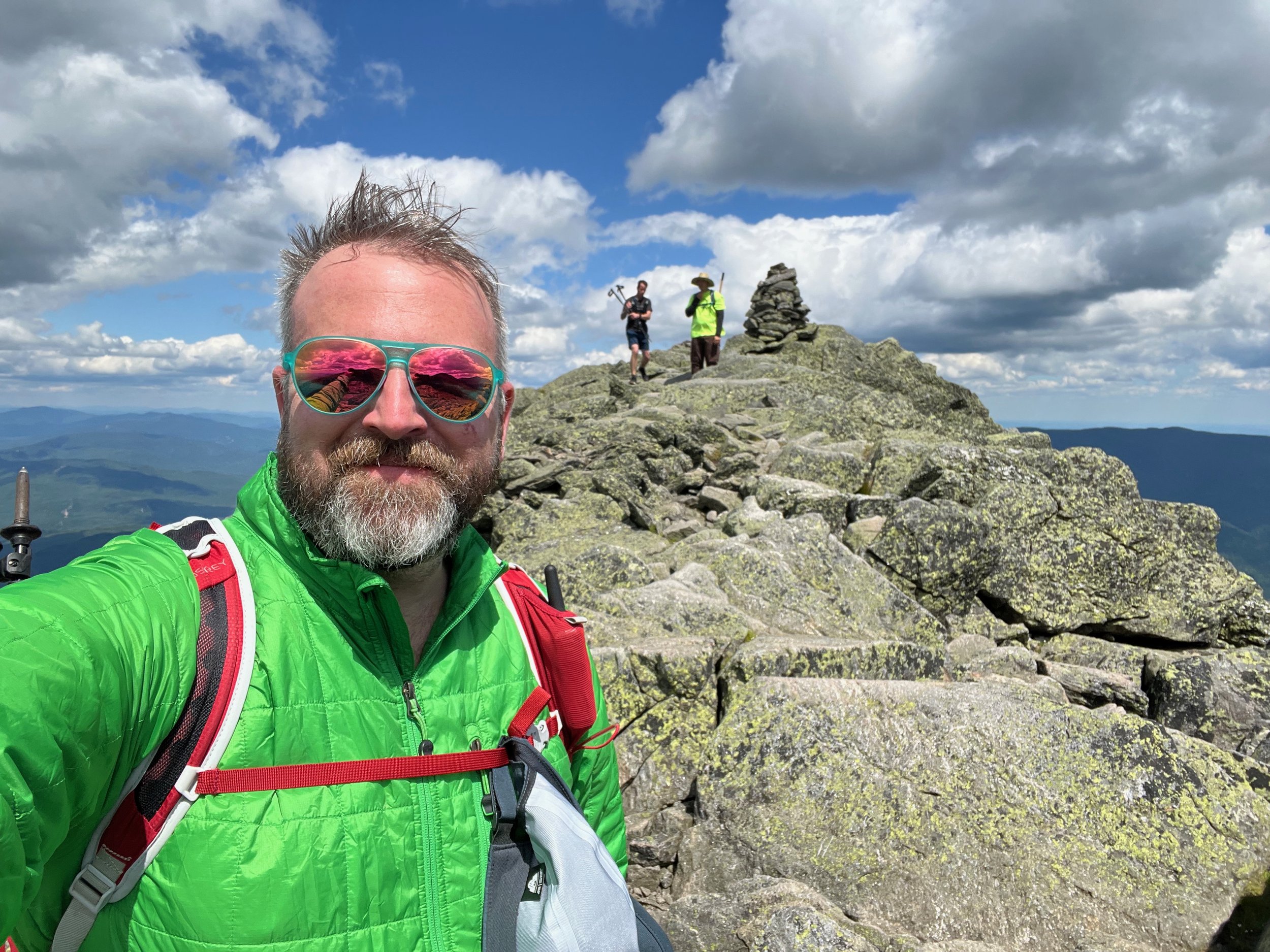
About 0.6 miles before the summit of Mount Madison, at Osgood Junction, the Osgood Trail merges with the Daniel Webster Scout Trail to make the final ascent to the Madison summit cone. At 0.3 miles the Howker Ridge Trail intersects and then for the the last 0.3 miles you’ll be scrambling in typical Presidential Range over and around boulders to the summit.
The total distance from the Great Gulf Trailhead to the summit of Mount Madsion is about 5 miles.
Mount Madison Ascent via the Madison Gulf Trail
The rest of the group continued on the Great Gulf Trail another mile, past the intersection with the Osgood Connector, to reach the intersection with the Madison Gulf Trail. Once on the Madison Gulf Trail, the terrain becomes more demanding almost immediately. The trail follows close to Parapet Brook, with rough footing, uneven rock steps, and short, steep pitches. As you move into the Gulf itself, the trail steepens significantly and becomes one of the more rugged climbs in the northern Presidentials. Expect scrambles over large boulders, eroded sections requiring careful footing, and stretches that will be slippery after rain.
At around 3,200–3,400 feet, the trail reaches the Madison Gulf headwall, the steepest and most technical portion of the route. This section climbs directly up the headwall, in places on exposed rock slabs and boulders. While not a technical climb, it requires the use of hands, careful route choices, and comfort with steep, rough terrain. In wet or icy conditions, the headwall is hazardous and not recommended.
Above the headwall, the trail enters the alpine zone and continues over broken rock and scattered boulders toward the junction with the Parapet Trail at 2.6 miles from the trail junction with the Great Gulf Trail. From here, we turned right onto the Parapet Trail, which traverses the rugged, alpine terrain above Madison Gulf, but below the summit of Mount Madison. The Parapet Trail is short but rocky and exposed, with uneven footing and scattered boulders typical of the Presidential Range, it was also pretty poorly maintained through the krummholz when we hiked it.
After the traverse, the Parapet Trail connects directly to the Osgood Trail at Osgood Junction (where the Daniel Webster Trail also joins the Osgood Trail). The Osgood Trail then climbs 0.3 miles to the intersection with the Howker Ridge Trail, then another 0.3 miles to the summit, consisting of steady boulder-hopping on open rock.
This route is best for experienced hikers comfortable with steep scrambles, exposure, and extended above treeline travel. The Madison Gulf headwall makes it one of the most strenuous and committing ways to reach Mount Madison.
Mount Madison Summit to Madison Spring Hut
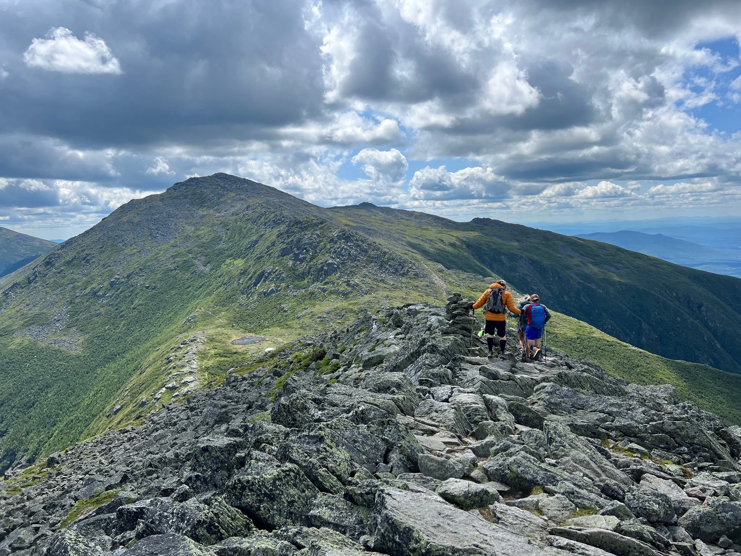
From the summit of Mount Madison, the Osgood Trail begins its descent by dropping immediately off the summit cone’s upper slopes. The footing is entirely on exposed talus for the first stretch, and hikers should take their time picking their way down. The trail follows a generally southwest line, and although it is steep, the route is well defined thanks to the large cairns that guide you through the open alpine terrain.
As you descend, the views remain wide open for most of this section, with clear sightlines to Mount Adams, Star Lake, Madison Spring Hut, and the high ridges of the Northern Presidentials. The Osgood Trail ends in front of the Madison Spring Hut sitting just below the col between Madison and Adams. Total distance from the summit is roughly 0.5 miles, but the descent is slow and deliberate due to the rocky terrain and sustained exposure above treeline.
Descent via the Star Lake Trail, the Buttress Trail, Six Husbands Trail, and Great Gulf Trail
From the Madison Spring Hut, we began our descent on the Star Lake Trail, passing the intersection with the Parapet Trail, and Star Lake’s shoreline before reaching the trail junction with the Buttress Trail. The Star Lake Trail doesn’t gain or lose much elevation in those 0.3 miles and the walk is surprisingly easy after all the rougher hiking earlier.
From the trail junction with the Star Lake Trail, the Buttress Trail begins its descent quickly - descending down through boulders and rocks, as its passes through the exposed alpine area and descends toward the krummholz and then deeper forests of the Great Gulf Wilderness. The upper segment remains above treeline for a short distance, with rocky, uneven footing and excellent views down into the Great Gulf cirque and across to the craggy ridges of Jefferson and Adams.
Once the trail begins its real plunge into the cirque, the terrain becomes steeper and more technical. Expect rough, rocky tread with a combination of boulders, ledges, and tight scrambles as the route threads its way down a series of buttresses along the ridge.
As you descend further, the forest gradually closes in. The rocks give way to the New England mix of roots, soil, and rocks. The trail remains steep and footing can be slick due to limited sunlight and persistent moisture.
Several viewpoints open up briefly where the trail crosses open ledges, and a much more incredible view opens up as you traverse a boulder field offering expansive looks around the Great Gulf. Eventually, the trail moderates its descent as it approaches the junction with the Six Husbands Trail at 1.9 miles from the Star Lake Trail junction.
Once on the Six Husbands Trail you’ll continue to descend at a more moderate rate about 0.5 miles to the intersection with the Great Gulf Trail. You’ll then take the Great Gulf Trail 3.5 miles back to the Great Gulf Trailhead on Route 16.
This was a 12.5+ mile hike with about 4,300 feet of elevation gain. We'd classify this as a very difficult hike, with rock scrambles, a few small climbs over large rocks, and then a very long and rocky descent on the Buttress Trail.
You can find the Mount Madison hike:
Help with hiking Mount Madison?
Don’t know where to start with hiking, backpacking, and camping? We can help you! Visit our professional Outdoor Hiking, Backpacking and Camping Guide Services Company at Hike On Guides. For hikes and backpacking trips in New Hampshire, we also offer a lodging option - let us know if you’re interested.
Hikes near Caribou Mountain in the White Mountains
More of our White Mountains hikes on YouTube
Gear we used on this hike:
Hydration and nutrition for this hike:
Some product links are affiliate links and we earn from qualifying purchases. Others are links through the Amazon Influencer program and as an Amazon Influencer, we earn from qualifying purchases. Still others, we just want you to know about some good gear we enjoy!
Our Hiking Advice and Hiking Gear Recommendations
Important Hiking Considerations:
Weather: Check the weather forecast before your hike and be prepared for changes in conditions.
Safety: Some sections of trail can be steep and rocky, others can be muddy, so use caution and always watch your footing.
Leave No Trace: As with any outdoor activity, remember to follow the principles of Leave No Trace. Pack out any trash, stay on the trail, and be respectful of the natural environment.