Kearsarge North Fire Tower Hike from Hurricane Mountain Road | White Mountains, NH
Kearsarge North Fire Tower Hike
Kearsarge North packs a substantial climb and wide-ranging views into a hike just outside North Conway and Intervale, New Hampshire. The Kearsarge North Trail climbs from Hurricane Mountain Road through forest and across rock slabs to a 3,268-foot summit, where a fire tower provides a 360-degree view of the White Mountains, Mount Washington Valley, and western Maine. Plan on about 6.2 miles round trip and roughly 2,600 feet of elevation gain.
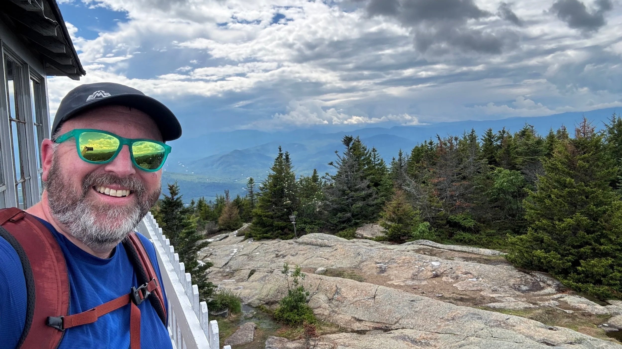
We started this hike together, excited to explore a part of the White Mountains where we hadn’t spent much time on the trails. Moe wasn’t feeling well and decided to turn back, while Jeff continued to the summit. A few showers made the upper ledges slick, but the clouds left enough room for an excellent view from the tower. With storm clouds building nearby, it was a short summit visit, and a good reminder that the descent deserves just as much planning as the climb.
Hike at a Glance
Location: White Mountain National Forest, near North Conway and Intervale, New Hampshire
Trailhead: Kearsarge North Trailhead on Hurricane Mountain Road in Bartlett (Google Maps)
Best Maps: AMC White Mountains Map, and AllTrails
Route: Kearsarge North Trail to the summit and fire tower, returning the same way
Distance: Approximately 6.2 miles
Elevation gain: Approximately 2,600 feet
Difficulty: Moderately challenging, with sustained climbing and steeper, rocky sections on the upper mountain
Highlights: Rock-slab viewpoints, open summit ledges, and the Kearsarge North Fire Tower
Getting to the Hurricane Mountain Road Trailhead
From North Conway, follow Route 16/302 north toward Intervale and turn onto Hurricane Mountain Road. The Kearsarge North Trailhead is on the left approximately 1.5 miles up the road. The parking area is small, with room for roughly eight to ten vehicles, so arriving early is worthwhile on busy hiking days. Park without blocking the road or neighboring access. Also note that the Town can and does ticket and tow vehicles that are not in the parking lot.
Make sure your directions are for Kearsarge North. This is a different mountain from Mount Kearsarge near Warner and Wilmot, which is accessed through Winslow and Rollins state parks. For this hike, you want Hurricane Mountain Road near North Conway - not either of those state parks.
The Lower Trail: Forest and a Brook Ravine
From the parking area, follow the Kearsarge North Trail into the woods. The opening section passes a small wet area and initially follows near a brook before climbing away from its ravine. This is the gentlest part of the approach, but it is still uphill rather than a long, level warm-up.
On our hike, the first three-quarters of a mile felt relatively gentle. After that, the climb became more sustained as the trail gained a shoulder and worked onto the ridge. Expect the footing to become rockier and rougher as you leave the lower drainage behind.
The route alternates between moderate climbing and more demanding pitches. There are occasional easier stretches, but few extended flat sections. Set a pace you can maintain: the summit is only a little over three miles from the road, yet the elevation gain makes this a more substantial outing than the mileage alone suggests.
Climbing Across the Rock Slabs
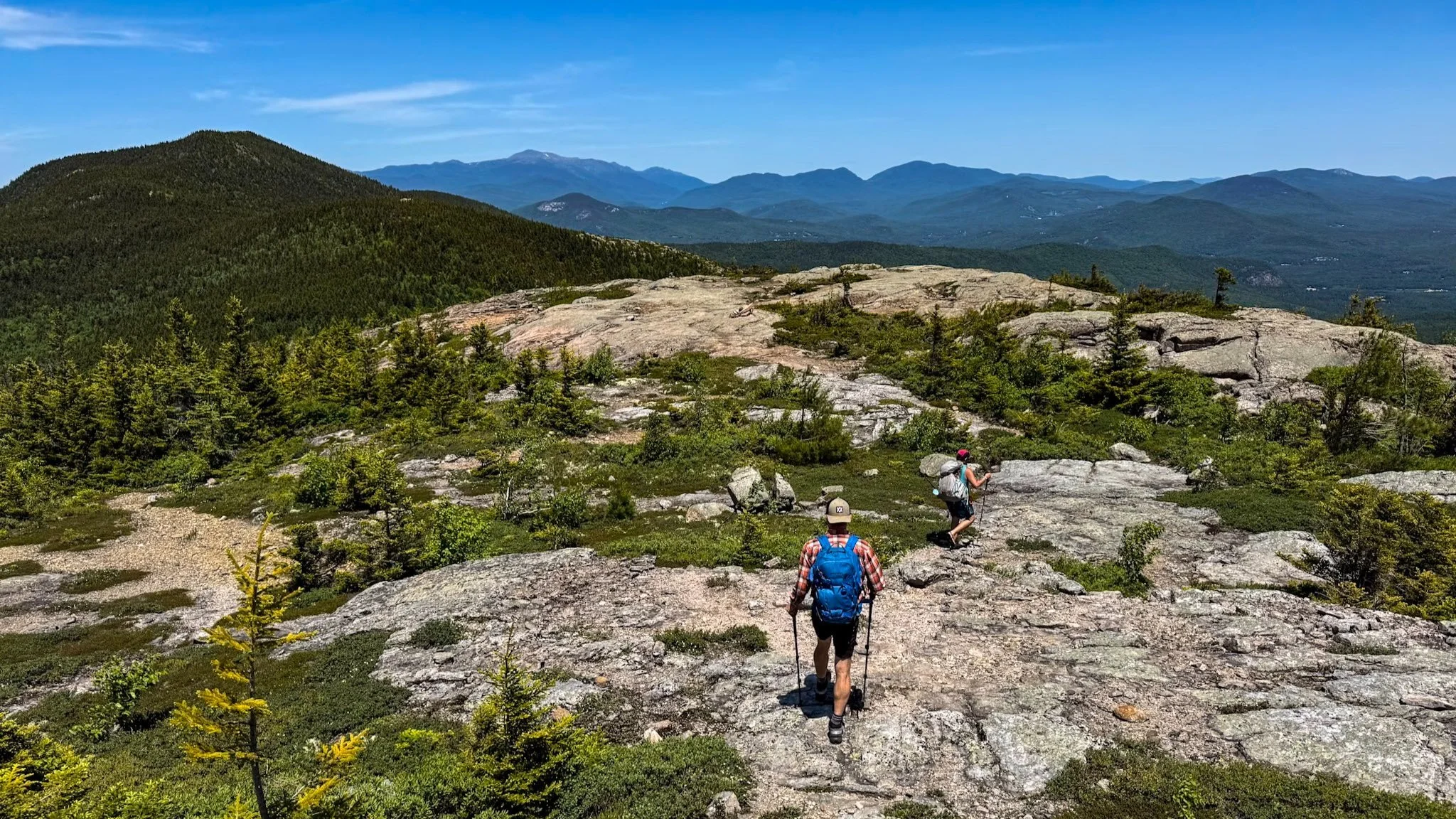
Higher on the mountain, the forest begins to open around stretches of exposed bedrock. The trail crosses rock slabs with trees still nearby, so this is not a continuous above-treeline ridge walk. Instead, you move between wooded sections and open rock, with viewpoints appearing along the climb.
Pause and look behind you as you gain elevation. Jeff walked past one of the viewpoints on the ascent without realizing how much there was to see; it became obvious when he faced downhill on the return. These openings are worth enjoying before reaching the summit, particularly if clouds are moving through.
The slabs were manageable on our hike, but showers and water running across the rock made some surfaces slippery. In dry conditions, these sections provide relatively clean footing compared with loose, rocky trail. When wet or icy, they require more care and can slow both the ascent and descent.
Follow the established route across the ledges. The climb continues beyond these early views, returning to the woods before the final approach to the summit.
The Final Climb to Kearsarge North
The upper mountain contains some of the route’s steepest and rockiest terrain. Jeff found the last three-quarters of a mile the most demanding section to negotiate. Expect uneven rock, roots, and sustained uphill travel rather than an easy stroll to the tower.
As you approach the top, the trail emerges onto the summit ledges. The fire tower rises above the open rock, marking the end of the climb. The standard trail distance is approximately 3.1 miles one way.
Kearsarge North Fire Tower and Summit Views
The fire tower is the centerpiece of this hike. Its enclosed, glass-windowed cab sits about 15 feet above the summit rock, adding a northern view to the scenery available from the ledges. The elevated lookout gives you a clear perspective across the surrounding landscape.
The present tower was rebuilt by the U.S. Forest Service in 1951 and remained in use for fire detection until 1968. Today, visitors can experience the lookout and understand why this summit was such a useful place to watch the surrounding forests.
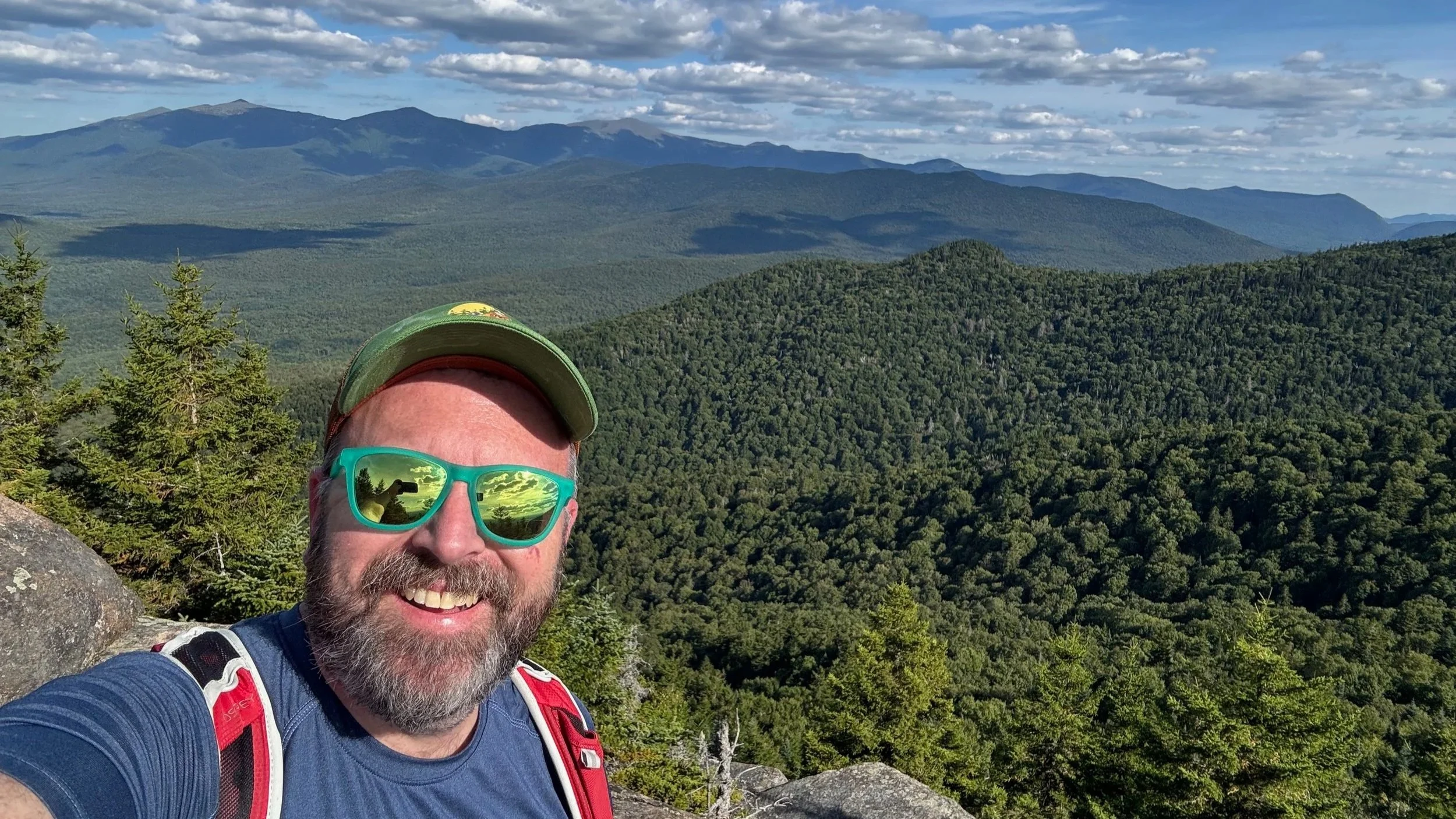
In clear weather, the panorama reaches across the Presidential Range, Carter–Moriah country, and the eastern White Mountains toward western Maine. Below you are the Mount Washington Valley and the mountains around North Conway, including the Moats and the familiar Cathedral and Whitehorse ledges. Middle-distance ridges and distant peaks give the view considerable depth.
Jeff’s reaction was immediate: if a little mountain-top cabin were on the Christmas list, this one would qualify. It was exactly the kind of place that invites a longer visit. But with storm clouds visible nearby, he left the tower and moved below the exposed summit rather than settling in.
Returning to Hurricane Mountain Road
Retrace the Kearsarge North Trail to return to the starting trailhead. The first part of the descent is the steepest and rockiest, so allow time to negotiate uneven steps and wet surfaces carefully. Reaching the tower is only the halfway point of the outing.
Below the summit, the trail returns to the open slabs and wooded ridge sections used on the ascent. This is another opportunity to enjoy the lower viewpoints, but assess conditions before stopping on exposed rock. On our hike, sunshine was drying the slabs as Jeff descended, while nearby thunderstorms were becoming more apparent.
Farther down, the route crosses the easier shoulder before dropping back into the brook ravine. The final section is less demanding than the upper mountain and leads through the forest to Hurricane Mountain Road. Jeff finished with approximately 6.4 miles recorded and rejoined Moe at the trailhead.
What the Difficulty Rating Really Means
We would describe Kearsarge North as moderately challenging, with strenuous stretches. It does not require a long approach or a complicated trail sequence, but climbing roughly 2,600 feet in a little over three miles is a meaningful effort. Other guides rate the route as hard, reflecting its sustained grade and rocky upper terrain.
The main considerations are:
Sustained ascent: Much of the route climbs continuously, with limited extended relief.
Rocky upper trail: Roots, uneven steps, and bedrock require attention.
Wet slabs: Rain or ice can make otherwise manageable rock surfaces difficult.
A substantial descent: The same elevation gained on the climb must be lost on the return.
This is a good choice for hikers comfortable with several hours of uphill and downhill travel who want a fire tower destination near North Conway. It should not be confused with a short, gentle walk to an observation tower.
Parking and Timing
The trail is popular and parking is limited. An early start helps with both trailhead logistics and leaving enough time for an unhurried ascent and descent.
Weather and Exposed Terrain
Our hike included showers, visible storm clouds, and thunder during the descent. Those conditions influenced how long Jeff stayed at the summit and where he stopped afterward. Build flexibility into your plan rather than treating the tower as a destination you must reach regardless of changing weather.
Wet rock is a practical concern even without a major storm. Footwear with dependable grip, weather layers, and enough time to descend carefully are especially important on the upper slabs.
Seasonal Footing
The ledgy sections can become icy in winter. Conditions near the summit may differ substantially from those at the trailhead, so check recent reports and prepare for the season rather than judging the entire route from the lower trail.
Choosing the Correct Return Route
Kearsarge North has another approach via the Weeks Brook Trail. Our outing used the Kearsarge North Trail from Hurricane Mountain Road in both directions; Weeks Brook is a different route with a different trailhead. Keep your intended route clear on your map before descending.
Why We’d Hike Kearsarge North Again
Kearsarge North gave us a sustained climb, interesting rock-slab terrain, and a fire tower with views in every direction. It also gave us an honest reminder that not every shared hiking day means both of us reaching the summit. Moe made the decision that was right for him, and Jeff came back with plenty of reasons for a return visit together.
For a White Mountains hike near North Conway and Intervale, this route offers a satisfying combination of accessible trailhead, substantial climbing, and a memorable summit destination. Give yourself time, choose a good weather window, and remember to turn around for those views on the way up.
Hello, World!
For More Information About the Kearsarge North Hike
More Hikes near Kearsarge North
Hiking and Backpacking Gear List
More of our White Mountains hikes on YouTube
Important Hiking Considerations:
Weather: Check the weather forecast before your hike and be prepared for changes in conditions.
Safety: Some sections of trail can be steep and rocky, others can be muddy, so use caution and always watch your footing.
Leave No Trace: As with any outdoor activity, remember to follow the principles of Leave No Trace. Pack out any trash, stay on the trail, and be respectful of the natural environment.