Mount Washington Loop Hike via Ammonoosuc Ravine & Jewell Trail (Trail Guide)
The Best Loop Hike of Mount Washington
Hiking Mount Washington via the Ammonoosuc Ravine and Jewell Trail loop is one of the best ways to reach the 6,288-foot summit of Mount Washington in New Hampshire. This challenging 10-mile loop hike climbs through waterfalls and rugged ravine terrain, crosses the alpine zone along Crawford Path and Gulfside Path, and then descends the exposed ridge of the Jewell Trail with sweeping Presidential Range views.
This Mount Washington trail guide covers route details, difficulty, trail conditions, weather considerations, and what to expect on one of the most popular Mount Washington hikes in the White Mountains.
The Ammonoosuc Ravine and Jewell Trail loop over Mount Washington offers what we think is the best loop hike of Mount Washington, especially for those not used to hiking in the White Mountains, but who still want to climb Mount Washington.
There are no easy trails up Mount Washington (nor really in the White Mountains), but the loop over Mount Washington that the Ammonoosuc Ravine and Jewell Trails offer is one of the best trails for most hikers to tackle the northeast’s highest peak. Even on this mellow route though, hikers should expect a demanding 10‑mile day with about 4,000 feet of elevation gain, long stretches of rock hopping, and slow travel above treeline
This trail is best done in the summer and early fall, as winter sets in early on Mount Washington and this hike would be a very challenging winter route except for all the most experienced hikers.
At 6,288 feet in elevation, Mount Washington is the highest mountain in New Hampshire and the highest mountain in the northeastern United States. Mount Washington claims to be home to the world’s worst weather and while we can argue over the details, suffice to say you should be prepared for all conditions, even on a hike in the middle of the summer.
Ammonoosuc Ravine Trail and Jewell Trail Quick Stats
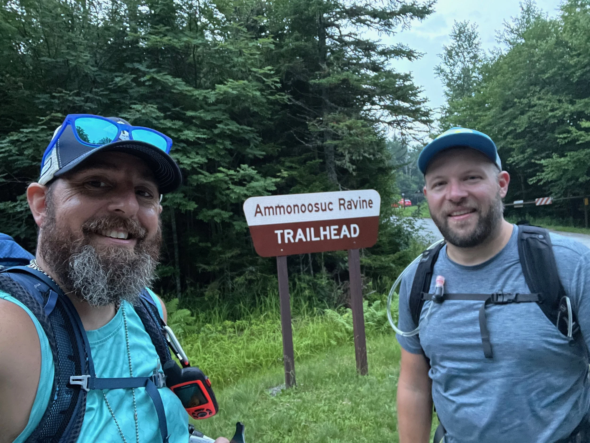
🧭 Trailhead: Ammonoosuc Ravine Trailhead (Google Maps)
🗺️ Route: Trailhead → Ammonoosuc Ravine Trail → Crawford Path → Trinity Heights Connector → Gulfside Trail → Jewell Trail
🥾 Distance: ~10 miles round trip
📈 Elevation Gain: ~4,000 ft
⚠️ Difficulty: Difficult
GPS Information: Trail Route in GPX Format
📱AllTrails Information: Trail Route and Information in AllTrails
Our Mount Washington Hike Experience
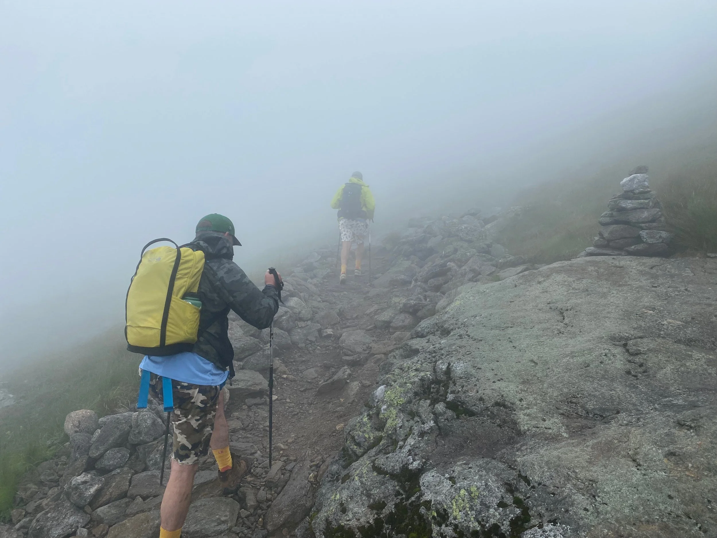
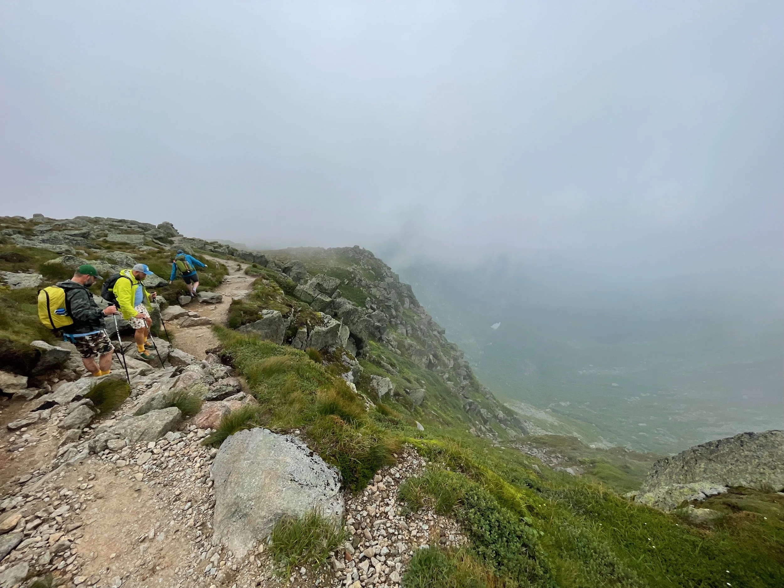
Part of the Presidential Range of the White Mountains, Mount Washington reaches well into the alpine zone and is home to extreme and highly variable weather conditions. The mountain is often shrouded in clouds with a climate that’s more reminiscent of areas of the arctic far to the north than the rest of the northeastern region.
While the weather wasn’t great for our climb, it wasn’t that bad either with temperatures in the 50s and 60s and winds in the 30mph range. For the most part we were hiking in the clouds once we reached the alpine zone, but we did have occasional views as the clouds would blow out. By the end of the hike, the clouds were definitely lifting and we could look back from the upper sections of the Jewell Trail and see the climb over Mount Washington we had just made.
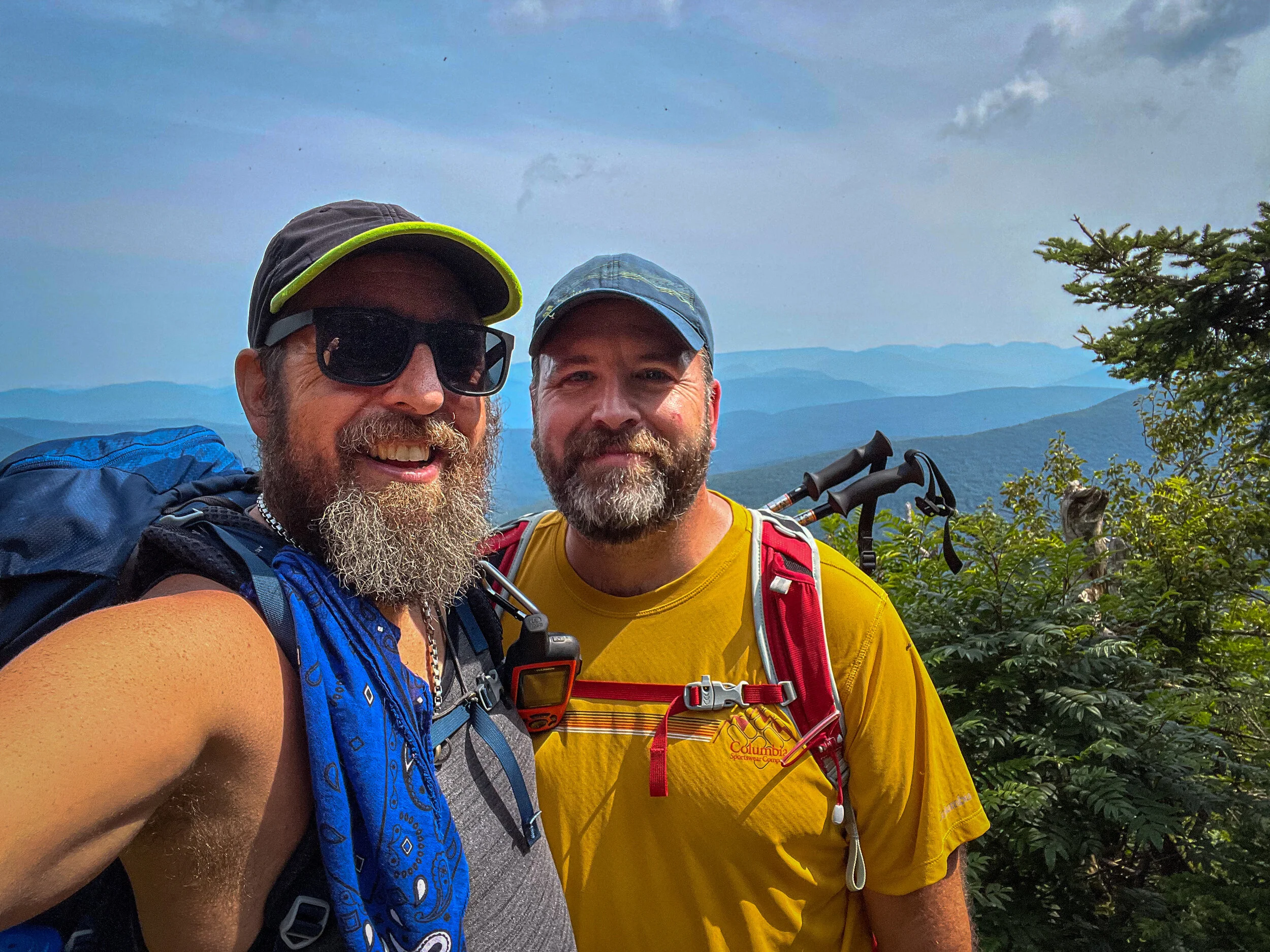
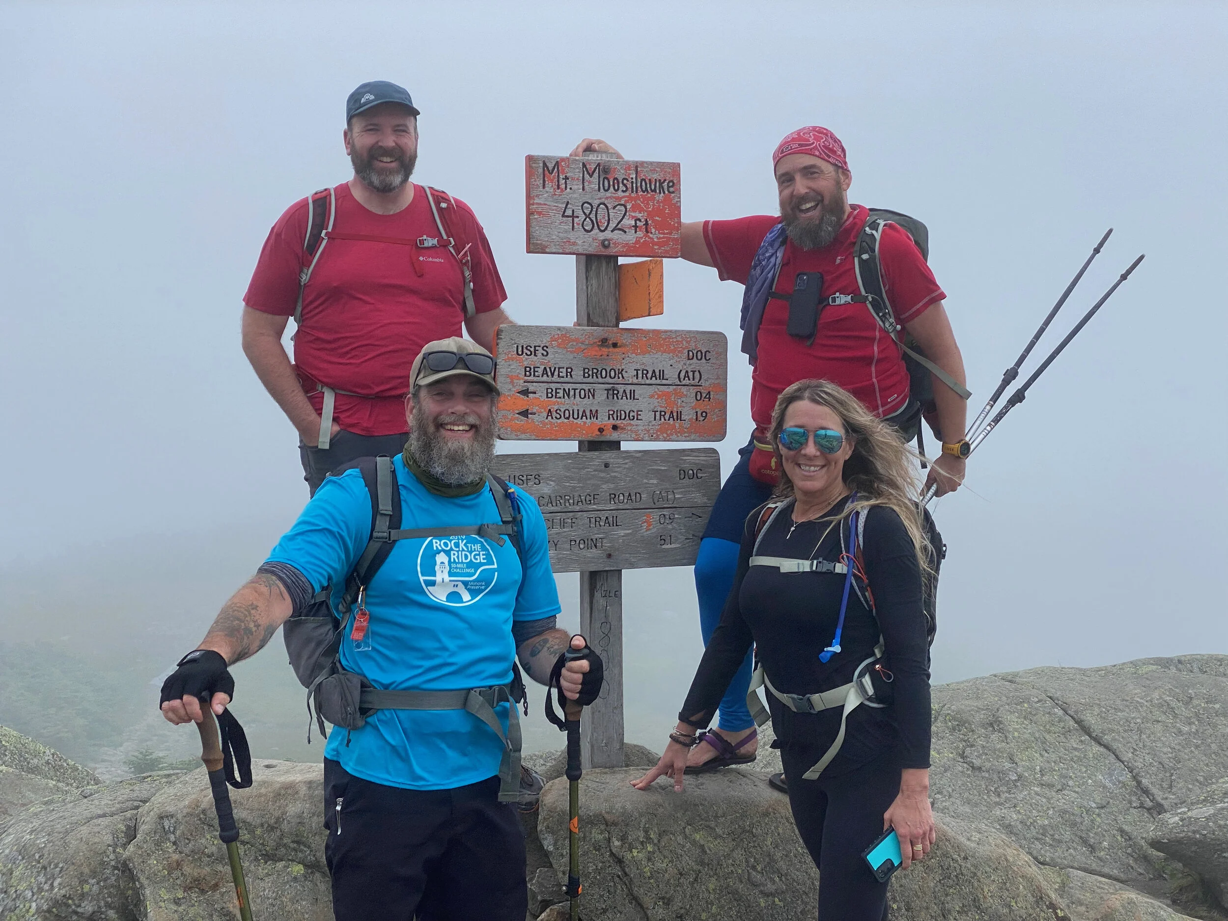
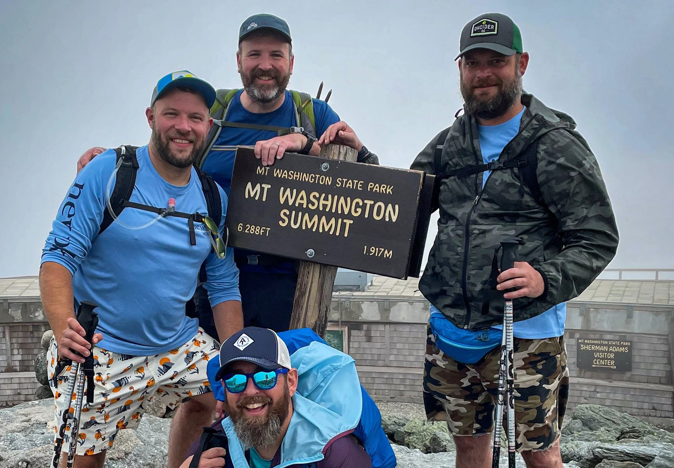
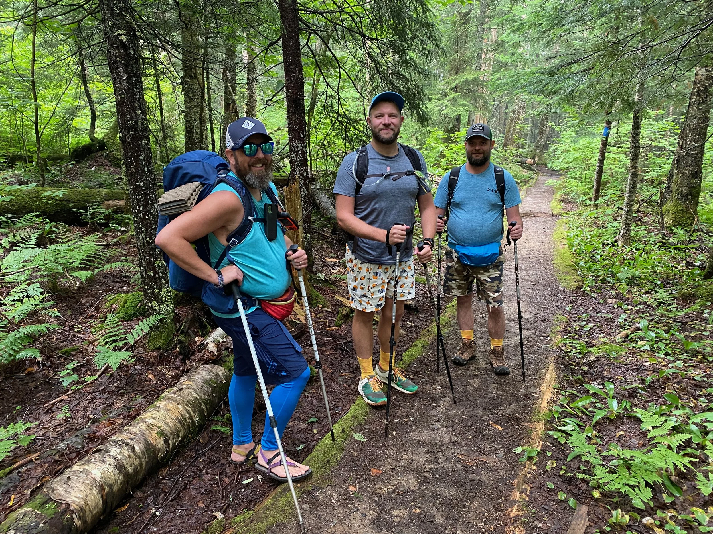
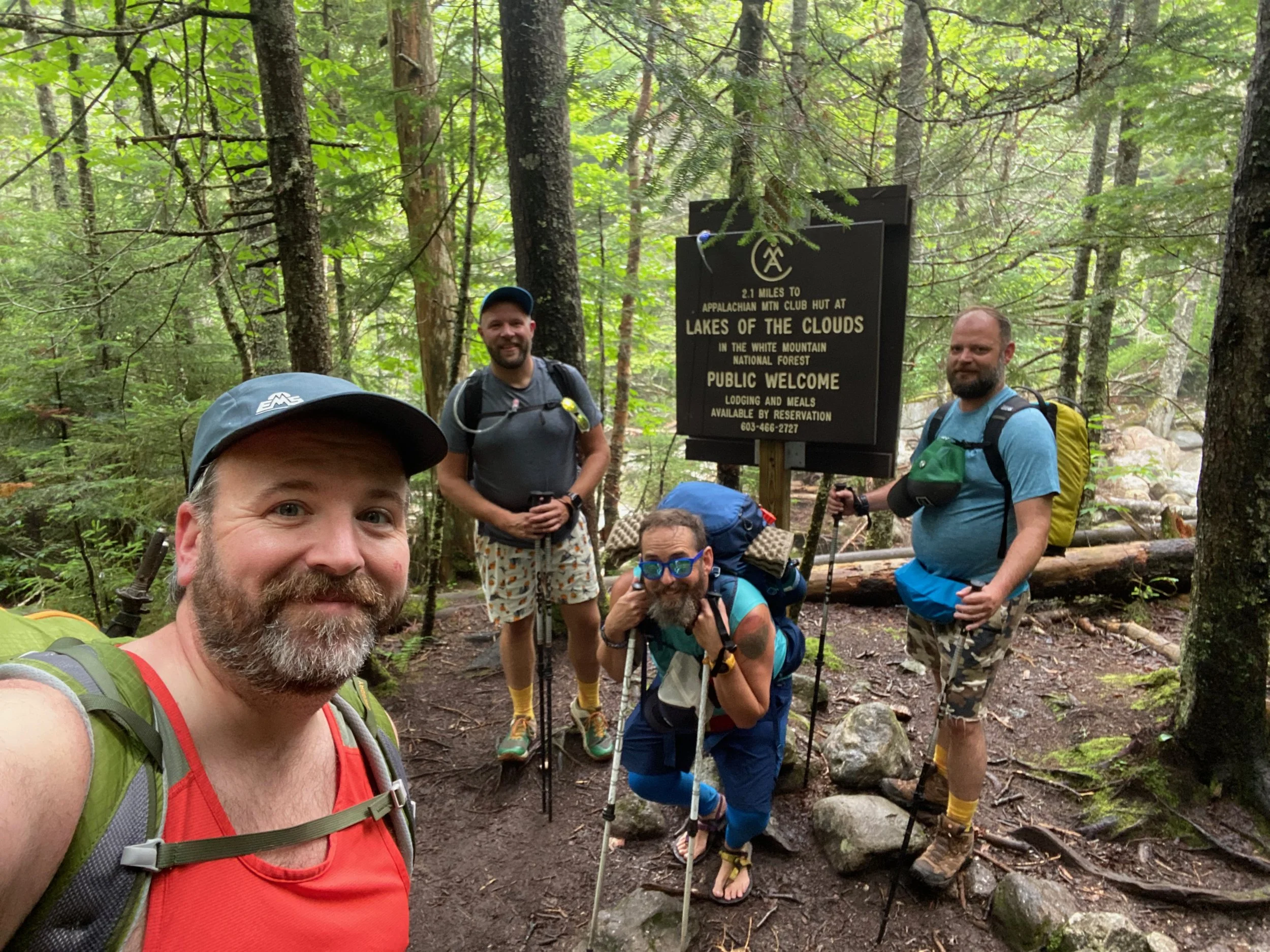
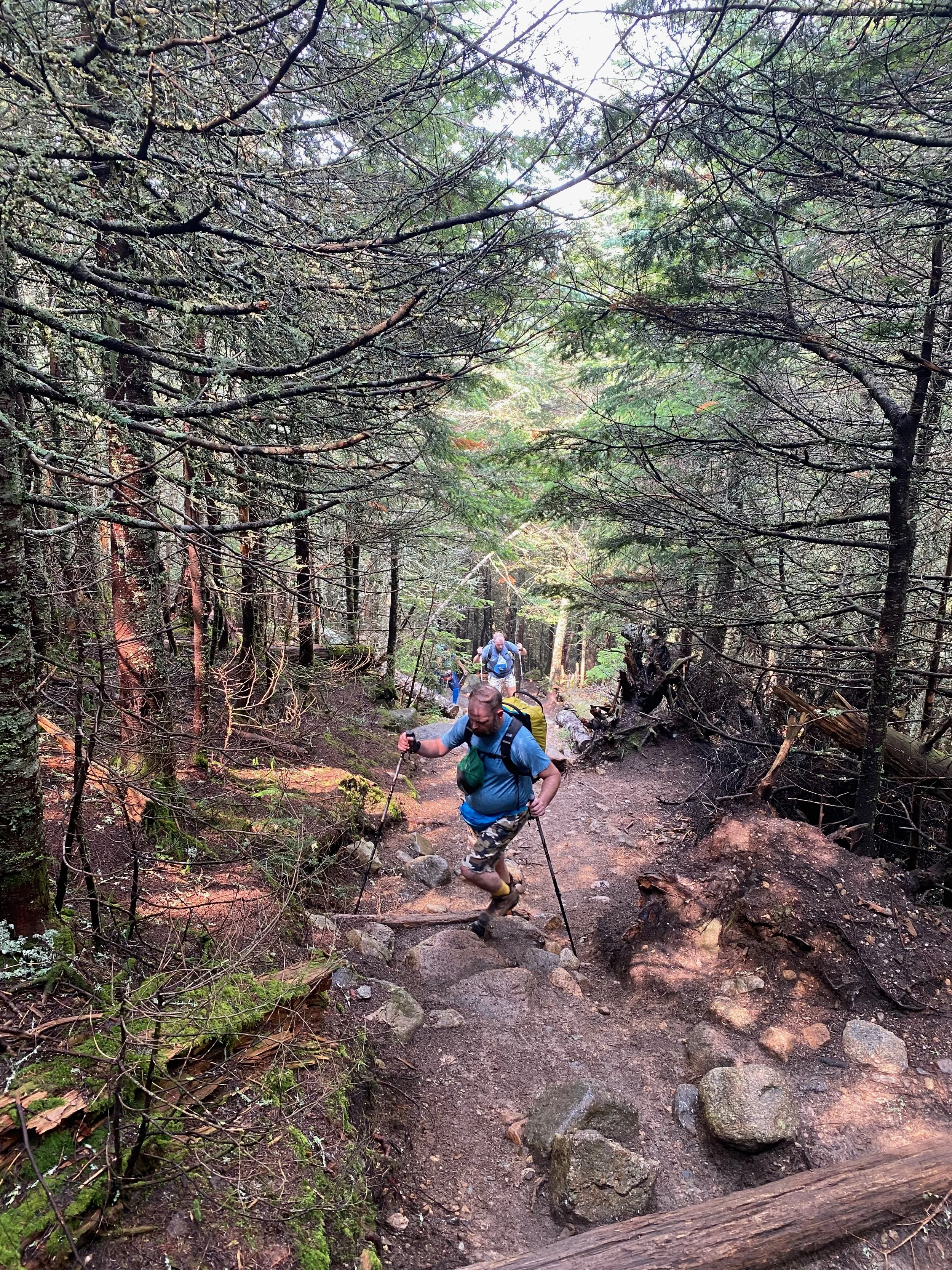
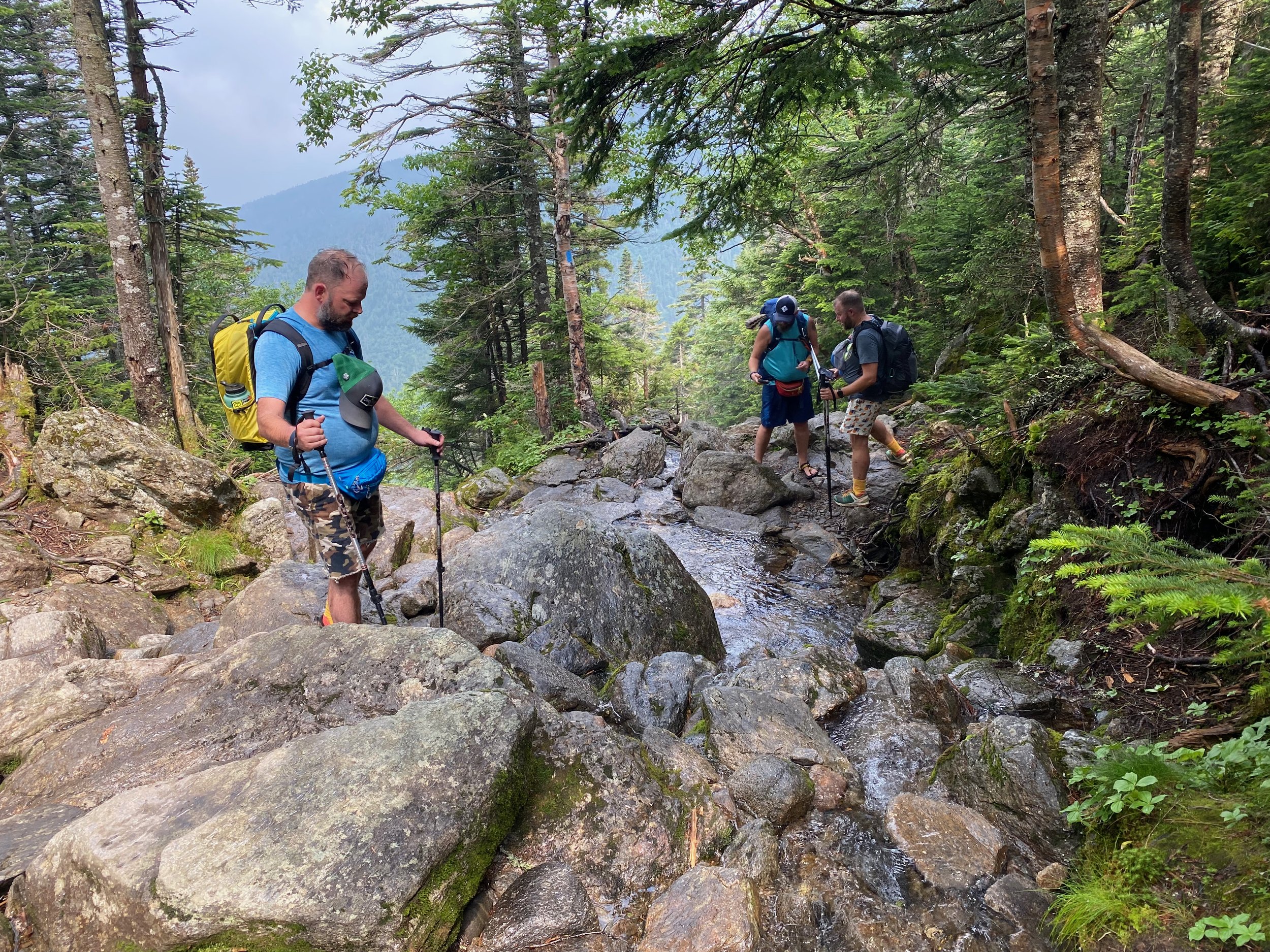
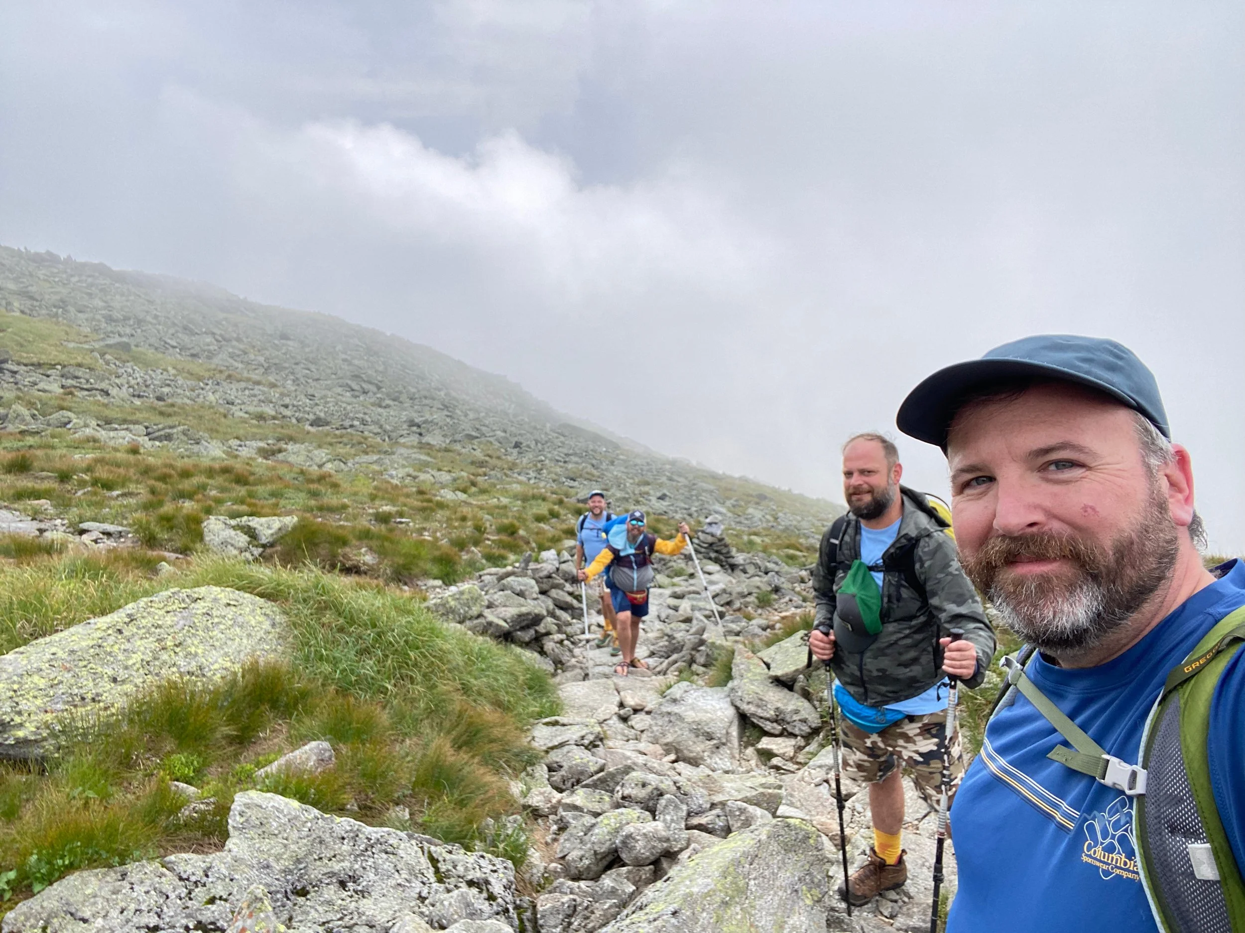
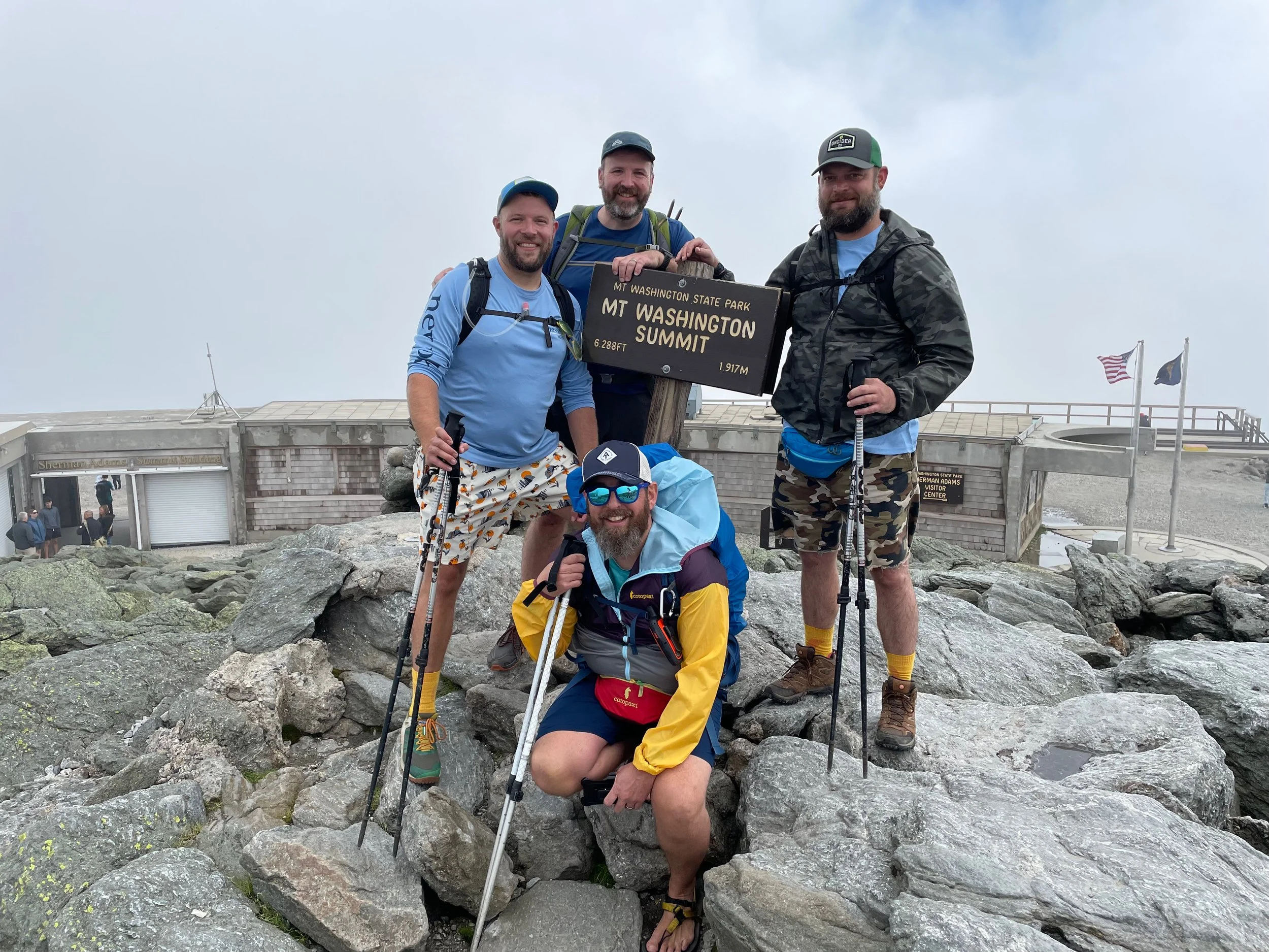
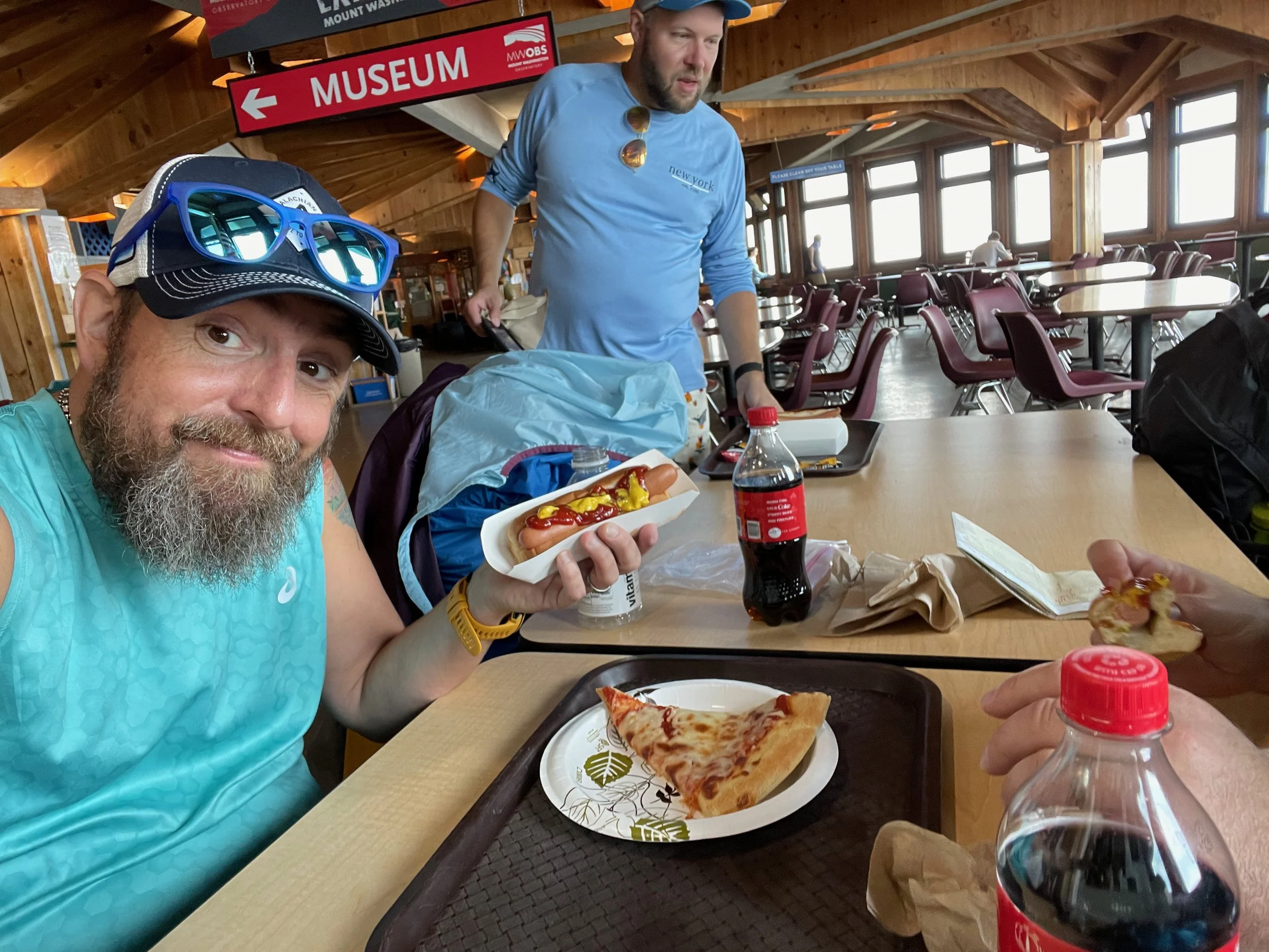
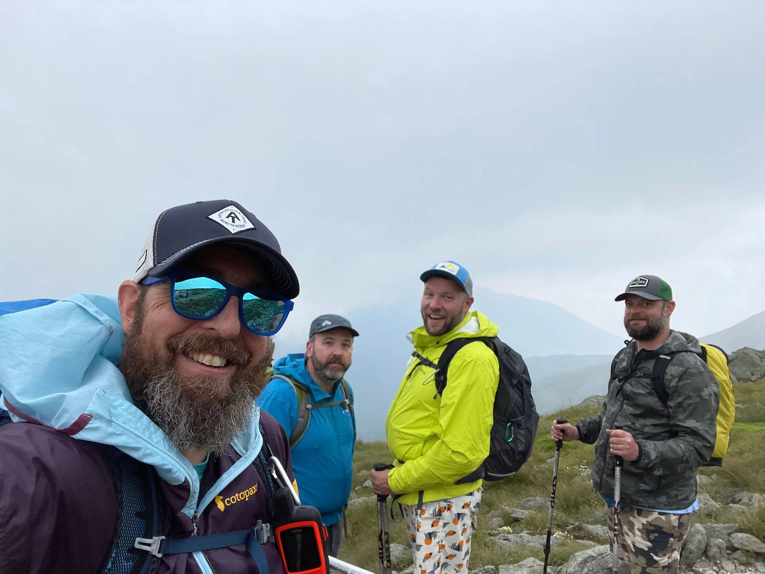
We were joined on the hike by our friends David and Paul, the Oklahomo Hikers on YouTube (their video of our climb up Mount Washington is here on YouTube). This was their introduction to northeastern hiking and it was also Moe’s birthday, so we decided to go big with a Mount Washington climb, while we were all spending time in New Hampshire!
You Need a Good Map in the White Mountains!
A note, the White Mountains, and especially the Presidential Range are home to many, many trails and are a place where a paper map really comes in handy because it is so easy to get redirected and end up in the wrong place if you aren’t paying attention. There are two great paper maps for the region:
While not a substitute for a good paper map, you can also download the entire White Mountain National Forest Trail System into the FarOut app and the AllTrails app has good coverage of the vast majority of WMNF trails. For those who love a detailed trail description, the White Mountain Guide is the trail bible for this region.
Mount Washington via Ammonoosuc Ravine and Jewell Trails Hike Description
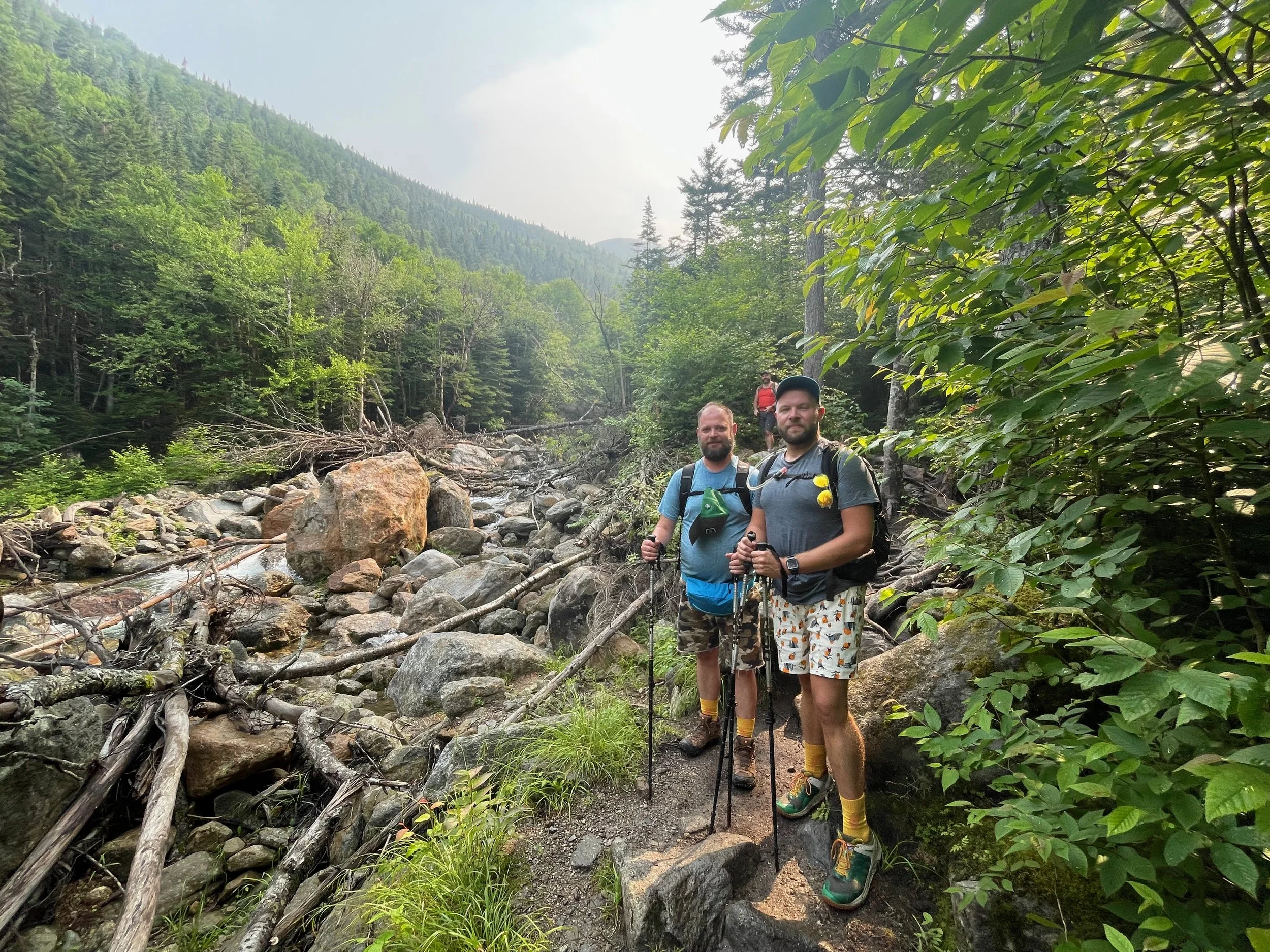
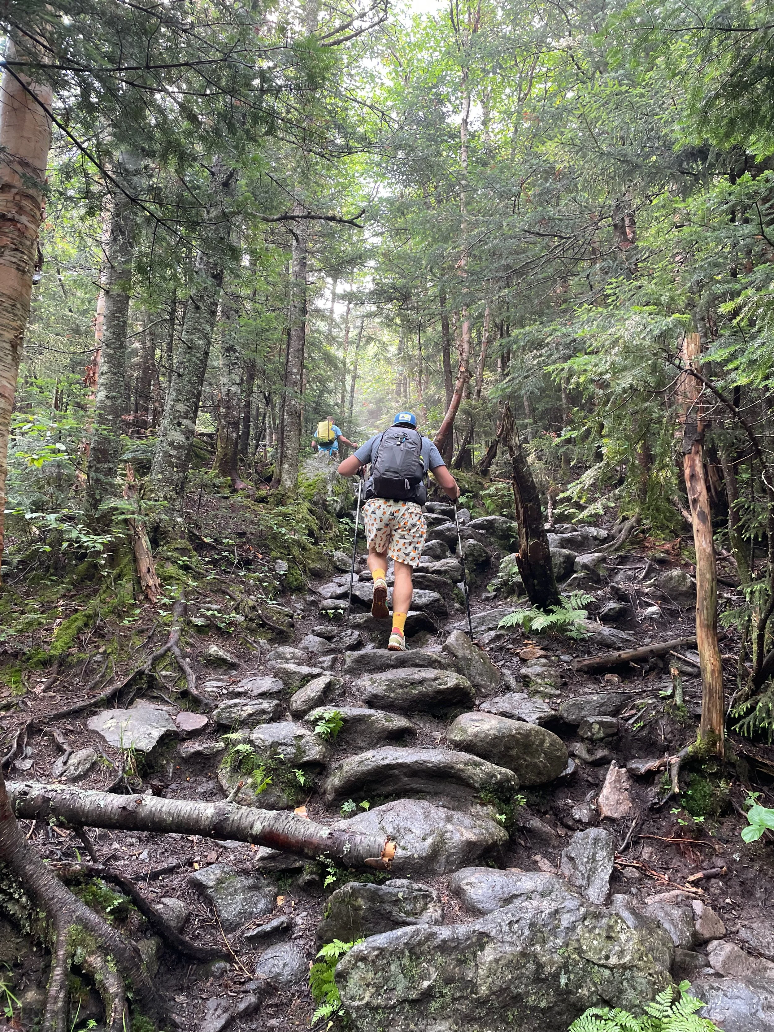
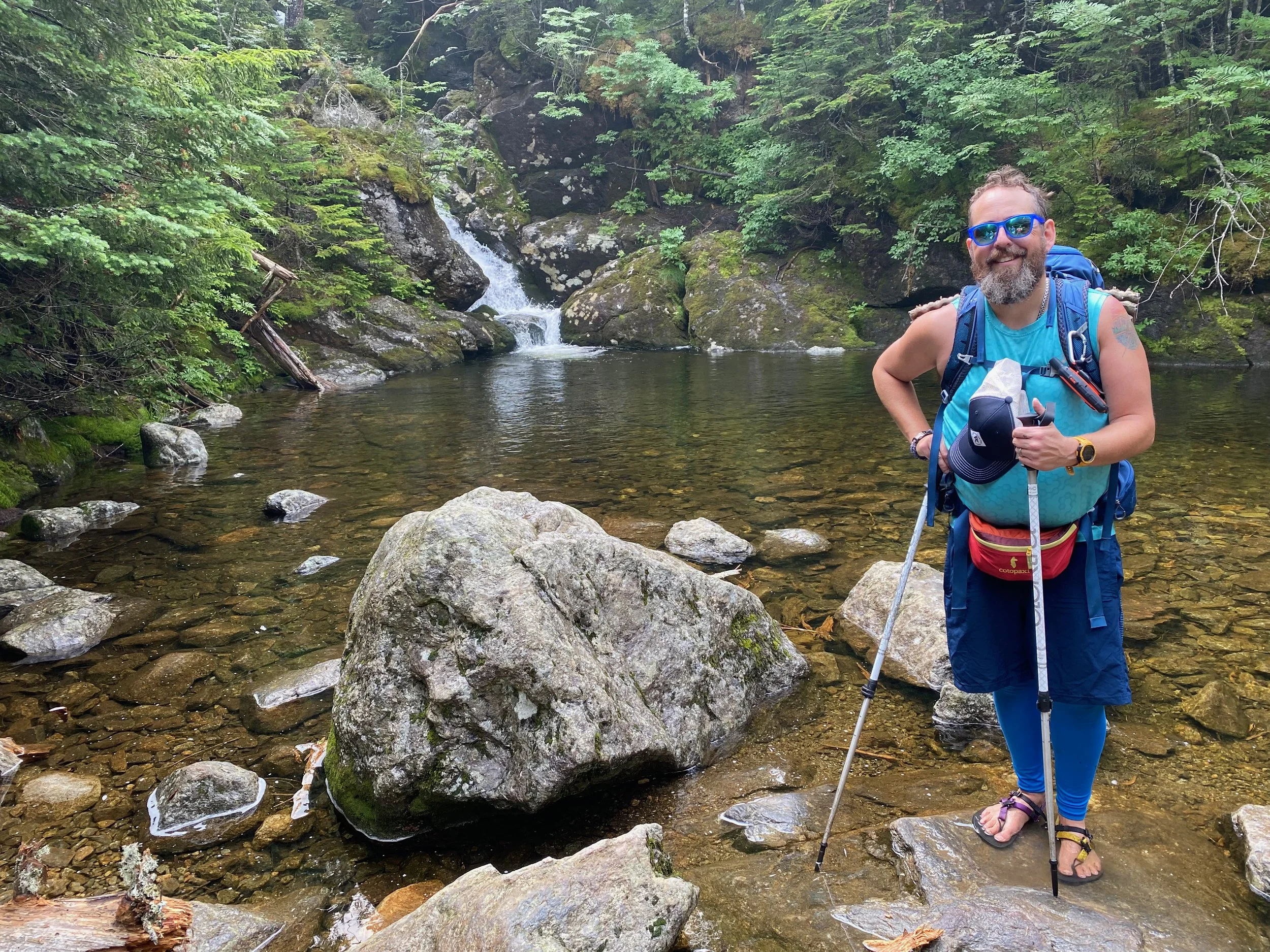
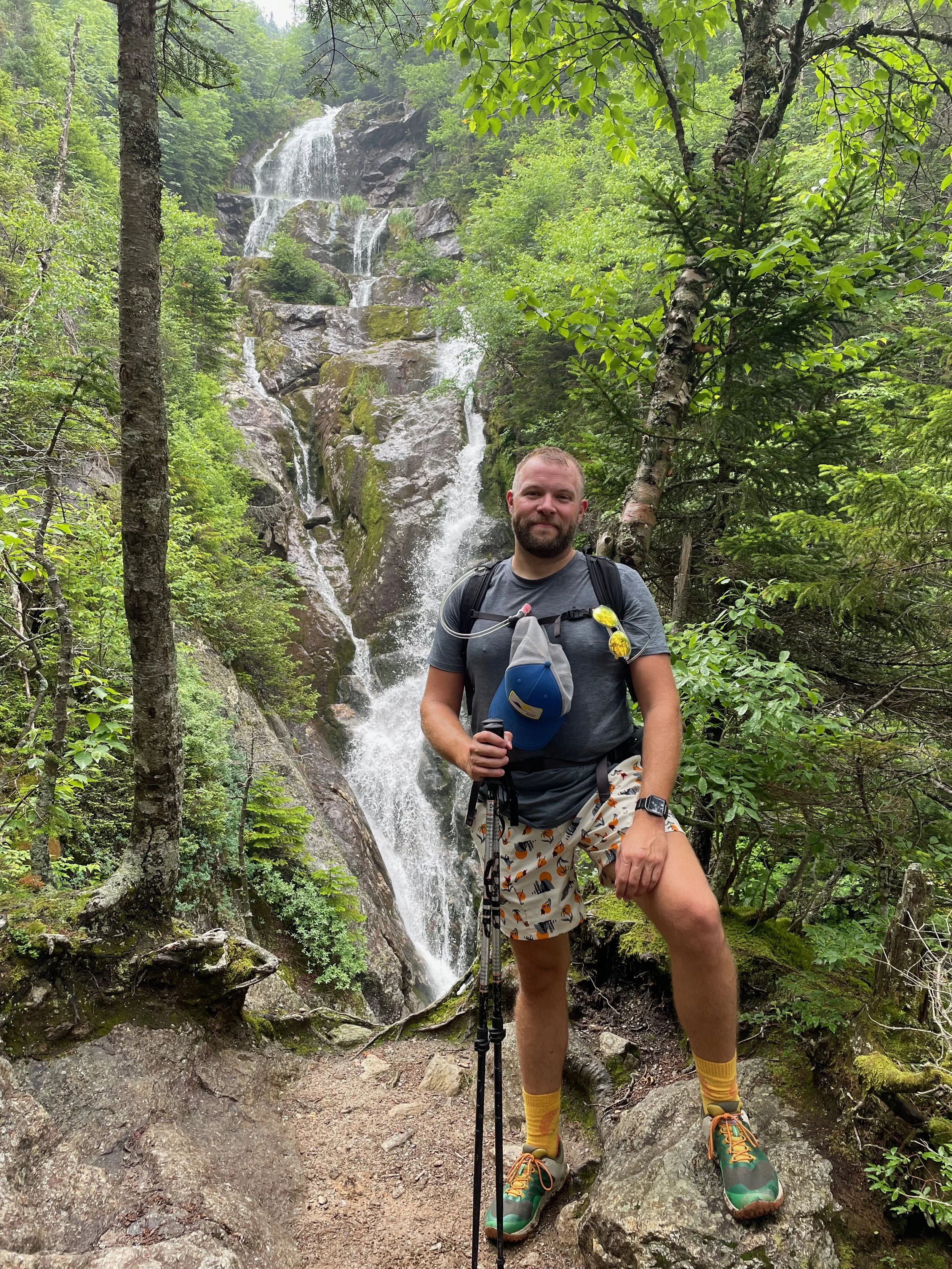
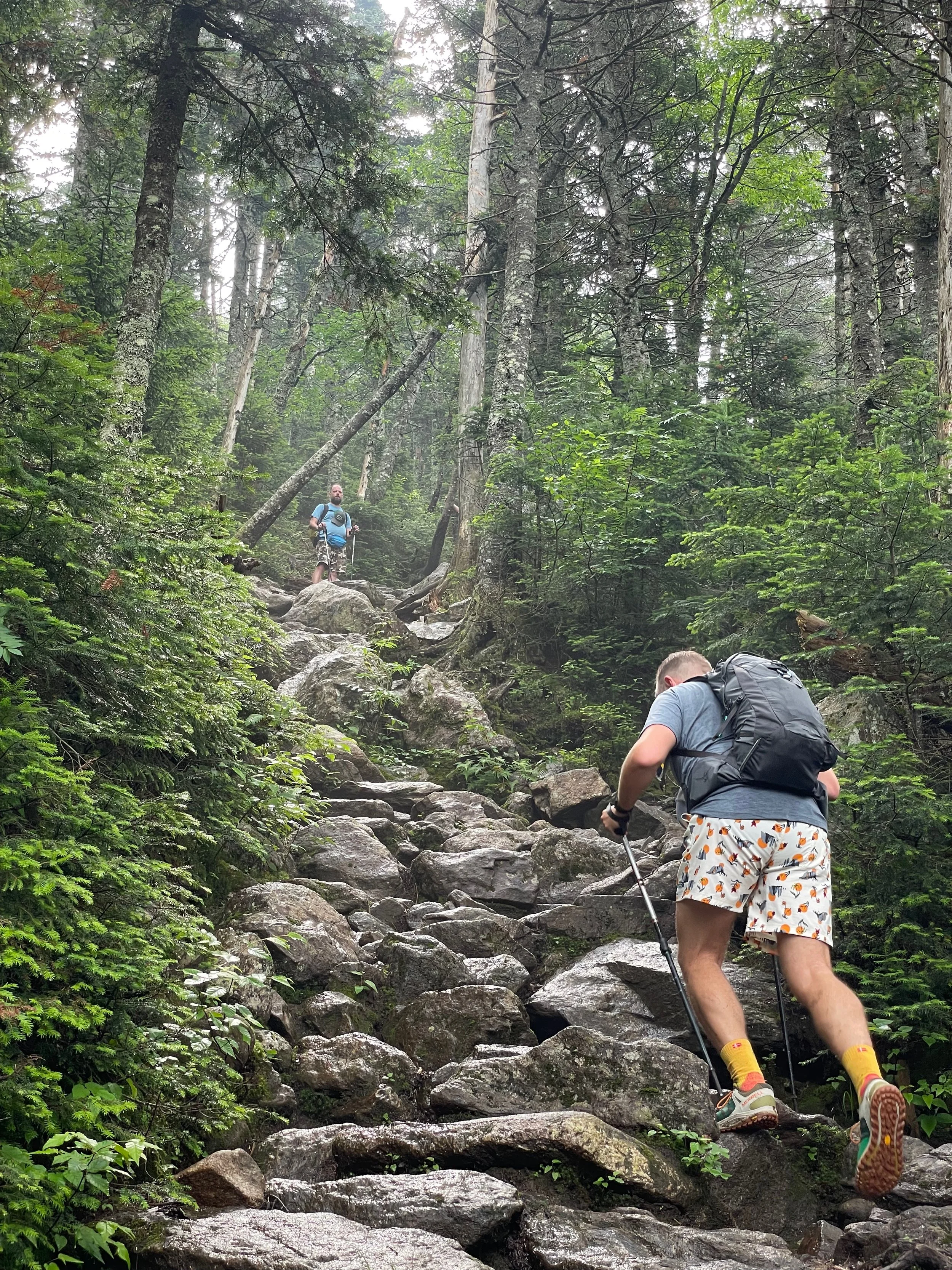
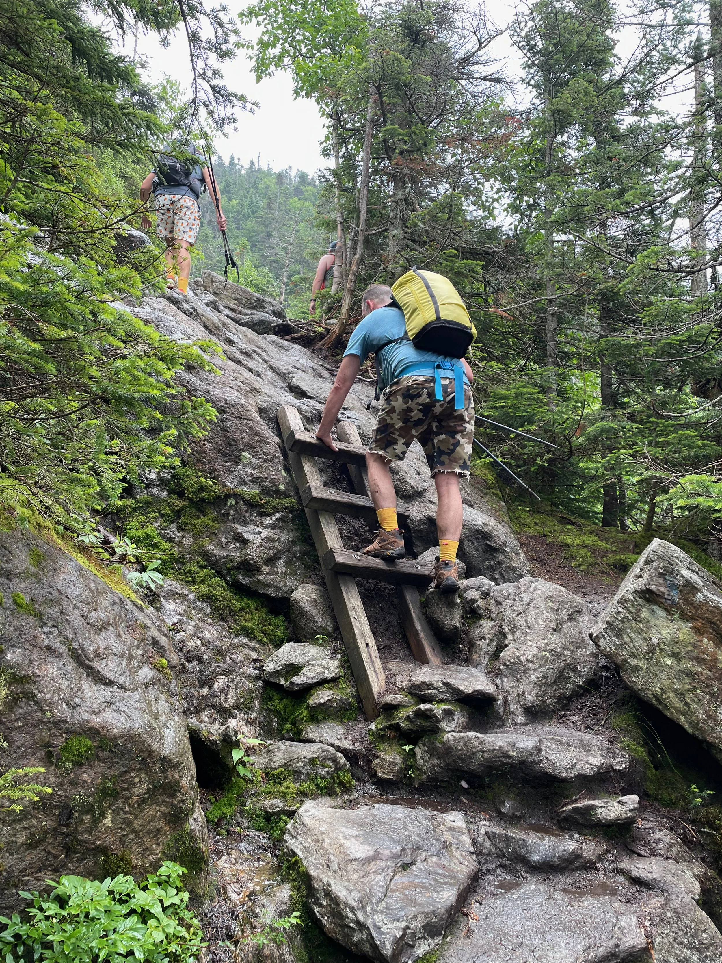
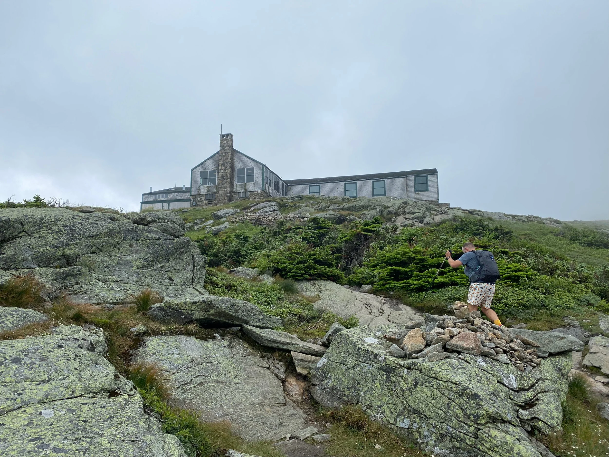
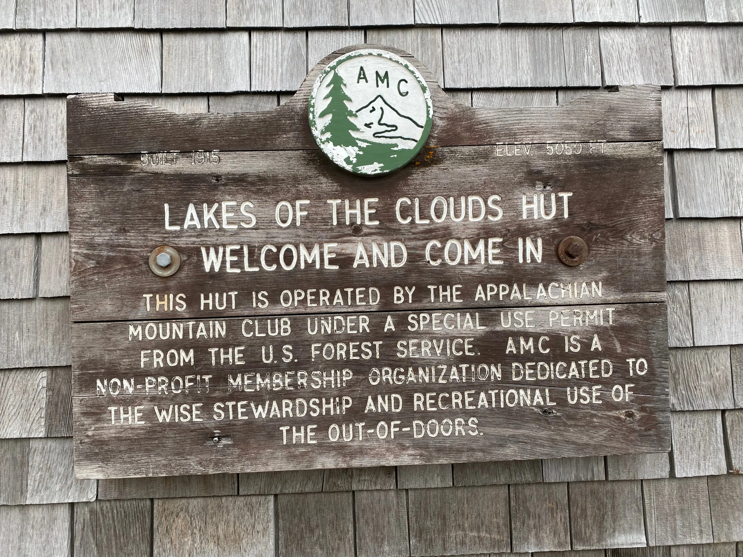
Ammonoosuc Ravine Trailhead to Lake of the Clouds Hut: From the Ammonoosuc Ravine trailhead just below the Cog Railway base station, the trail starts out on a moderate grade through the forest, then reaches a trail junction with the Ammonoosuc Link trail. From there you’ll be following the Ammonoosuc River. After a gentle start, the trail steepens steadily, becoming rougher and rockier as it climbs toward Gem Pool and the series of cascades higher in the ravine. Above Gem Pool, the trail steepens significantly and you encounter sections of slabby rock and open ledges where you’re often using hands for balance; in wet conditions these ledges can be slick and are why we prefer to go up Ammonoosuc rather than down it. The final push to Lakes of the Clouds Hut climbs the ravine headwall on very steep, rugged terrain before you break out at treeline and arrive at the hut, a welcome place to rest, refuel, and step inside out of the weather if it’s open for the season.
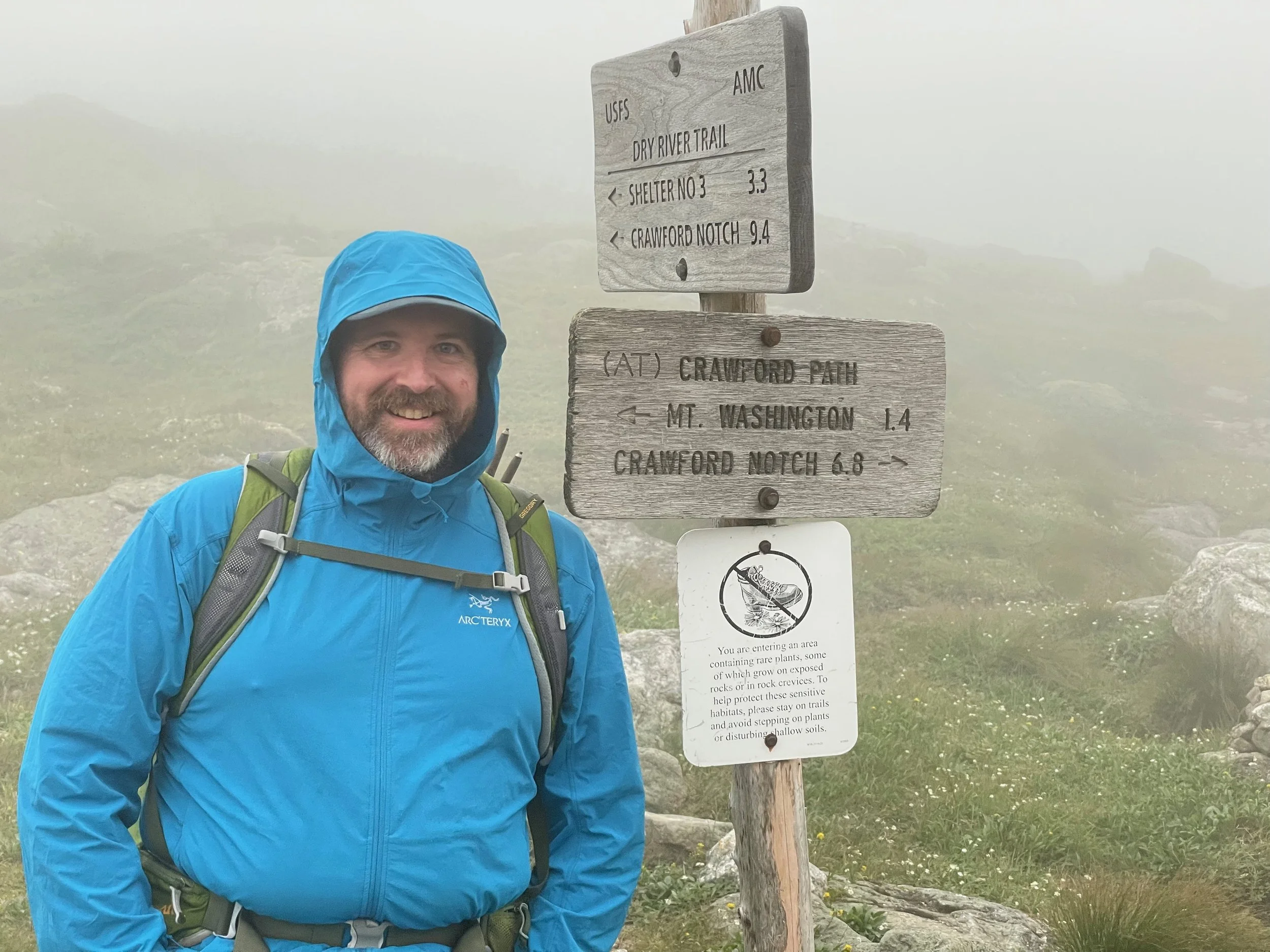
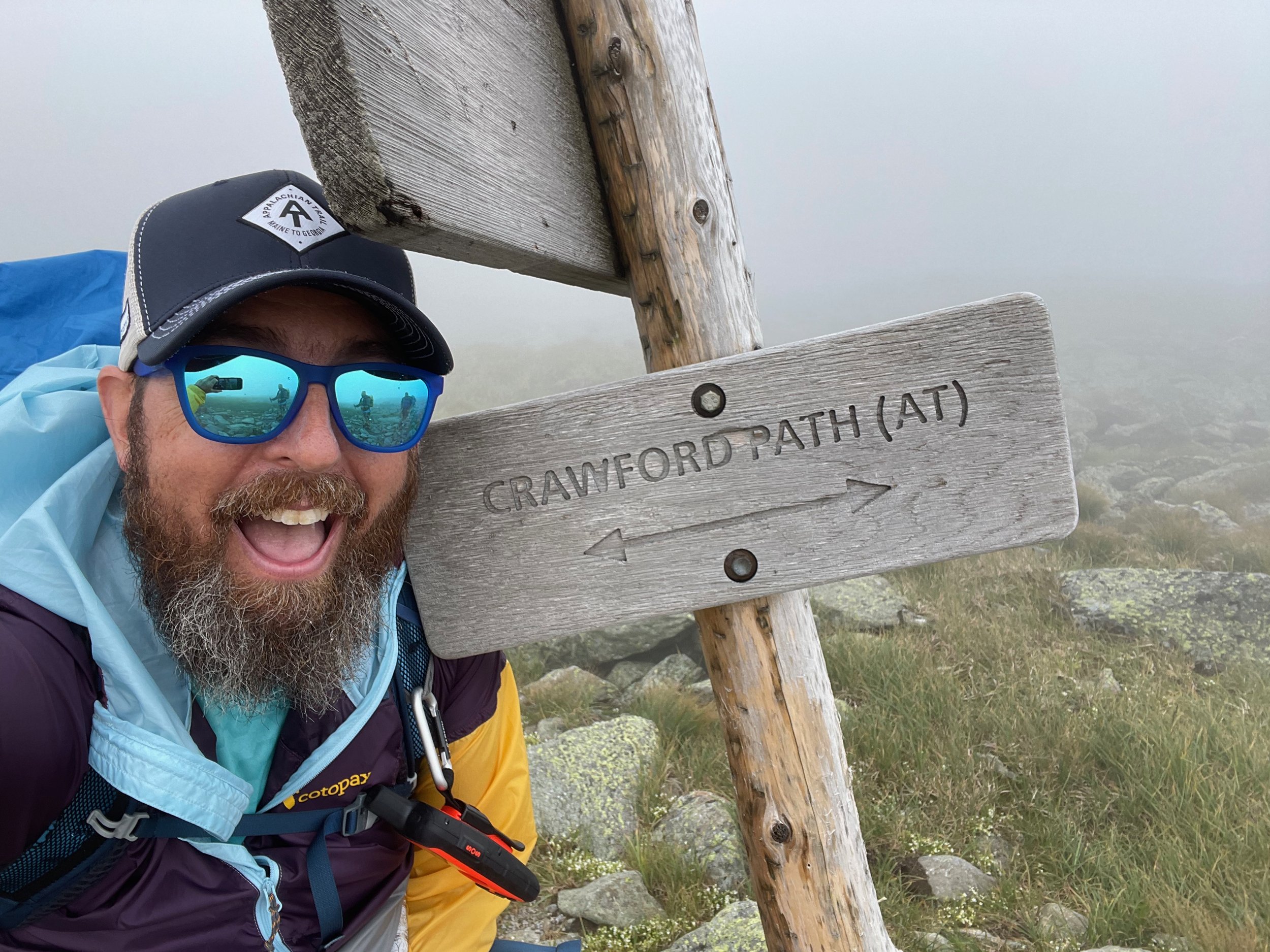
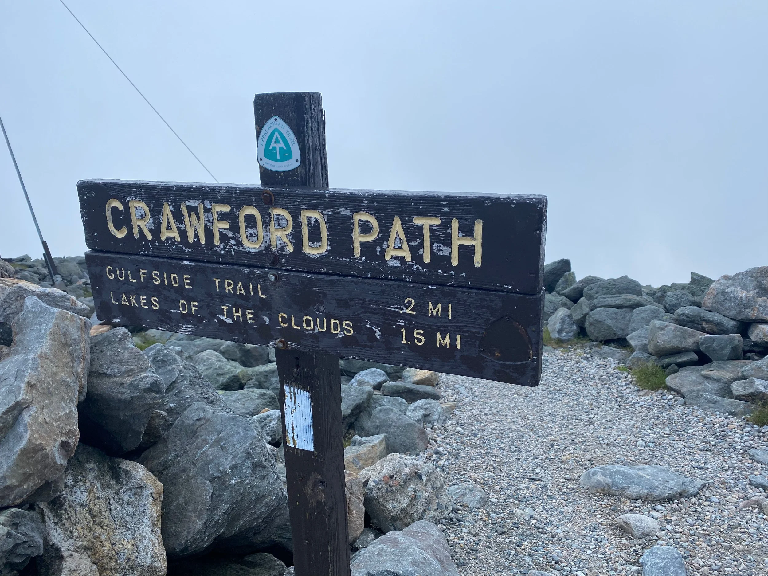
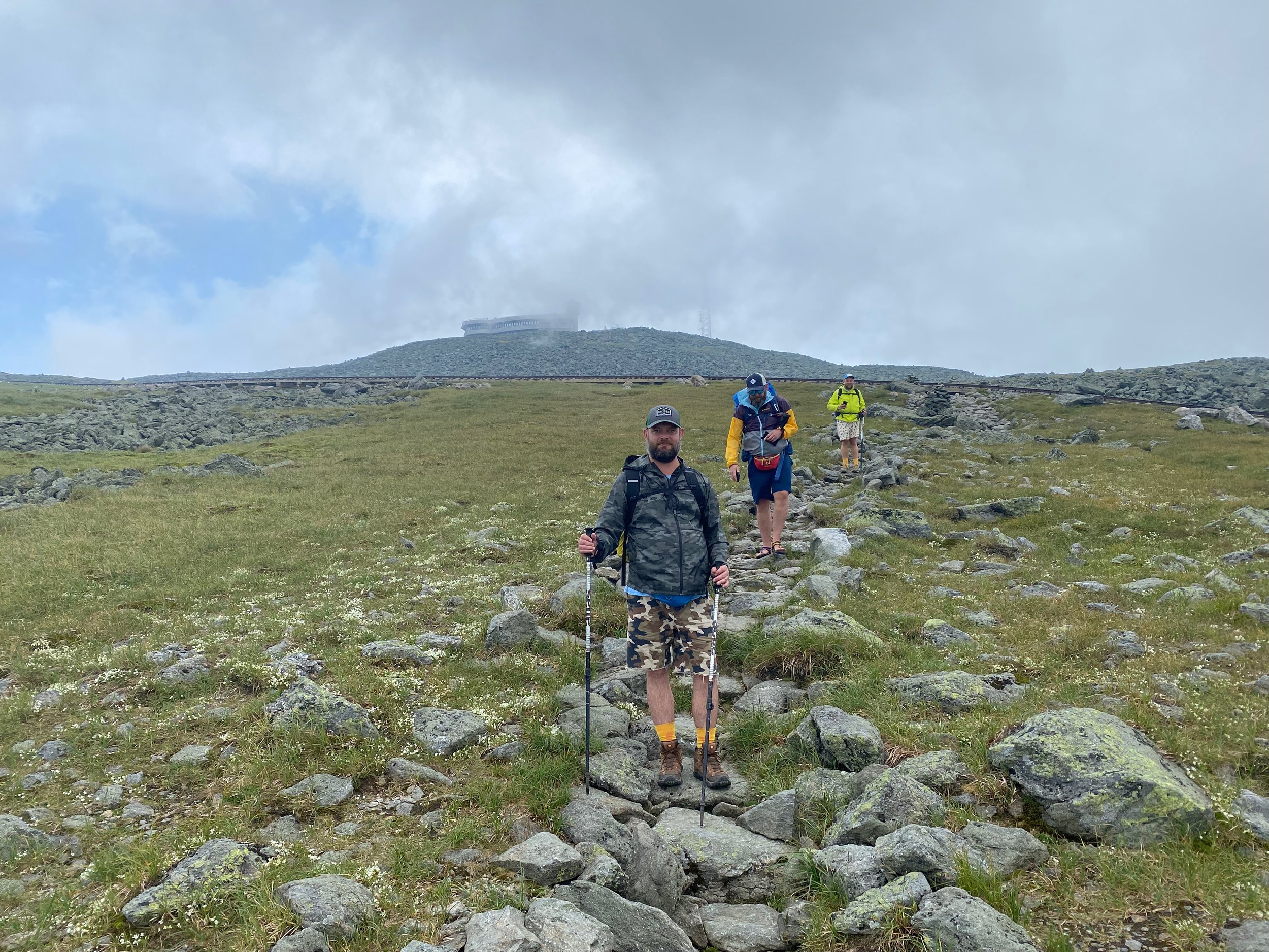
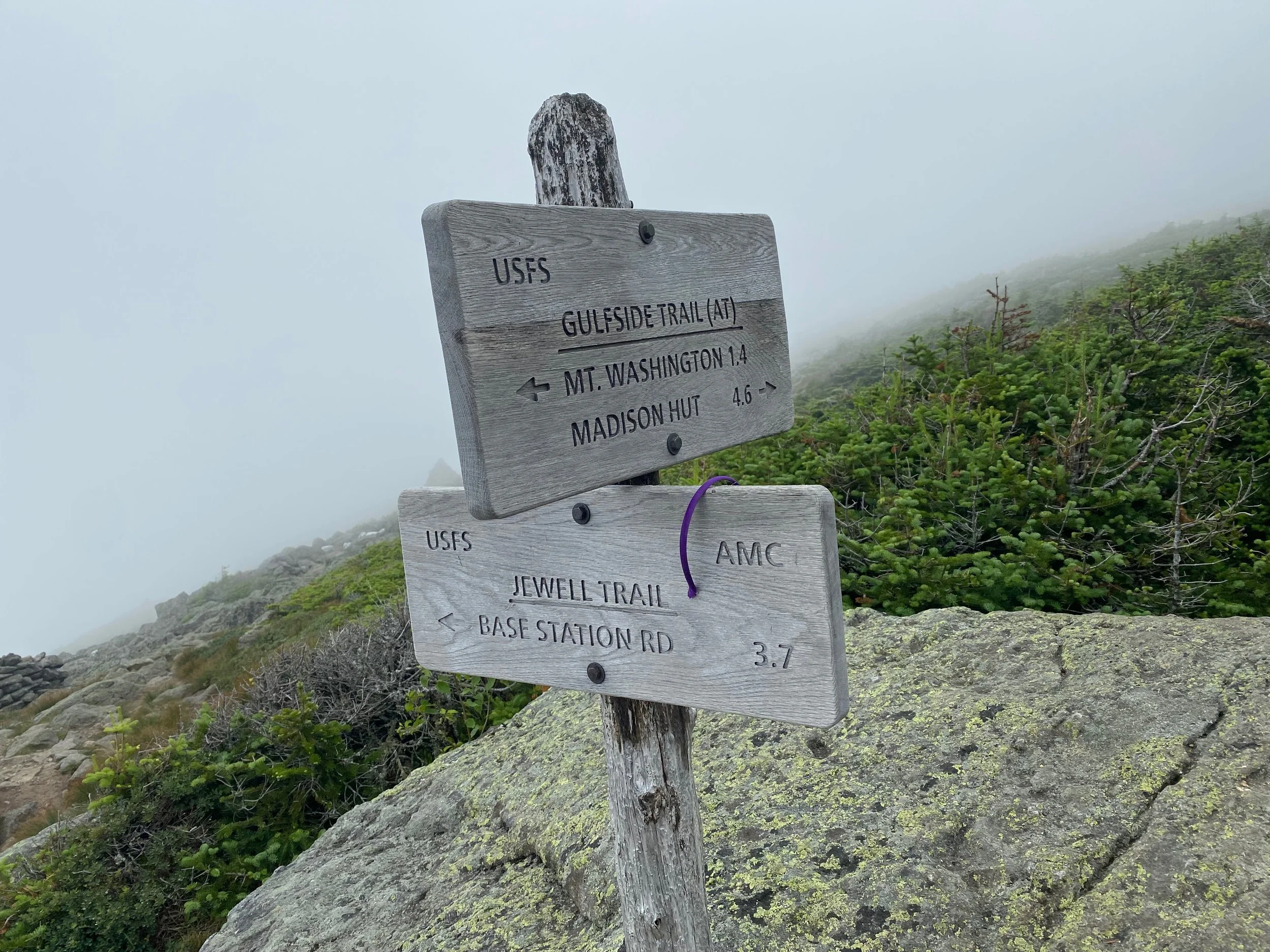
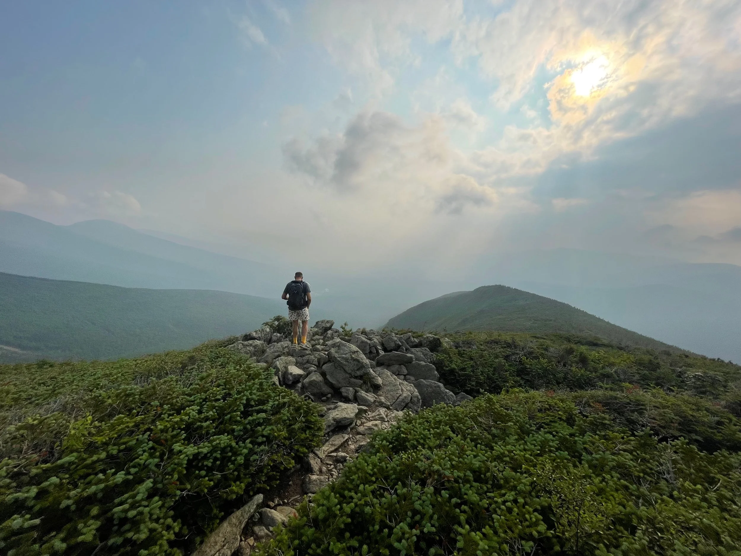
Lake of the Clouds Hut to Mount Washington Summit: At Lakes of the Clouds Hut, the Ammonoosuc Ravine Trail ends and you join Crawford Path (which is also the Appalachian Trail) for the upper part of the climb. Compared to the ravine, the grade here is more moderate and the hiking easier, but the trail is fully in the alpine zone, with open rock, low krummholz, and constant exposure to wind and rapidly changing weather. The trail has been improved in many spots with rock work, which makes the climbing more straightforward, but you still have a sustained, rocky ascent of roughly 1.4 miles and more than 1,200 vertical feet to reach the summit. On clear days the summit buildings and towers feel deceptively close; in clouds and fog it can be a white‑out navigation exercise where staying within sight of your group and following cairns is essential.
Mount Washington Summit: After the hike up the mountain, it can be jarring to arrive at the very busy and very touristy summit of Mount Washington. There’s a railroad station, the parking lots for the auto road, along with the visitor center that has a snack bar, gift shop, a museum, and the weather observatory. We always take a break at the top, enjoy a soda and a snack, and then return to the mountain.
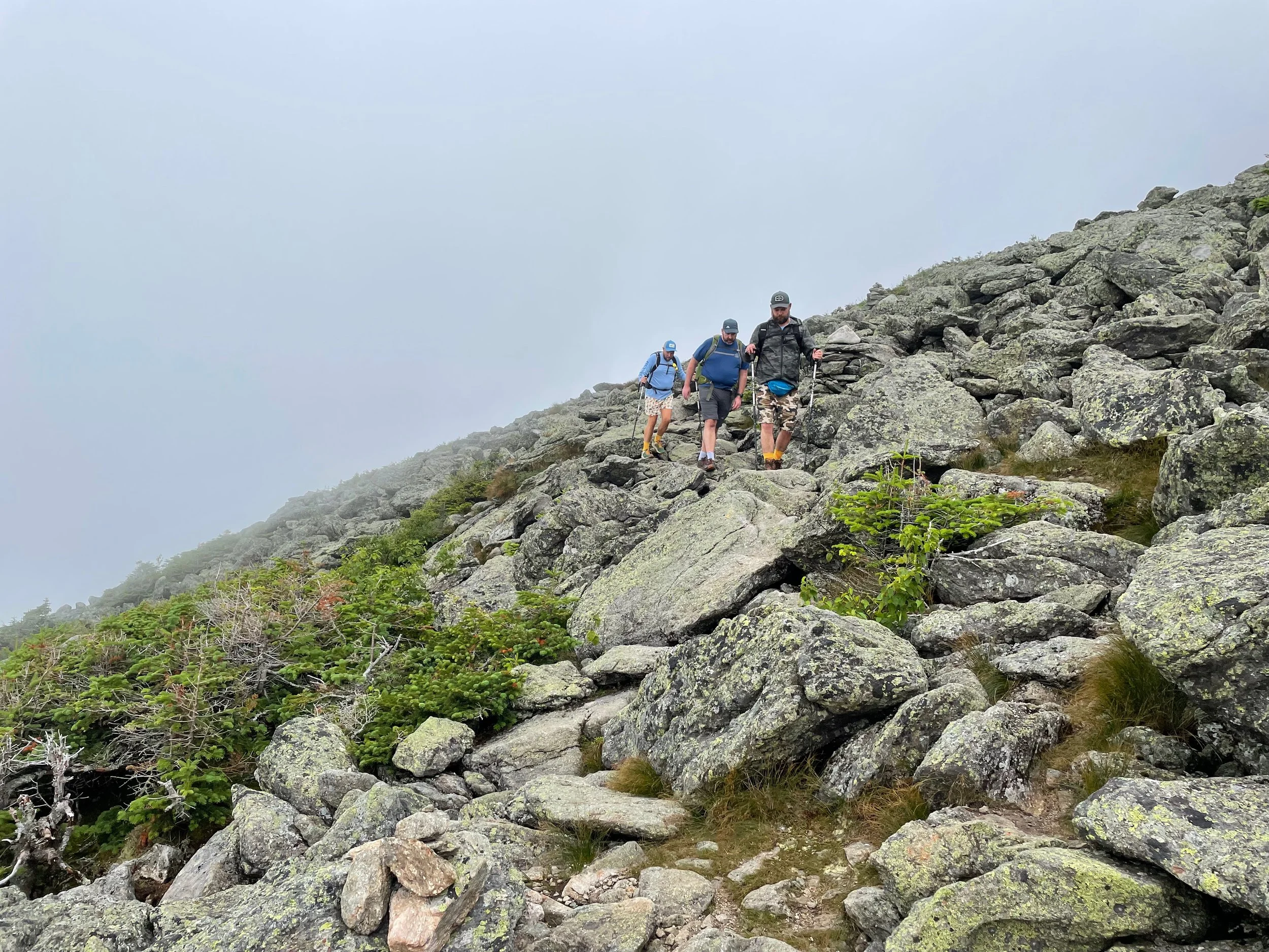
Mount Washington Summit to Ammonoosuc Ravine Trailhead: From the summit, after a short walk on the Trinity Heights Connector, you pick up Gulfside Trail (still the Appalachian Trail here), contouring away from the crowded summit complex, crossing the Cog Railway (it is a tradition for Appalachian Trail thru hikers to moon the train as it goes by) and then toward the shoulder leading to the Jewell Trail junction. The grade along Gulfside is generally moderate, but the tread is rougher than Crawford Path, with more uneven boulders and rock hopping that demand attention, especially when legs are tired.
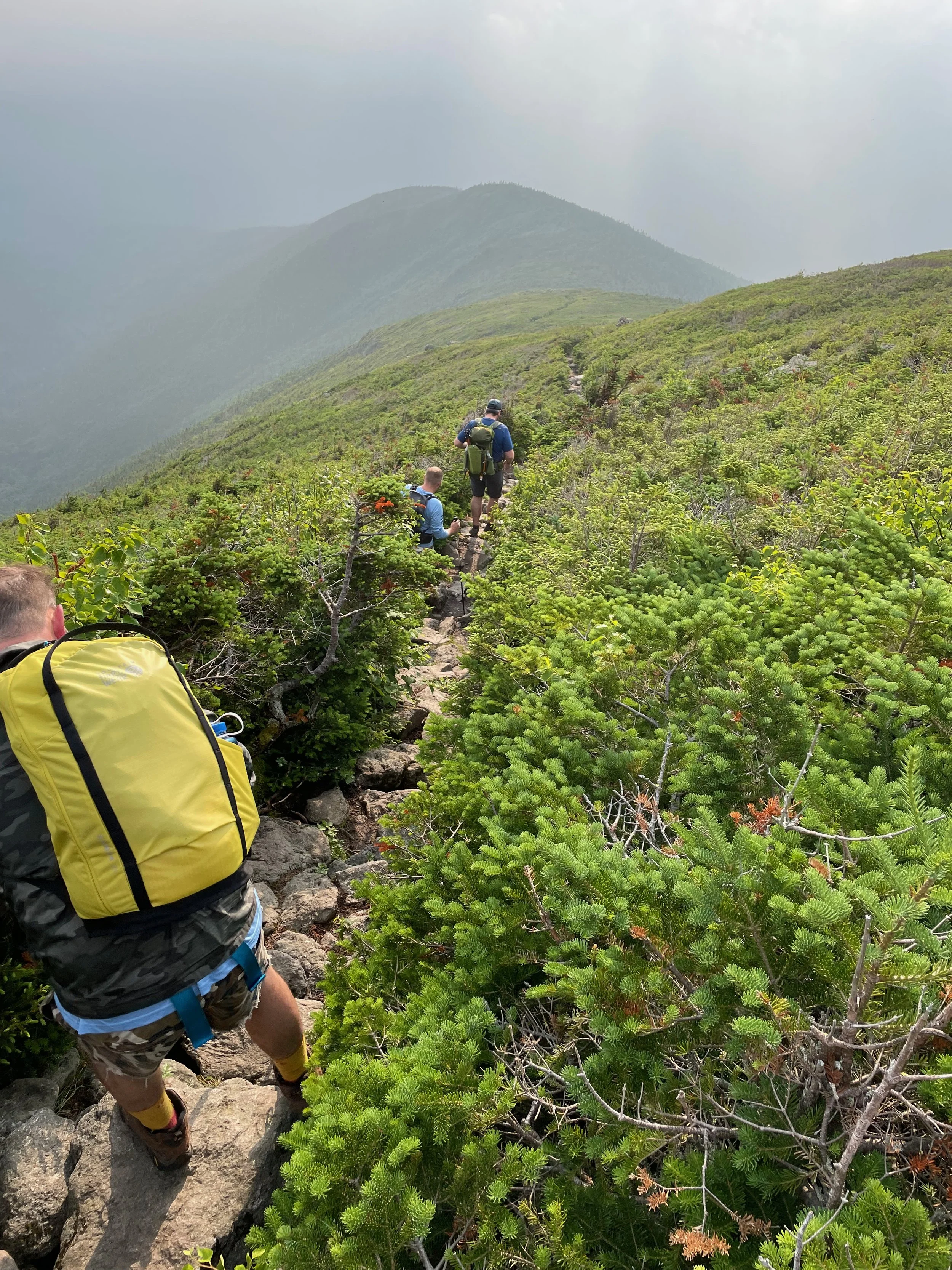
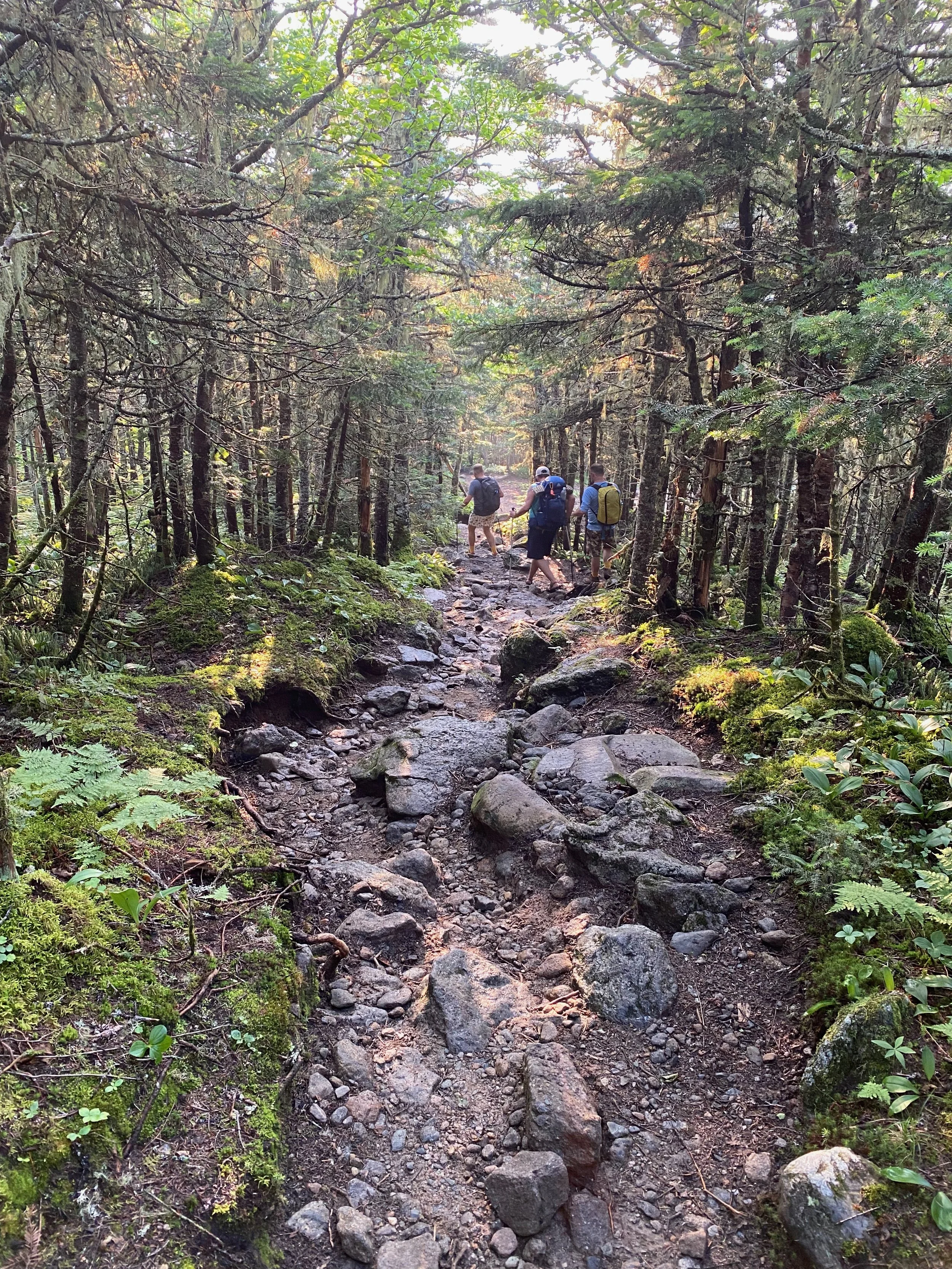
As you approach the start of the Jewell Trail, the terrain becomes increasingly rocky and you remain above treeline for a while, with big, open views of the Presidential Range on clear days and full exposure to wind and weather when conditions are less friendly. Once on the Jewell Trail proper, you descend along the ridge on a very rocky path at first, then eventually drop back below treeline where while the trail is rocky in a few places, it is really just a steady, moderate to steep descent on good tread, returning you to the trailhead.
Our total hike was just under 10 miles with about 4,000 feet of elevation gain.
How Difficult Is the Mount Washington Loop Hike?
While we consider this the best route to introduce folks to hiking Mount Washington, it is by no means an easy walk. The Ammonoosuc Ravine Trail is a rough, steep trail, that in places climbs up and over open rock ledges. Footing can be difficult and you are gaining elevation very quickly. That said, the route is generally within the trees and offers less exposure to weather than other routes. From the Lake of the Clouds Hut to the summit of Mount Washington, the trail is completely exposed to the weather above treeline and can be difficult to follow in very foggy weather. The same goes for the route from the summit down to treeline on the Jewell Trail. These trails are completely exposed and offer no protection in bad weather. Once below treeline on the Jewell Trail, the route is more protected and while still steep, is more like other below treeline trails you’ll find in the White Mountains.
Tips for Hiking Mount Washington
Footwear: The trail is muddy, rocky, wet, and very steep - wear sturdy boots or trail shoes.
Navigation: Trail junctions are marked and trails are easy to follow, but you should always bring a map or GPS because the sheer size of the trail network can make it easy to get yourself lost.
Parking: The lot at the trailhead is moderate in size, but can and does fill up quickly on weekends.
Timing: Allow 8-10 hours for the full hike, depending on your pace and how long you linger at the the hut, viewpoints and the summit.
For more information on Hiking Mount Washington via the Ammonoosuc Ravine and Jewell Trails, you can find this hike:
Hire Hike On Guides to Climb Mount Washington
Need help on a hike like this? Hike On Guides is our full‑service hiking, backpacking, and camping guiding company, helping hikers of all levels explore New York, New Hampshire, Vermont, and Massachusetts safely and confidently. You can hire us for custom day hikes, overnight backpacking trips, skills coaching, long‑distance hike planning, and more - all so you can focus on the views while we handle route planning, safety, and logistics. Learn more or book your next adventure at Hike On Guides.
More hikes near Mount Washington
More of our White Mountains hikes on YouTube
Gear we used on the Mount Washington hike:
Nutrition and Hydration for this hike:
Some product links are affiliate links and we earn from qualifying purchases. Others are links through the Amazon Influencer program and as an Amazon Influencer, we earn from qualifying purchases. Still others, we just want you to know about some good gear we enjoy!
Our Hiking Advice and Hiking Gear Recommendations
Important Hiking Considerations:
Weather: Check the weather forecast before your hike and be prepared for changes in conditions.
Safety: Some sections of trail can be steep and rocky, others can be muddy, so use caution and always watch your footing.
Leave No Trace: As with any outdoor activity, remember to follow the principles of Leave No Trace. Pack out any trash, stay on the trail, and be respectful of the natural environment.
Mount Washington Loop Hike FAQ
How hard is the Mount Washington Ammonoosuc Ravine hike?
The Ammonoosuc Ravine and Jewell Trail loop is a difficult 10-mile hike with roughly 4,000 feet of elevation gain and extensive exposure above treeline.
How long does it take to hike Mount Washington via Ammonoosuc Ravine?
Most hikers take 8–10 hours to complete the loop depending on pace and weather conditions.
Is Ammonoosuc Ravine the easiest route up Mount Washington?
While no route is easy, many hikers consider this loop one of the more approachable routes compared to steeper options like Tuckerman Ravine.
Can beginners hike Mount Washington?
Mount Washington is not recommended for beginners due to extreme weather, rugged terrain, and alpine exposure.