Hiking Mount Moosilauke via the Asquam Ridge Trail, Beaver Brook (AT), and Gorge Brook Trails
Hiking Mount Moosilauke Loop via Asquam Ridge Trail | White Mountains Hike
Explore the Moosilauke Loop, hiking Mount Moosilauke via Asquam Ridge, Beaver Brook, and Gorge Brook Trails. Enjoy spectacular views and diverse terrain on this iconic White Mountains adventure.
One of the New Hampshire 4000 footers, Mount Moosilauke stands at 4,802 feet tall. The mountain is crossed by a number of trails, including the Appalachian Trail. For Appalachian Trail hikers, Mount Moosilauke is often considered the gateway to the White Mountains by northbound thru hikers, and the end of the Whites for southbound thru hikers.
We were welcoming our friends Greg and Barbara to hiking in the White Mountains with some iffy weather, so we wanted to give them the White Mountains experience without all the exposure of the highest peaks. Moosilauke made for that perfect intro.
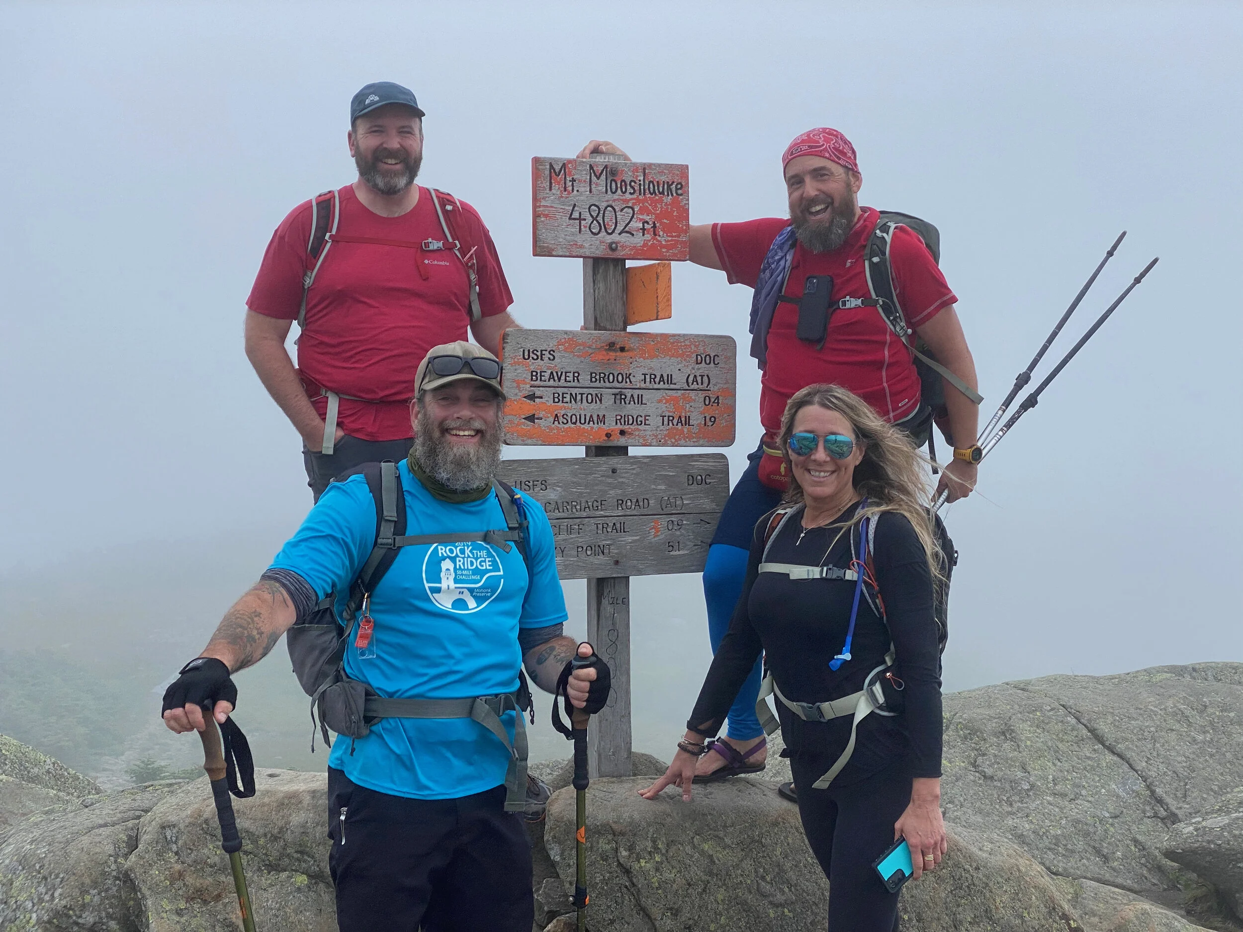
For our hike, we began at the trailhead located on Ravine Lodge Road (off of NH Route 118). From the trailhead, we followed the Asquam Ridge Trail to Mount Jim and the trail’s intersection/end with the Beaver Brook Trail (which is also the Appalachian Trail). We followed the Beaver Brook Trail over Mount Blue, to its intersection with the Benton Trail and then followed the Beaver Brook up to the summit of Mount Moosilauke where the trail ends and intersects with the Carriage Road Trail (Appalachian Trail) and the Gorge Brook Trail.
Ascending the roughly 2700-feet of elevation from the trailhead to the summit via this is a generally moderate climb with a few more strenuous (and difficult) sections towards the top of the climb. The Asquam Ridge Trail, for the majority of its length follows old roads, which while washed out in places, have a steady, yet relatively gentle grade. When the Ridge Trail leaves the former roadway and makes its way cross-country below the summit of Mount Jim, it does become steeper and rockier. Once on the Beaver Brook Trail, the trail does have some steep, rocky sections as you make your way around Mount Blue, but overall climbs steadily without too many steep, difficult sections.
From the summit of Mount Moosilauke, we took the Gorge Brook Trail down, descending quickly first to the intersection with the Snapper Trail, and then with the Hurricane Trail, before ending back at the trailhead on Ravine Lodge Road. The Gorge Brook Trail doesn't waste any time in descending. After leaving the relatively gentle summit area, the trail descends quickly and steeply.
Our total hike on this loop was 10.5 miles with about 2700' of elevation gain along the way.
Outdoor Hiking, Backpacking and Camping Guide Services:
Gear we used on this video: